Chest opened
+${chestReward.xp} XP
Explorer
NOUVEAU ×${chestReward.collectible.quantity}
tapez pour fermer
Chest locked

Open chests in the app

Around Us is built for your phone — chests unlock when you walk, explore and capture nearby places.

Enable Location

We need your location to show you interesting places around you

Discover nearby places

Find interesting locations and hidden gems around you

Precise directions

Get accurate directions and distances to places

Your location is never shared with other users. It's only used when you tap the location button.

Log in to your account

Start exploring — it's free

Trusted by 72,883 travelers worldwide

Continue with Google
Continue with Apple
or

We will send you a code to connect

By continuing, you accept our Terms and Conditions and our Privacy Policy

Check your inbox

We've sent a pincode in your inbox. Please enter the code below.

Discussion Reviews Photo
15.3k Popularity

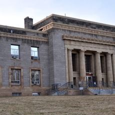
Herlong, Census-designated place in Lassen County, California.

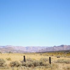
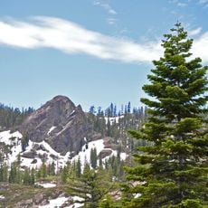
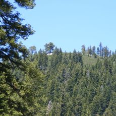
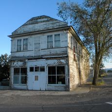
Herlong is a small settlement in southeastern Honey Lake Valley on the eastern edge of the Sierra Nevada mountains. The community spreads across flat, rural land with scattered buildings typical of mountain foothills communities.

The settlement emerged in 1942 after Pearl Harbor, created to house civilian workers supporting the nearby Sierra Army Depot. This military connection shaped the founding and early growth of the place.

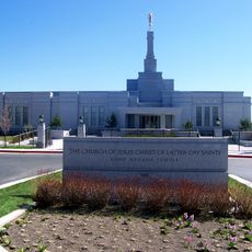
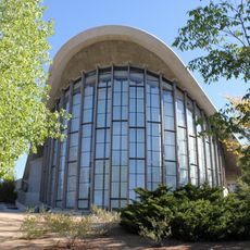
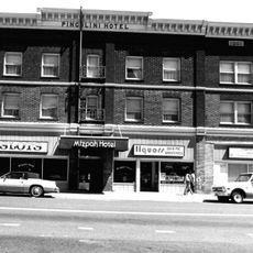
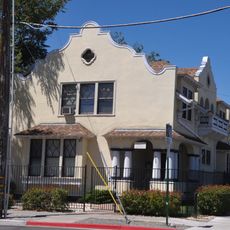
Local churches form the social core of this small community, where residents gather for worship and fellowship. These places of worship shape how people here connect with one another.

The settlement sits 70 miles north of Reno and 45 miles south of Susanville, connected to larger cities via State Route 395. Shops and services are mainly in Susanville, so expect a quiet rural setting with limited amenities nearby.

The nearby Sierra Army Depot functions as a major hub for military logistics and equipment storage on a national scale. This facility remains one of the largest of its kind and continues to shape the region's economy.

The community of curious travelers

AroundUs brings together thousands of curated places, local tips, and hidden gems, enriched daily by 60,000 contributors worldwide.

Start exploring
Location
GPS coordinates
40.14361,-120.13472
Latest update
December 7, 2025 19:31
Around this place
Mackay Stadium
United States of America

Mackay Stadium

71.7 km
Plumas National Forest
United States of America

Plumas National Forest

35.8 km
Western Pacific Railroad Museum
United States of America

Western Pacific Railroad Museum

47.8 km
Beckwourth Pass
United States of America

Beckwourth Pass

39.2 km
Plumas-Eureka State Park
United States of America

Plumas-Eureka State Park

64.8 km
1872 California-Nevada State Boundary Marker
United States of America

1872 California-Nevada State Boundary Marker

69.9 km
Crystal Peak
United States of America

Crystal Peak

65.3 km
Antelope Dam
United States of America

Antelope Dam

40.4 km
Reno Nevada Temple
United States of America

Reno Nevada Temple

70.7 km
Reno Air Defense Sector
United States of America

Reno Air Defense Sector

58.9 km
Anaho Island National Wildlife Refuge
United States of America

Anaho Island National Wildlife Refuge

57.1 km
Mackay School of Earth Sciences and Engineering
United States of America

Mackay School of Earth Sciences and Engineering

72.6 km
Fleischmann Planetarium & Science Center
United States of America

Fleischmann Planetarium & Science Center

71.8 km
United States of America

UNLV Arboretum

71.9 km
Clio trestle
United States of America

Clio trestle

57 km
Hosselkus Limestone
United States of America

Hosselkus Limestone

50.7 km
University of Nevada Reno Historic District
United States of America

University of Nevada Reno Historic District

72.7 km
Alpha Tau Omega Fraternity House
United States of America

Alpha Tau Omega Fraternity House

72.9 km
Morrill Hall
United States of America

Morrill Hall

72.9 km
Twaddle Mansion
United States of America

Twaddle Mansion

73.4 km
Roop's Fort
United States of America

Roop's Fort

53.8 km
Mizpah Hotel
United States of America

Mizpah Hotel

73.1 km
Humphrey House
United States of America

Humphrey House

73.4 km
Schroeder Mountain
United States of America

Schroeder Mountain

66.6 km
Standish Hall
United States of America

Standish Hall

34.6 km
Lassen County Court House
United States of America

Lassen County Court House

54.1 km
Lassen County Fairgrounds
United States of America

Lassen County Fairgrounds

52 km
Topsy The Clown
United States of America

Topsy The Clown

73.4 km
Show the full map
Reviews
Share your experience

No review yet

Discussions
Start a discussion...

No discussion yet

« Herlong - Census-designated place in Lassen County, California » is provided by Around Us (aroundus.com). Images and texts are derived from Wikimedia project under a Creative Commons license. You are allowed to copy, distribute, and modify copies of this page, under the conditions set by the license, as long as this note is clearly visible.

Discover hidden gems everywhere you go!

From secret cafés to breathtaking viewpoints, skip the crowded tourist spots and find places that match your style. Our app makes it easy with voice search, smart filtering, route optimization, and insider tips from travelers worldwide. Download now for the complete mobile experience.

Around Us App Screenshot

A unique approach to discovering new places

Le Figaro

All the places worth exploring

France Info

A tailor-made excursion in just a few clicks

20 Minutes

Around Us
Travel Guide & Maps
Download

Send to your phone

QR Code
1

Open the camera app on your mobile.

2

Point at the QR code with your camera. A notification will appear.

3

Tap the notification to open the link.