Chest opened
+${chestReward.xp} XP
Explorer
NOUVEAU ×${chestReward.collectible.quantity}
tapez pour fermer
Chest locked

Open chests in the app

Around Us is built for your phone — chests unlock when you walk, explore and capture nearby places.

Enable Location

We need your location to show you interesting places around you

Discover nearby places

Find interesting locations and hidden gems around you

Precise directions

Get accurate directions and distances to places

Your location is never shared with other users. It's only used when you tap the location button.

Log in to your account

Start exploring — it's free

Trusted by 72,891 travelers worldwide

Continue with Google
Continue with Apple
or

We will send you a code to connect

By continuing, you accept our Terms and Conditions and our Privacy Policy

Check your inbox

We've sent a pincode in your inbox. Please enter the code below.

Diamond Valley
Discussion Reviews Photo
1.2k Popularity

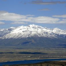
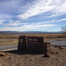
Diamond Valley, Basin in Eureka County and Elko County, United States.

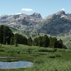
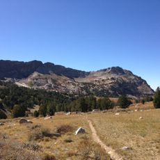
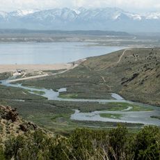
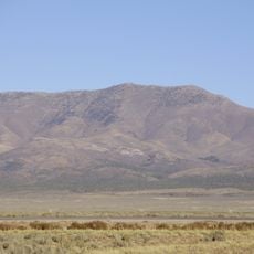
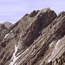
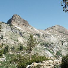
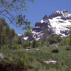
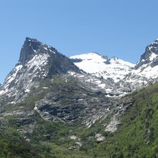
Diamond Valley is a basin stretching roughly 45 miles in length and 12 miles in width, nestled between the Sulphur Spring Range and Diamond Mountains in Nevada. The valley floor sits at approximately 5,890 feet elevation, creating a high-altitude setting surrounded by mountain ranges.

Mining once dominated the region before settlers gradually shifted focus to farming and established agricultural practices over time. This transition marked the valley's transformation from an extractive economy to one based on cultivation and ranching.

The farming way of life shapes how the valley looks and functions today, with fields and ranches spread across the landscape. Locals rely on this land-based economy that has been central to the community for generations.

The valley experiences cold winters and very hot summers, so timing your visit depends on your comfort with these temperature extremes. Access to the area requires traveling through relatively remote Nevada highways and backcountry roads.

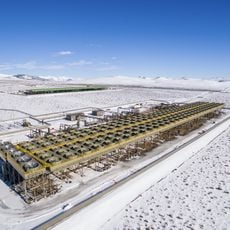
The valley produces high-quality timothy hay and alfalfa that supply equestrian facilities and dairy operations worldwide. This specialized agricultural focus has established it as a significant source for premium animal feed.

The community of curious travelers

AroundUs brings together thousands of curated places, local tips, and hidden gems, enriched daily by 60,000 contributors worldwide.

Start exploring
Location
Location
GPS coordinates
39.75920,-115.97300
Latest update
December 14, 2025 18:00
Around this place
Ely State Prison
United States of America

Ely State Prison

98 km
Stokes Castle
United States of America

Stokes Castle

99.4 km
Hotel Nevada and Gambling Hall
United States of America

Hotel Nevada and Gambling Hall

108.8 km
Ruby Dome
United States of America

Ruby Dome

105 km
Ruby Lake National Wildlife Refuge
United States of America

Ruby Lake National Wildlife Refuge

64.1 km
Fort Ruby
United States of America

Fort Ruby

51.2 km
Ruby Mountains Wilderness
United States of America

Ruby Mountains Wilderness

103.9 km
Ruby Crest National Recreation Trail
United States of America

Ruby Crest National Recreation Trail

100.2 km
South Fork State Recreation Area
United States of America

South Fork State Recreation Area

101.8 km
McGinness Hills Geothermal Complex
United States of America

McGinness Hills Geothermal Complex

82.6 km
Goshute Canyon Wilderness
United States of America

Goshute Canyon Wilderness

99.2 km
Currant Mountain Wilderness
United States of America

Currant Mountain Wilderness

105.5 km
Toquima Cave
United States of America

Toquima Cave

94.6 km
Diamond Peak
United States of America

Diamond Peak

23.5 km
United States of America

Carlin Canyon

108.5 km
Mount Fitzgerald
United States of America

Mount Fitzgerald

105.6 km
Palisade Canyon
United States of America

Palisade Canyon

96.1 km
Currant Mountain
United States of America

Currant Mountain

105.7 km
Snow Lake Peak
United States of America

Snow Lake Peak

106.2 km
Ely L.D.S. Stake Tabernacle
United States of America

Ely L.D.S. Stake Tabernacle

109.1 km
Capital Theatre
United States of America

Capital Theatre

108.8 km
Mount Gilbert
United States of America

Mount Gilbert

106.2 km
Austin Masonic and Odd Fellows Hall
United States of America

Austin Masonic and Odd Fellows Hall

98.6 km
Seitz Canyon
United States of America

Seitz Canyon

108.5 km
Eureka Historic District
United States of America

Eureka Historic District

27.4 km
Lander County Courthouse
United States of America

Lander County Courthouse

98.7 km
Lander County High School
United States of America

Lander County High School

99.3 km
Austin City Hall
United States of America

Austin City Hall

98.7 km
Show the full map
Reviews
Share your experience

No review yet

Discussions
Start a discussion...

No discussion yet

« Diamond Valley - Basin in Eureka County and Elko County, United States » is provided by Around Us (aroundus.com). Images and texts are derived from Wikimedia project under a Creative Commons license. You are allowed to copy, distribute, and modify copies of this page, under the conditions set by the license, as long as this note is clearly visible.

Discover hidden gems everywhere you go!

From secret cafés to breathtaking viewpoints, skip the crowded tourist spots and find places that match your style. Our app makes it easy with voice search, smart filtering, route optimization, and insider tips from travelers worldwide. Download now for the complete mobile experience.

Around Us App Screenshot

A unique approach to discovering new places

Le Figaro

All the places worth exploring

France Info

A tailor-made excursion in just a few clicks

20 Minutes

Around Us
Travel Guide & Maps
Download

Send to your phone

QR Code
1

Open the camera app on your mobile.

2

Point at the QR code with your camera. A notification will appear.

3

Tap the notification to open the link.