Chest opened
+${chestReward.xp} XP
Explorer
NOUVEAU ×${chestReward.collectible.quantity}
tapez pour fermer
Chest locked

Open chests in the app

Around Us is built for your phone — chests unlock when you walk, explore and capture nearby places.

Enable Location

We need your location to show you interesting places around you

Discover nearby places

Find interesting locations and hidden gems around you

Precise directions

Get accurate directions and distances to places

Your location is never shared with other users. It's only used when you tap the location button.

Log in to your account

Start exploring — it's free

Trusted by 72,894 travelers worldwide

Continue with Google
Continue with Apple
or

We will send you a code to connect

By continuing, you accept our Terms and Conditions and our Privacy Policy

Check your inbox

We've sent a pincode in your inbox. Please enter the code below.

Granite Peak Installation
Discussion Reviews Photo
7k Popularity

Granite Peak Installation, Military testing facility in Utah, US.

Granite Peak Installation is a military facility within Dugway Proving Ground containing laboratory buildings, residential quarters, and a medical facility. The site operated with its own utility systems, an airstrip, and paved road networks serving its self-contained operations.

The installation was built in 1943 as the primary testing site for biological weapons by the United States military during World War II. It served for decades as a center for military experimental programs.

The facility contributed to military scientific advancement through various experimental programs, including tests with the M33 cluster bomb and biological agents.

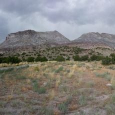
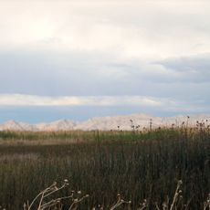
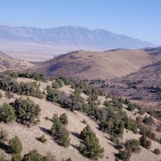
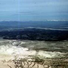
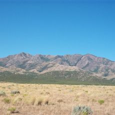
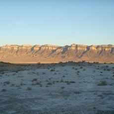
The site is geographically separated from the main Dugway Proving Ground and was designed as an independent operating complex. Visitors should expect remote conditions and limited accessibility to the area.

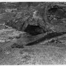
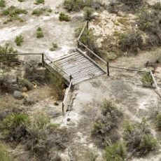
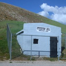
Only two structures remained at the site by 1985: a pump house and an underground storage building. These sparse remnants reflect the complex's former scale.

The community of curious travelers

AroundUs brings together thousands of curated places, local tips, and hidden gems, enriched daily by 60,000 contributors worldwide.

Start exploring
Location
GPS coordinates
40.17070,-113.29600
Latest update
December 10, 2025 15:48
Around this place
Bonneville Speedway
United States of America

Bonneville Speedway

83.2 km
Metaphor: The Tree of Utah
United States of America

Metaphor: The Tree of Utah

66.3 km
Wendover Air Force Base
United States of America

Wendover Air Force Base

87.2 km
Topaz Mountain
United States of America

Topaz Mountain

53.9 km
Fish Springs National Wildlife Refuge
United States of America

Fish Springs National Wildlife Refuge

34.9 km
Danger Cave
United States of America

Danger Cave

88.9 km
Deseret Peak
United States of America

Deseret Peak

65.3 km
Cedar Mountain Wilderness
United States of America

Cedar Mountain Wilderness

55.2 km
Deseret Peak Wilderness
United States of America

Deseret Peak Wilderness

58 km
Baker Hot Springs
United States of America

Baker Hot Springs

78.7 km
Fumarole Butte
United States of America

Fumarole Butte

75.9 km
Lincoln Highway Bridge
United States of America

Lincoln Highway Bridge

31.8 km
Thomas N. Taylor House
United States of America

Thomas N. Taylor House

29.3 km
Stockton Jail
United States of America

Stockton Jail

85.2 km
Harker Canyon (Tooele County, Utah)
United States of America

Harker Canyon (Tooele County, Utah)

73 km
Swasey Mountain
United States of America

Swasey Mountain

87.1 km
Hilda Erickson House
United States of America

Hilda Erickson House

84.7 km
Tooele County Courthouse and City Hall
United States of America

Tooele County Courthouse and City Hall

93.8 km
Alex and Mary Alice Johnson House
United States of America

Alex and Mary Alice Johnson House

85.3 km
James and Penninah Wrathall House
United States of America

James and Penninah Wrathall House

84.9 km
Grantsville First Ward Meetinghouse
United States of America

Grantsville First Ward Meetinghouse

84.7 km
Grantsville School and Meetinghouse
United States of America

Grantsville School and Meetinghouse

84.7 km
John T. Rich House
United States of America

John T. Rich House

84.8 km
Tooele Carnegie Library
United States of America

Tooele Carnegie Library

93.8 km
John C. Sharp House
United States of America

John C. Sharp House

73.9 km
Ophir Town Hall
United States of America

Ophir Town Hall

91.3 km
Johnson Hall-Deseret Mercantile Building
United States of America

Johnson Hall-Deseret Mercantile Building

85.2 km
David E. Davis House
United States of America

David E. Davis House

75.4 km
Show the full map
Reviews
Share your experience

No review yet

Discussions
Start a discussion...

No discussion yet

« Granite Peak Installation - Military testing facility in Utah, US » is provided by Around Us (aroundus.com). Images and texts are derived from Wikimedia project under a Creative Commons license. You are allowed to copy, distribute, and modify copies of this page, under the conditions set by the license, as long as this note is clearly visible.

Discover hidden gems everywhere you go!

From secret cafés to breathtaking viewpoints, skip the crowded tourist spots and find places that match your style. Our app makes it easy with voice search, smart filtering, route optimization, and insider tips from travelers worldwide. Download now for the complete mobile experience.

Around Us App Screenshot

A unique approach to discovering new places

Le Figaro

All the places worth exploring

France Info

A tailor-made excursion in just a few clicks

20 Minutes

Around Us
Travel Guide & Maps
Download

Send to your phone

QR Code
1

Open the camera app on your mobile.

2

Point at the QR code with your camera. A notification will appear.

3

Tap the notification to open the link.