Dugway Proving Ground

Log in to your account

AroundUs is a community-driven map of interesting places, built by curious explorers like you. It grows with every review, story, and photo you share.
Connect to save your favorite spots, contribute locations, and create personalized routes.
By continuing, you accept our Terms and Conditions and our Privacy Policy

Dugway Proving Ground

Add to collection
Map
Suggest a change
Share

Dugway Proving Ground, Military testing facility in Tooele County, United States.

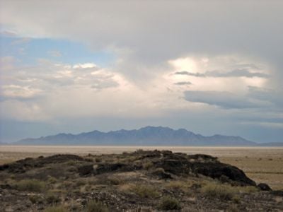
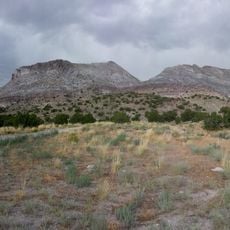
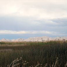
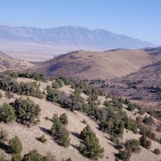
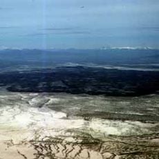
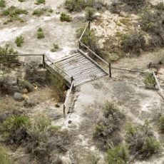
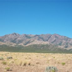
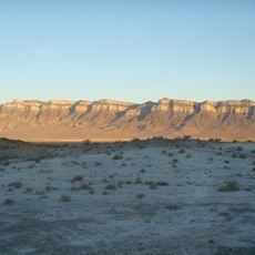
Dugway Proving Ground is a military installation in Tooele County that occupies roughly 800 square miles of western Utah desert landscape. The facility includes testing ranges for weapons systems, chemical and biological defense research, and zones designed to evaluate military equipment under extreme conditions.

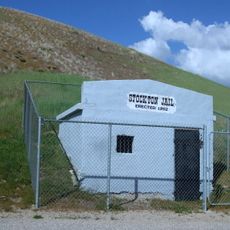
The facility was established in 1942 as a chemical weapons testing site during World War II and retained its role as a defense technology research base after the war ended. Over the decades, its focus expanded from chemical testing to a broader range of military evaluations.

Military personnel and civilian contractors work together at this installation, conducting research programs and maintaining national defense capabilities.

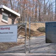
Access to the installation is strictly controlled and limited to authorized personnel and pre-approved visitors with appropriate security clearance. Housing on the base is available to military members and civilian employees who work on the research and testing programs.

In 2004, NASA chose this military site as the landing zone for the return of the Genesis spacecraft after the desert floor was deemed safe for spacecraft reentry. The decision was based on the flat topography and clear airspace over the testing grounds.

Location: Tooele County

Inception: 1942

Website: http://dugway.army.mil

GPS coordinates: 40.18861,-113.21278

Latest update: December 12, 2025 17:44

Photos
Secret military sites and underground facilities around the world

This collection brings together underground military sites, strategic bunkers, and highly secured installations across the world. Many of these places were built during the Cold War, when nuclear threats pushed governments to create protected command centers deep under mountains or in remote areas....

Around this place
Bonneville Speedway
United States of America

Bonneville Speedway

86.2 km
Metaphor: The Tree of Utah
United States of America

Metaphor: The Tree of Utah

67.1 km
Topaz Mountain
United States of America

Topaz Mountain

54.2 km
Fish Springs National Wildlife Refuge
United States of America

Fish Springs National Wildlife Refuge

38.7 km
Deseret Peak
United States of America

Deseret Peak

58.2 km
Cedar Mountain Wilderness
United States of America

Cedar Mountain Wilderness

50 km
Deseret Peak Wilderness
United States of America

Deseret Peak Wilderness

51.1 km
Baker Hot Springs
United States of America

Baker Hot Springs

76.3 km
Fumarole Butte
United States of America

Fumarole Butte

73.8 km
Lincoln Highway Bridge
United States of America

Lincoln Highway Bridge

24.7 km
Thomas N. Taylor House
United States of America

Thomas N. Taylor House

22 km
Stockton Jail
United States of America

Stockton Jail

77.9 km
Harker Canyon (Tooele County, Utah)
United States of America

Harker Canyon (Tooele County, Utah)

66.8 km
Swasey Mountain
United States of America

Swasey Mountain

89.5 km
Hilda Erickson House
United States of America

Hilda Erickson House

77.8 km
Tooele County Courthouse and City Hall
United States of America

Tooele County Courthouse and City Hall

86.5 km
Alex and Mary Alice Johnson House
United States of America

Alex and Mary Alice Johnson House

78.3 km
James and Penninah Wrathall House
United States of America

James and Penninah Wrathall House

78 km
Grantsville First Ward Meetinghouse
United States of America

Grantsville First Ward Meetinghouse

77.8 km
Grantsville School and Meetinghouse
United States of America

Grantsville School and Meetinghouse

77.8 km
John T. Rich House
United States of America

John T. Rich House

77.9 km
Tooele Carnegie Library
United States of America

Tooele Carnegie Library

86.5 km
John C. Sharp House
United States of America

John C. Sharp House

67.2 km
Knight Grain Elevator
United States of America

Knight Grain Elevator

91 km
Ophir Town Hall
United States of America

Ophir Town Hall

84 km
Johnson Hall-Deseret Mercantile Building
United States of America

Johnson Hall-Deseret Mercantile Building

78.3 km
David E. Davis House
United States of America

David E. Davis House

68 km
Reddick Hotel-Ophir LDS Meetinghouse
United States of America

Reddick Hotel-Ophir LDS Meetinghouse

83.8 km
Show the full map
Reviews

Visited this place? Tap the stars to rate it and share your experience / photos with the community! Try now! You can cancel it anytime.

« Dugway Proving Ground - Military testing facility in Tooele County, United States » is provided by Around Us (aroundus.com). Images and texts are derived from Wikimedia project under a Creative Commons license. You are allowed to copy, distribute, and modify copies of this page, under the conditions set by the license, as long as this note is clearly visible.

Discover hidden gems everywhere you go!

From secret cafés to breathtaking viewpoints, skip the crowded tourist spots and find places that match your style. Our app makes it easy with voice search, smart filtering, route optimization, and insider tips from travelers worldwide. Download now for the complete mobile experience.

Around Us App Screenshot

A unique approach to discovering new places

Le Figaro

All the places worth exploring

France Info

A tailor-made excursion in just a few clicks

20 Minutes