Enable Location

We need your location to show you interesting places around you

Discover nearby places

Find interesting locations and hidden gems around you

Precise directions

Get accurate directions and distances to places

Your location is never shared with other users. It's only used when you tap the location button.

Log in to your account

Start exploring — it's free

Trusted by 69,586 travelers worldwide

Continue with Google
Continue with Apple
or

We will send you a code to connect

By continuing, you accept our Terms and Conditions and our Privacy Policy

Check your inbox

We've sent a pincode in your inbox. Please enter the code below.

Neffs Cave
Discussion Reviews Photo
4.5k Popularity

Neffs Cave, Limestone cave in Mount Olympus, United States.

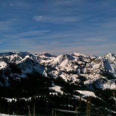
Neffs Cave is a limestone cave on the slopes of Mount Olympus in Salt Lake County, Utah. The cave follows a single vertical fissure that drops deep into the mountain, making it one of the deepest cave systems in the state.

The cave came to wider attention in 1949 when John and Jamie Lyon were trapped inside for three days. After their rescue, the National Speleological Society began formal mapping work in 1957 to document the full extent of the system.

The cave takes its name from the Neff family, who once lived at the base of Mount Olympus. Today, local caving clubs manage access and share knowledge about the geology of the Wasatch Range.

Access to the cave is only possible for experienced caving teams with proper gear and official authorization. Anyone interested in visiting should reach out to local caving groups in advance, as they coordinate access and safety oversight.

The cave sits directly on the Wasatch Fault, an active geological fault line that runs beneath the Salt Lake Valley. An underground river flows below the vertical fissure and can be seen by caving teams who reach the lower sections of the system.

The community of curious travelers

AroundUs brings together thousands of curated places, local tips, and hidden gems, enriched daily by 60,000 contributors worldwide.

Start exploring
Location
GPS coordinates
40.67616,-111.77507
Latest update
March 3, 2026 10:06
Around this place
Big Cottonwood Canyon
United States of America

Big Cottonwood Canyon

8.3 km
Hogle Zoo
United States of America

Hogle Zoo

8.9 km
This Is the Place Heritage Park
United States of America

This Is the Place Heritage Park

9.2 km
Mount Olympus
United States of America

Mount Olympus

2.2 km
Cottonwood Paper Mill
United States of America

Cottonwood Paper Mill

5.8 km
Mill Creek Canyon
United States of America

Mill Creek Canyon

1.7 km
This is the Place Monument
United States of America

This is the Place Monument

9.1 km
This Is The Place Heritage Park
United States of America

This Is The Place Heritage Park

9.2 km
Henry J. Wheeler Farm
United States of America

Henry J. Wheeler Farm

8.7 km
Granite Stake Tabernacle
United States of America

Granite Stake Tabernacle

9.4 km
Mountain Dell Dam
United States of America

Mountain Dell Dam

9.5 km
Murray City Park
United States of America

Murray City Park

9.2 km
Stairs Station Hydroelectric Power Plant Historic District
United States of America

Stairs Station Hydroelectric Power Plant Historic District

6.3 km
Sugar House Monument
United States of America

Sugar House Monument

9 km
George M. Cannon House
United States of America

George M. Cannon House

9.3 km
Amanda Conk Best House
United States of America

Amanda Conk Best House

7.3 km
Granite Hydroelectric Power Plant Historic District
United States of America

Granite Hydroelectric Power Plant Historic District

6.4 km
Converse Hall
United States of America

Converse Hall

9.1 km
Emery County Cabin
United States of America

Emery County Cabin

9.4 km
Third Presbyterian Church Parsonage
United States of America

Third Presbyterian Church Parsonage

9.5 km
Anders Hintze House
United States of America

Anders Hintze House

4.1 km
Harold W. and Evelyn Burton House
United States of America

Harold W. and Evelyn Burton House

5.3 km
Ray F. and Ethel Smith House
United States of America

Ray F. and Ethel Smith House

6.9 km
J. Leo Fairbanks House
United States of America

J. Leo Fairbanks House

9.5 km
Sugarbeets
United States of America

Sugarbeets

8.9 km
Sprague Branch of the Salt Lake City Public Library
United States of America

Sprague Branch of the Salt Lake City Public Library

9 km
Neffs Canyon
United States of America

Neffs Canyon

59 m
Evergreen Avenue Historic District
United States of America

Evergreen Avenue Historic District

4.5 km
Show the full map
Reviews
Share your experience

No review yet

Discussions
Start a discussion...

No discussion yet

« Neffs Cave - Limestone cave in Mount Olympus, United States » is provided by Around Us (aroundus.com). Images and texts are derived from Wikimedia project under a Creative Commons license. You are allowed to copy, distribute, and modify copies of this page, under the conditions set by the license, as long as this note is clearly visible.

Discover hidden gems everywhere you go!

From secret cafés to breathtaking viewpoints, skip the crowded tourist spots and find places that match your style. Our app makes it easy with voice search, smart filtering, route optimization, and insider tips from travelers worldwide. Download now for the complete mobile experience.

Around Us App Screenshot

A unique approach to discovering new places

Le Figaro

All the places worth exploring

France Info

A tailor-made excursion in just a few clicks

20 Minutes

Around Us
Travel Guide & Maps
Download

Send to your phone

QR Code
1

Open the camera app on your mobile.

2

Point at the QR code with your camera. A notification will appear.

3

Tap the notification to open the link.