Enable Location

We need your location to show you interesting places around you

Discover nearby places

Find interesting locations and hidden gems around you

Precise directions

Get accurate directions and distances to places

Your location is never shared with other users. It's only used when you tap the location button.

Big Cottonwood Canyon

Log in to your account

Start exploring — it's free

Trusted by 62,250 travelers worldwide

Continue with Google
Continue with Apple
or

We will send you a code to connect

By continuing, you accept our Terms and Conditions and our Privacy Policy

Check your inbox

We've sent a pincode in your inbox. Please enter the code below.

Big Cottonwood Canyon

Big Cottonwood Canyon, Natural canyon in Salt Lake County, United States

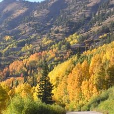
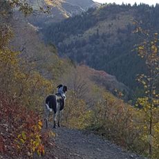
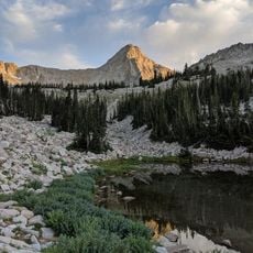
Big Cottonwood Canyon is a mountain valley in the Wasatch Range with steep granite cliffs, thick forests, and peaks rising above 10,000 feet (3,000 meters). The landscape changes from narrow sections to wider areas, with diverse tree cover and rocky overlooks throughout the canyon floor and sides.

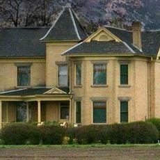
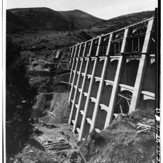
The valley served as an important passage for Native American groups and European settlers, then became a mining area during the 1800s. These earlier uses left marks on the landscape that visitors can still notice today.

The canyon is home to two major ski resorts, Brighton and Solitude, which have shaped how people in Utah spend their winters since they opened in the mid-20th century. These places have become gathering spots where locals and visitors return year after year for snow sports.

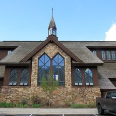
A scenic road through the valley provides marked trails, camping areas, and picnic spots for different activities. Pets have restrictions to protect the water supply, so visitors should plan accordingly.

The valley grows rare plants like Wasatch shooting star that are found only in this mountain region. At the same time, the watershed here supplies drinking water to many people living below in the valley cities.

The community of curious travelers

AroundUs brings together thousands of curated places, local tips, and hidden gems, enriched daily by 60,000 contributors worldwide.

Start exploring
Location
GPS coordinates
40.64100,-111.68900
Latest update
December 7, 2025 19:26
Around this place
Little Cottonwood Canyon
United States of America

Little Cottonwood Canyon

7.9 km
Mount Olympus
United States of America

Mount Olympus

7.2 km
Pfeifferhorn
United States of America

Pfeifferhorn

12 km
Lone Peak
United States of America

Lone Peak

13.9 km
Cottonwood Paper Mill
United States of America

Cottonwood Paper Mill

9.4 km
Mill Creek Canyon
United States of America

Mill Creek Canyon

9.7 km
Cecret Lake
United States of America

Cecret Lake

9.7 km
Doughnut Falls
United States of America

Doughnut Falls

3.1 km
Lone Peak Wilderness
United States of America

Lone Peak Wilderness

12 km
Henry J. Wheeler Farm
United States of America

Henry J. Wheeler Farm

14.6 km
Mountain Dell Dam
United States of America

Mountain Dell Dam

12.5 km
Stairs Station Hydroelectric Power Plant Historic District
United States of America

Stairs Station Hydroelectric Power Plant Historic District

5 km
Joe Quinney Winter Sports Center
United States of America

Joe Quinney Winter Sports Center

13.3 km
Granite Hydroelectric Power Plant Historic District
United States of America

Granite Hydroelectric Power Plant Historic District

8.1 km
Granite LDS Ward Chapel-Avard Fairbanks Studio
United States of America

Granite LDS Ward Chapel-Avard Fairbanks Studio

12.3 km
Anders Hintze House
United States of America

Anders Hintze House

12.2 km
Harold W. and Evelyn Burton House
United States of America

Harold W. and Evelyn Burton House

11.9 km
Ray F. and Ethel Smith House
United States of America

Ray F. and Ethel Smith House

13 km
McPolin Farmstead
United States of America

McPolin Farmstead

14.3 km
St. Mary of the Assumption Church
United States of America

St. Mary of the Assumption Church

13.6 km
Albion Basin
United States of America

Albion Basin

9.3 km
Maybird Gulch
United States of America

Maybird Gulch

8.2 km
Silver Lake
United States of America

Silver Lake

9.4 km
Bells Canyon
United States of America

Bells Canyon

12.9 km
Neffs Canyon
United States of America

Neffs Canyon

8.2 km
Red Pine Lake
United States of America

Red Pine Lake

10.9 km
Evergreen Avenue Historic District
United States of America

Evergreen Avenue Historic District

12.7 km
Hidden Peak
United States of America

Hidden Peak

9.7 km
Show the full map
« Big Cottonwood Canyon - Natural canyon in Salt Lake County, United States » is provided by Around Us (aroundus.com). Images and texts are derived from Wikimedia project under a Creative Commons license. You are allowed to copy, distribute, and modify copies of this page, under the conditions set by the license, as long as this note is clearly visible.

Discover hidden gems everywhere you go!

From secret cafés to breathtaking viewpoints, skip the crowded tourist spots and find places that match your style. Our app makes it easy with voice search, smart filtering, route optimization, and insider tips from travelers worldwide. Download now for the complete mobile experience.

Around Us App Screenshot

A unique approach to discovering new places

Le Figaro

All the places worth exploring

France Info

A tailor-made excursion in just a few clicks

20 Minutes

Around Us
Travel Guide & Maps
Download

Send to your phone

QR Code
1

Open the camera app on your mobile.

2

Point at the QR code with your camera. A notification will appear.

3

Tap the notification to open the link.