Anderson Mesa Station

Log in to your account

AroundUs is a community-driven map of interesting places, built by curious explorers like you. It grows with every review, story, and photo you share.
Connect to save your favorite spots, contribute locations, and create personalized routes.
By continuing, you accept our Terms and Conditions and our Privacy Policy
Add to collection
Map
Suggest a change
Share

Anderson Mesa Station, Astronomical observatory in Coconino County, Arizona, US
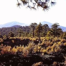
The Anderson Mesa Station stands at 2,163 meters elevation and features multiple telescopes for astronomical research in the clear skies of Arizona.

The station began operations in 1960 when Paul Wright donated the Wright 28 telescope, establishing a foundation for future astronomical discoveries.

Scientists and researchers from multiple institutions collaborate at Anderson Mesa Station to conduct astronomical studies and share knowledge about celestial objects.

The facility maintains advanced software systems and specialized cameras to capture, process, and archive high-quality astronomical images for research purposes.

The Naval Precision Optical Interferometer at Anderson Mesa combines data from multiple telescopes to create detailed images of celestial objects.

Location: Coconino County

Inception: 1960

Elevation above the sea: 2,163 m

Website: http://www.lowell.edu/

Website: http://lowell.edu

GPS coordinates: 35.09694,-111.53583

Latest update: April 3, 2025 18:23

Around this place
Show the full map
San Francisco Peaks
United States of America

San Francisco Peaks

29.3 km
Lowell Observatory
United States of America

Lowell Observatory

16.6 km
Oak Creek Canyon
United States of America

Oak Creek Canyon

26.9 km
Slide Rock State Park
United States of America

Slide Rock State Park

26.9 km
Riordan Mansion State Historic Park
United States of America

Riordan Mansion State Historic Park

15.1 km
Museum of Northern Arizona
United States of America

Museum of Northern Arizona

19.3 km
Agassiz Peak
United States of America

Agassiz Peak

28.6 km
Kachina Peaks Wilderness
United States of America

Kachina Peaks Wilderness

29.3 km
Elden Pueblo
United States of America

Elden Pueblo

16.6 km
Fremont Peak
United States of America

Fremont Peak

27.6 km
Weatherford Hotel
United States of America

Weatherford Hotel

15.2 km
The Arboretum at Flagstaff
United States of America

The Arboretum at Flagstaff

19.1 km
Doyle Peak
United States of America

Doyle Peak

27.8 km
Railroad Addition Historic District
United States of America

Railroad Addition Historic District

15.1 km
Lenox Crater
United States of America

Lenox Crater

29.3 km
Our Lady of Guadaloupe Church
United States of America

Our Lady of Guadaloupe Church

15.3 km
Presbyterian Church Parsonage
United States of America

Presbyterian Church Parsonage

15.2 km
Brannen-Devine House
United States of America

Brannen-Devine House

14.9 km
Cliffs Ranger Station
United States of America

Cliffs Ranger Station

8.8 km
Riordan Mansion
United States of America

Riordan Mansion

15.1 km
Flagstaff Armory
United States of America

Flagstaff Armory

15.5 km
Pioneer Museum--Arizona Historical Society
United States of America

Pioneer Museum--Arizona Historical Society

17.8 km
Flagstaff Southside Historic District
United States of America

Flagstaff Southside Historic District

15 km
Woody Mountain Lookout Tower
United States of America

Woody Mountain Lookout Tower

20.3 km
Walnut Canyon Visitor Center
United States of America

Walnut Canyon Visitor Center

8.6 km
Flagstaff Federated Community Church
United States of America

Flagstaff Federated Community Church

15.7 km
Pumphouse Wash Bridge
United States of America

Pumphouse Wash Bridge

19.9 km
Flagstaff City-coconino County Public Library
United States of America

Flagstaff City-coconino County Public Library

15.6 km
Show the full map

Reviews

Visited this place? Tap the stars to rate it and share your experience / photos with the community! Try now! You can cancel it anytime.

« Anderson Mesa Station: Astronomical observatory in Coconino County, Arizona, US » is provided by Around Us (aroundus.com). Images and texts are derived from Wikimedia project under a Creative Commons license. You are allowed to copy, distribute, and modify copies of this page, under the conditions set by the license, as long as this note is clearly visible.

Discover hidden gems everywhere you go!

From secret cafés to breathtaking viewpoints, skip the crowded tourist spots and find places that match your style. Our app makes it easy with voice search, smart filtering, route optimization, and insider tips from travelers worldwide. Download now for the complete mobile experience.

Around Us App Screenshot

A unique approach to discovering new places

Le Figaro

All the places worth exploring

France Info

A tailor-made excursion in just a few clicks

20 Minutes