Enable Location

We need your location to show you interesting places around you

Discover nearby places

Find interesting locations and hidden gems around you

Precise directions

Get accurate directions and distances to places

Your location is never shared with other users. It's only used when you tap the location button.

Hite Crossing Bridge

Log in to your account

Start exploring — it's free

Trusted by 65,430 travelers worldwide

Continue with Google
Continue with Apple
or

We will send you a code to connect

By continuing, you accept our Terms and Conditions and our Privacy Policy

Check your inbox

We've sent a pincode in your inbox. Please enter the code below.

Hite Crossing Bridge
Discussion Reviews 1 Photos
6.3k Popularity

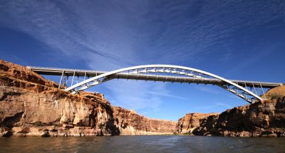
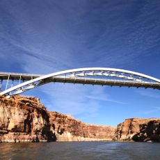
Hite Crossing Bridge, Steel arch bridge at Narrow Canyon, Utah.

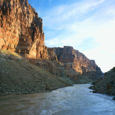
Hite Crossing Bridge is a steel arch bridge over the Colorado River in Utah, carrying Utah State Route 95 between Garfield County and San Juan County. It sits inside Glen Canyon National Recreation Area, spanning a canyon section where the river meets the upper end of Lake Powell.

The bridge was completed in 1966, shortly after the Glen Canyon Dam changed water levels across this stretch of the river. It replaced a ferry service known as Dandy Crossing that had been operating here for about 20 years before the dam altered the area.

The bridge takes its name from prospector Cass Hite, who set up a river crossing here in the 1880s and brought some of the first settlers to this remote stretch of canyon country. Drivers crossing today follow roughly the same route that mule teams and early travelers once used to get from one side of the Colorado to the other.

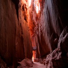
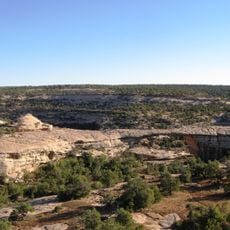
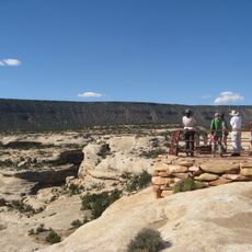
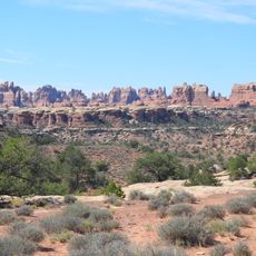
The bridge sits in one of the most remote parts of Utah, far from towns or gas stations, so carrying extra water and fuel before heading out is a good idea. The road across is paved, but the surrounding desert offers little shade and conditions can change quickly depending on the time of year.

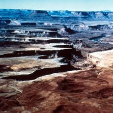
The bridge deck sits about 200 feet (61 meters) above the river, placing it right at the point where Cataract Canyon ends and the calmer waters of Lake Powell begin. This means that from the bridge, you can look upstream into a canyon shaped by rapids and downstream into an open reservoir, all at once.

The community of curious travelers

AroundUs brings together thousands of curated places, local tips, and hidden gems, enriched daily by 60,000 contributors worldwide.

Start exploring
Location
Location
Inception
June 3, 1966
Official opening
June 3, 1966
GPS coordinates
37.89110,-110.37100
Latest update
March 3, 2026 22:40
Reviews
Share your experience

No review yet

Discussions
Start a discussion...

No discussion yet

« Hite Crossing Bridge - Steel arch bridge at Narrow Canyon, Utah » is provided by Around Us (aroundus.com). Images and texts are derived from Wikimedia project under a Creative Commons license. You are allowed to copy, distribute, and modify copies of this page, under the conditions set by the license, as long as this note is clearly visible.

Discover hidden gems everywhere you go!

From secret cafés to breathtaking viewpoints, skip the crowded tourist spots and find places that match your style. Our app makes it easy with voice search, smart filtering, route optimization, and insider tips from travelers worldwide. Download now for the complete mobile experience.

Around Us App Screenshot

A unique approach to discovering new places

Le Figaro

All the places worth exploring

France Info

A tailor-made excursion in just a few clicks

20 Minutes

Around Us
Travel Guide & Maps
Download

Send to your phone

QR Code
1

Open the camera app on your mobile.

2

Point at the QR code with your camera. A notification will appear.

3

Tap the notification to open the link.