Chest opened
+${chestReward.xp} XP
Explorer
NOUVEAU ×${chestReward.collectible.quantity}
tapez pour fermer
Chest locked

Open chests in the app

Around Us is built for your phone — chests unlock when you walk, explore and capture nearby places.

Enable Location

We need your location to show you interesting places around you

Discover nearby places

Find interesting locations and hidden gems around you

Precise directions

Get accurate directions and distances to places

Your location is never shared with other users. It's only used when you tap the location button.

Kewa Pueblo

Log in to your account

Start exploring — it's free

Trusted by 72,878 travelers worldwide

Continue with Google
Continue with Apple
or

We will send you a code to connect

By continuing, you accept our Terms and Conditions and our Privacy Policy

Check your inbox

We've sent a pincode in your inbox. Please enter the code below.

Discussion Reviews 1 Photos
11.8k Popularity

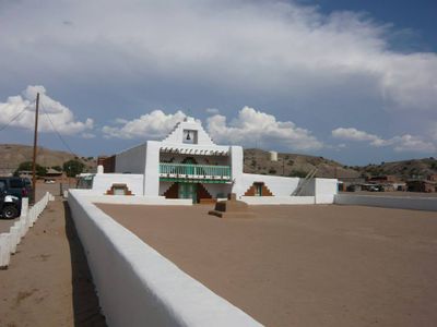
Kewa Pueblo, Native American census place in Sandoval County, United States.

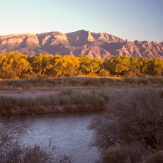
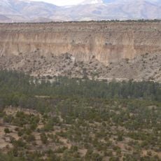
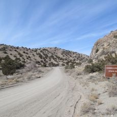
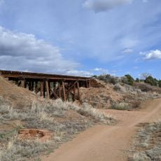
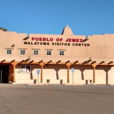
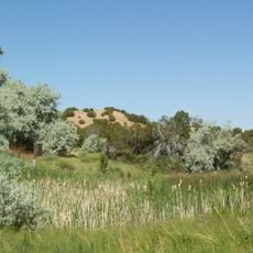
Kewa Pueblo is a census-designated place in Sandoval County in northern New Mexico where the Kewa people live and maintain their traditions. The community sits between Albuquerque and Santa Fe, anchored to land they have occupied for centuries.

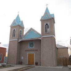
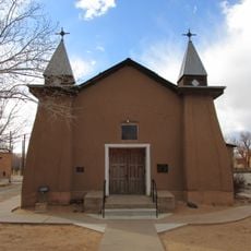
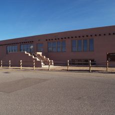
The Kewa people have occupied this land since before European contact and maintained an unbroken presence through centuries of change. A tribal council continues to govern community affairs and guide decisions today.

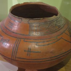
The Kewa create traditional pottery, jewelry, and beadwork that reflect their skilled craftsmanship and knowledge passed down through families. These works remain central to daily life and community gatherings throughout the year.

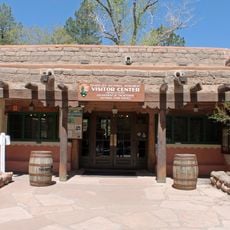
The community is accessible from nearby cities and offers cultural programs and events throughout the year for visitors to attend. It is helpful to plan ahead and check what activities are happening when you want to visit.

The vast majority of residents here identify as American Indian, making this one of the strongest centers of Kewa traditions in the region. This deep connection to heritage and identity shapes how the community functions and celebrates its way of life.

The community of curious travelers

AroundUs brings together thousands of curated places, local tips, and hidden gems, enriched daily by 60,000 contributors worldwide.

Start exploring
Location
Elevation above the sea
1,581 m
GPS coordinates
35.51440,-106.36300
Latest update
December 7, 2025 20:48
Around this place
Meow Wolf
United States of America

Meow Wolf

36.7 km
Sandia Mountains
United States of America

Sandia Mountains

34.8 km
Sandia Peak Tramway
United States of America

Sandia Peak Tramway

37.6 km
La Luz Trail
United States of America

La Luz Trail

35 km
Sandia Cave
United States of America

Sandia Cave

29.1 km
Pajarito Plateau
United States of America

Pajarito Plateau

37.8 km
El Rancho de las Golondrinas
United States of America

El Rancho de las Golondrinas

23.7 km
Coronado State Monument
United States of America

Coronado State Monument

27.1 km
Bandelier Tuff
United States of America

Bandelier Tuff

28 km
San Lazaro archaeological site
United States of America

San Lazaro archaeological site

33.9 km
Budaghers
United States of America

Budaghers

6.8 km
Cerrillos Hills State Park
United States of America

Cerrillos Hills State Park

20 km
Santa Fe Rail Trail
United States of America

Santa Fe Rail Trail

34.1 km
Our Lady of Sorrows Church
United States of America

Our Lady of Sorrows Church

27.7 km
San Ysidro Church
United States of America

San Ysidro Church

38.7 km
Tonque Pueblo
United States of America

Tonque Pueblo

17.4 km
Tinkertown Museum
United States of America

Tinkertown Museum

38.4 km
Bandelier CCC Historic District
United States of America

Bandelier CCC Historic District

30.6 km
San Antonito Church and Cemetery
United States of America

San Antonito Church and Cemetery

39 km
The Santa Fe Reptile and Bug Museum
United States of America

The Santa Fe Reptile and Bug Museum

31.9 km
Walatowa Visitor Center
United States of America

Walatowa Visitor Center

36 km
Tanos Formation
United States of America

Tanos Formation

12.1 km
Roosevelt School
United States of America

Roosevelt School

28.9 km
Jardín botánico de Santa Fe
United States of America

Jardín botánico de Santa Fe

24.6 km
Leonora Curtin Wetland Preserve
United States of America

Leonora Curtin Wetland Preserve

24.6 km
Frijoles Canyon Visitor Center
United States of America

Frijoles Canyon Visitor Center

30.6 km
Los Alamos VLBA station
United States of America

Los Alamos VLBA station

30.9 km
Becoming Human
United States of America

Becoming Human

36.6 km
Show the full map
Reviews
Share your experience

No review yet

Discussions
Start a discussion...

No discussion yet

« Kewa Pueblo - Native American census place in Sandoval County, United States » is provided by Around Us (aroundus.com). Images and texts are derived from Wikimedia project under a Creative Commons license. You are allowed to copy, distribute, and modify copies of this page, under the conditions set by the license, as long as this note is clearly visible.

Discover hidden gems everywhere you go!

From secret cafés to breathtaking viewpoints, skip the crowded tourist spots and find places that match your style. Our app makes it easy with voice search, smart filtering, route optimization, and insider tips from travelers worldwide. Download now for the complete mobile experience.

Around Us App Screenshot

A unique approach to discovering new places

Le Figaro

All the places worth exploring

France Info

A tailor-made excursion in just a few clicks

20 Minutes

Around Us
Travel Guide & Maps
Download

Send to your phone

QR Code
1

Open the camera app on your mobile.

2

Point at the QR code with your camera. A notification will appear.

3

Tap the notification to open the link.