Chest opened
+${chestReward.xp} XP
Explorer
NOUVEAU ×${chestReward.collectible.quantity}
tapez pour fermer
Chest locked

Open chests in the app

Around Us is built for your phone — chests unlock when you walk, explore and capture nearby places.

Enable Location

We need your location to show you interesting places around you

Discover nearby places

Find interesting locations and hidden gems around you

Precise directions

Get accurate directions and distances to places

Your location is never shared with other users. It's only used when you tap the location button.

San Rafael Swell

Log in to your account

Start exploring — it's free

Trusted by 72,993 travelers worldwide

Continue with Google
Continue with Apple
or

We will send you a code to connect

By continuing, you accept our Terms and Conditions and our Privacy Policy

Check your inbox

We've sent a pincode in your inbox. Please enter the code below.

San Rafael Swell
Discussion Reviews 1 Photos
38.4k Popularity

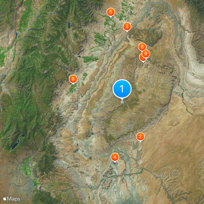
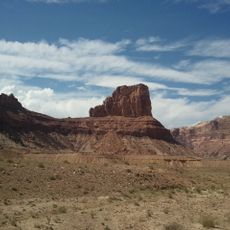
San Rafael Swell, Mountain range in Emery County, Utah.

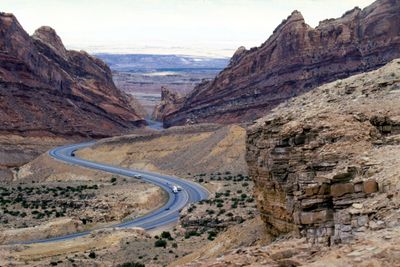
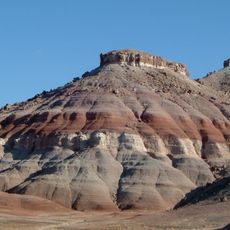
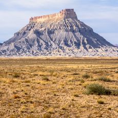
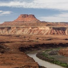
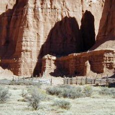
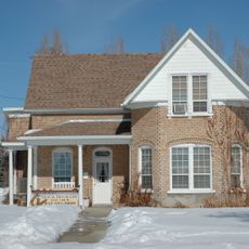
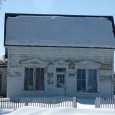
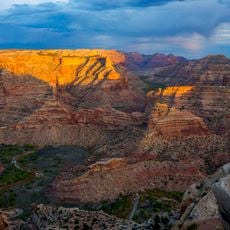
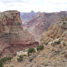
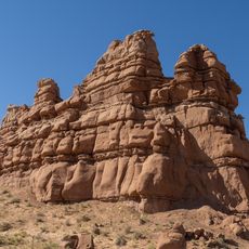
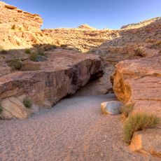
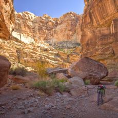
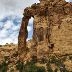
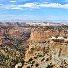
San Rafael Swell is a mountain range in Utah featuring extensive sandstone formations, deep canyons, plateaus, and natural arches across its landscape. The terrain shows layers of colored rock carved by erosion into a complex network of valleys and ridges.

About 50 million years ago, volcanic activity lifted a large mass of land and created this region's distinctive dome shape. Over time, wind and water eroded this uplifted rock, carving the canyons and valleys visible today.

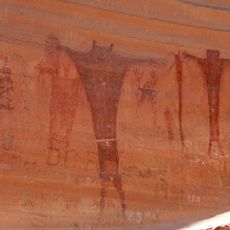
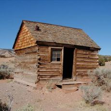
This area was home to Fremont, Paiute, and Ute peoples who left rock art at sites like Buckhorn Draw that you can still see today. These ancient markings tell the story of the people who lived and traveled through this land long ago.

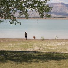
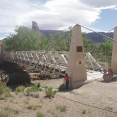
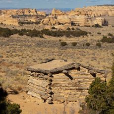
This region is remote with no services or supplies inside, so arrive with water, food, and a full gas tank. Many locations require four-wheel-drive vehicles and you should plan trips carefully with plenty of time.

The Mars Society operates a research station here because the landscape resembles Mars' red terrain. Scientists use this environment to study how humans might work on other planets.

The community of curious travelers

AroundUs brings together thousands of curated places, local tips, and hidden gems, enriched daily by 60,000 contributors worldwide.

Start exploring
Location
GPS coordinates
38.81300,-110.85500
Latest update
December 17, 2025 09:43
Around this place
Goblin Valley State Park
United States of America

Goblin Valley State Park

30.2 km
Cedar Mountain Formation
United States of America

Cedar Mountain Formation

48.8 km
Factory Butte
United States of America

Factory Butte

42.1 km
Huntington State Park
United States of America

Huntington State Park

59.1 km
Buckhorn Draw Pictograph Panel
United States of America

Buckhorn Draw Pictograph Panel

37.3 km
Bottleneck Peak and Moon
United States of America

Bottleneck Peak and Moon

31.1 km
Emery LDS Church
United States of America

Emery LDS Church

36.1 km
San Rafael Bridge
United States of America

San Rafael Bridge

34 km
Ekker Butte
United States of America

Ekker Butte

59.3 km
Cathedral Valley Corral
United States of America

Cathedral Valley Corral

56.4 km
Samuel Singleton House
United States of America

Samuel Singleton House

38.6 km
Lesley Morrell Line Cabin and Corral
United States of America

Lesley Morrell Line Cabin and Corral

57.5 km
Ferron Presbyterian Church and Cottage
United States of America

Ferron Presbyterian Church and Cottage

39.8 km
Castle Dale School
United States of America

Castle Dale School

46.8 km
Lars Peter Larson House
United States of America

Lars Peter Larson House

59.4 km
Paul C. Christensen House
United States of America

Paul C. Christensen House

46.8 km
Leander Lemmon House
United States of America

Leander Lemmon House

57.9 km
Cleveland-Lloyd Dinosaur Quarry
United States of America

Cleveland-Lloyd Dinosaur Quarry

58.6 km
Wedge Overlook
United States of America

Wedge Overlook

32.8 km
Little Grand Canyon
United States of America

Little Grand Canyon

33.8 km
Kathline Rock
United States of America

Kathline Rock

42.3 km
Little Wild Horse Canyon
United States of America

Little Wild Horse Canyon

34.4 km
Carl’s Critter Garden
United States of America

Carl’s Critter Garden

50.4 km
Bell Canyon
United States of America

Bell Canyon

25.3 km
Swasey's Cabin
United States of America

Swasey's Cabin

4.8 km
Eagle Canyon Arch
United States of America

Eagle Canyon Arch

4.4 km
Eagle Canyon
United States of America

Eagle Canyon

20.9 km
Eagle Canyon Bridge
United States of America

Eagle Canyon Bridge

5.3 km
Show the full map
Reviews
Share your experience

No review yet

Discussions
Start a discussion...

No discussion yet

« San Rafael Swell - Mountain range in Emery County, Utah » is provided by Around Us (aroundus.com). Images and texts are derived from Wikimedia project under a Creative Commons license. You are allowed to copy, distribute, and modify copies of this page, under the conditions set by the license, as long as this note is clearly visible.

Discover hidden gems everywhere you go!

From secret cafés to breathtaking viewpoints, skip the crowded tourist spots and find places that match your style. Our app makes it easy with voice search, smart filtering, route optimization, and insider tips from travelers worldwide. Download now for the complete mobile experience.

Around Us App Screenshot

A unique approach to discovering new places

Le Figaro

All the places worth exploring

France Info

A tailor-made excursion in just a few clicks

20 Minutes

Around Us
Travel Guide & Maps
Download

Send to your phone

QR Code
1

Open the camera app on your mobile.

2

Point at the QR code with your camera. A notification will appear.

3

Tap the notification to open the link.