Enable Location

We need your location to show you interesting places around you

Discover nearby places

Find interesting locations and hidden gems around you

Precise directions

Get accurate directions and distances to places

Your location is never shared with other users. It's only used when you tap the location button.

Ouray National Wildlife Refuge

Log in to your account

Start exploring — it's free

Trusted by 62,284 travelers worldwide

Continue with Google
Continue with Apple
or

We will send you a code to connect

By continuing, you accept our Terms and Conditions and our Privacy Policy

Check your inbox

We've sent a pincode in your inbox. Please enter the code below.

Ouray National Wildlife Refuge

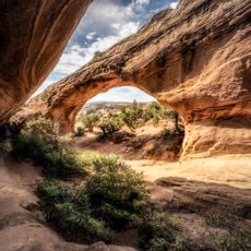
Ouray National Wildlife Refuge, Nature reserve along Green River in Uintah County, Utah.

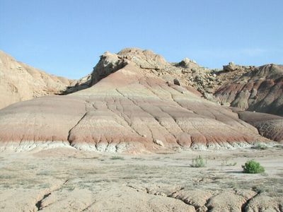
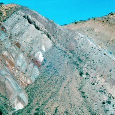
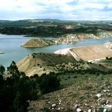
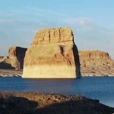
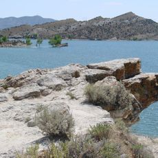
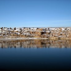
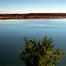
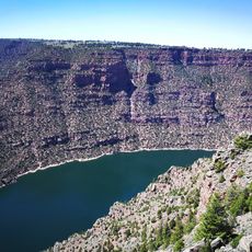
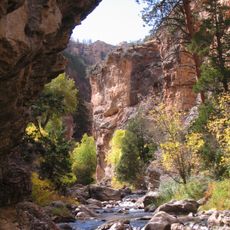
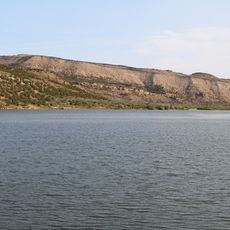
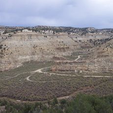
Ouray National Wildlife Refuge is a nature reserve along the Green River in Utah that spans several miles. The landscape includes wetlands, grasslands, and clay bluffs that provide habitat for many bird species and other wildlife.

The refuge was established in 1960 by the U.S. Fish and Wildlife Service and partly used land leased from the Uintah and Ouray Indian Reservation. This decision marked the beginning of protection for this river landscape and its animal populations.

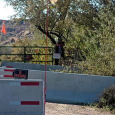
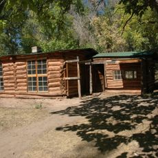
The refuge lets visitors watch native wildlife through designated viewing spots and walking paths that cross different habitats. These trails show how various landscapes meet and support the animals that live here.

The refuge offers various activities including seasonal hunting on waterfowl, deer, and elk, plus fishing from an accessible pier. Visitors should check at visitor centers for current conditions and which paths are open to walk.

The grounds contain a national fish hatchery that breeds endangered freshwater species like razorback suckers and humpback chubs. These breeding programs help keep populations of species that naturally occur in these waters.

The community of curious travelers

AroundUs brings together thousands of curated places, local tips, and hidden gems, enriched daily by 60,000 contributors worldwide.

Start exploring
Location
Operator
US Fish and Wildlife Service
GPS coordinates
40.17286,-109.58977
Latest update
December 13, 2025 11:47
Around this place
Skinwalker Ranch
United States of America

Skinwalker Ranch

27.1 km
Morrison Formation
United States of America

Morrison Formation

38.7 km
Fantasy Canyon
United States of America

Fantasy Canyon

21.1 km
Red Fleet State Park
United States of America

Red Fleet State Park

47.5 km
Lone Rock
United States of America

Lone Rock

62 km
Josie Bassett Morris Ranch Complex
United States of America

Josie Bassett Morris Ranch Complex

45.1 km
Steinaker State Park
United States of America

Steinaker State Park

38.7 km
Quarry Visitor Center
United States of America

Quarry Visitor Center

38.6 km
Utah Field House of Natural History State Park Museum
United States of America

Utah Field House of Natural History State Park Museum

32 km
Dinah the Pink Dinosaur
United States of America

Dinah the Pink Dinosaur

32.2 km
Quarry Exhibit Hall
United States of America

Quarry Exhibit Hall

38.6 km
Rial Chew Ranch Complex
United States of America

Rial Chew Ranch Complex

60.9 km
Fred Hayes State Park at Starvation
United States of America

Fred Hayes State Park at Starvation

73 km
Big Sand Wash Reservoir
United States of America

Big Sand Wash Reservoir

55.8 km
Utah Field House of Natural History State Park Museum
United States of America

Utah Field House of Natural History State Park Museum

32 km
Earl Douglass Workshop-Laboratory
United States of America

Earl Douglass Workshop-Laboratory

38.6 km
Lewis Curry House
United States of America

Lewis Curry House

30.7 km
Manfred and Ethel Martin House
United States of America

Manfred and Ethel Martin House

32.1 km
St. Paul's Episcopal Church and Lodge
United States of America

St. Paul's Episcopal Church and Lodge

31.9 km
Gibson-Sowards House
United States of America

Gibson-Sowards House

36.9 km
Vernal Tithing Office
United States of America

Vernal Tithing Office

31.5 km
Moonshine Arch
United States of America

Moonshine Arch

42.8 km
Starvation Reservoir
United States of America

Starvation Reservoir

74.5 km
Argyle Canyon
United States of America

Argyle Canyon

77.2 km
Hole in the Wall Canyon
United States of America

Hole in the Wall Canyon

49.5 km
Kenney Reservoir
United States of America

Kenney Reservoir

75.1 km
Cooper Canyon
United States of America

Cooper Canyon

58.6 km
Fenn-Bullock House
United States of America

Fenn-Bullock House

32 km
Show the full map
« Ouray National Wildlife Refuge - Nature reserve along Green River in Uintah County, Utah » is provided by Around Us (aroundus.com). Images and texts are derived from Wikimedia project under a Creative Commons license. You are allowed to copy, distribute, and modify copies of this page, under the conditions set by the license, as long as this note is clearly visible.

Discover hidden gems everywhere you go!

From secret cafés to breathtaking viewpoints, skip the crowded tourist spots and find places that match your style. Our app makes it easy with voice search, smart filtering, route optimization, and insider tips from travelers worldwide. Download now for the complete mobile experience.

Around Us App Screenshot

A unique approach to discovering new places

Le Figaro

All the places worth exploring

France Info

A tailor-made excursion in just a few clicks

20 Minutes

Around Us
Travel Guide & Maps
Download

Send to your phone

QR Code
1

Open the camera app on your mobile.

2

Point at the QR code with your camera. A notification will appear.

3

Tap the notification to open the link.