Enable Location

We need your location to show you interesting places around you

Discover nearby places

Find interesting locations and hidden gems around you

Precise directions

Get accurate directions and distances to places

Your location is never shared with other users. It's only used when you tap the location button.

Steinaker State Park

Log in to your account

Start exploring — it's free

Trusted by 62,835 travelers worldwide

Continue with Google
Continue with Apple
or

We will send you a code to connect

By continuing, you accept our Terms and Conditions and our Privacy Policy

Check your inbox

We've sent a pincode in your inbox. Please enter the code below.

Steinaker State Park, State park and International Dark Sky Park in Uintah County, Utah.

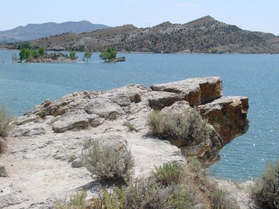
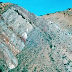
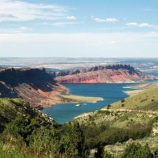
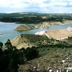
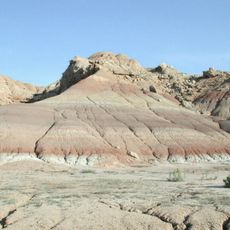
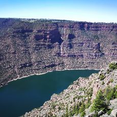
Steinaker State Park is a 2,283-acre (924-hectare) nature reserve near Vernal with a reservoir surrounded by juniper trees, cacti, and sagebrush at 5,500 feet (1,680 meters) elevation. The lake is bordered by dry, rolling hills and includes designated areas for swimming, boating, and relaxation.

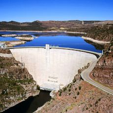
The site was established as a state park in 1964, named after settlers who came to the region generations earlier. The dam was constructed between 1959 and 1962, creating the reservoir that became the park's defining feature.

The park takes its name from John Steinaker, a member of one of the early settler families in the region. Local history remains woven into the landscape through this remembrance of the pioneers who shaped the valley.

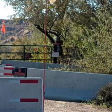
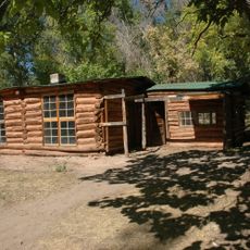
Open year-round with campgrounds featuring electric hookups, a paved boat ramp, and modern facilities spread throughout. The best season to visit runs from spring through fall when weather is mild and all amenities are fully available.

The park holds International Dark Sky Park certification, meaning its nighttime darkness is protected for exceptional stargazing opportunities. The reservoir also contains an aqua park and serves as a reliable location for spotting golden eagles and osprey hunting over the water.

The community of curious travelers

AroundUs brings together thousands of curated places, local tips, and hidden gems, enriched daily by 60,000 contributors worldwide.

Start exploring
Location
Inception
1964
GPS coordinates
40.51750,-109.53000
Latest update
December 12, 2025 09:00
Around this place
Skinwalker Ranch
United States of America

Skinwalker Ranch

41.9 km
Morrison Formation
United States of America

Morrison Formation

21.2 km
Flaming Gorge Dam
United States of America

Flaming Gorge Dam

45.1 km
Flaming Gorge National Recreation Area
United States of America

Flaming Gorge National Recreation Area

45.1 km
Fantasy Canyon
United States of America

Fantasy Canyon

52.7 km
Red Fleet State Park
United States of America

Red Fleet State Park

11 km
Lone Rock
United States of America

Lone Rock

36.7 km
Josie Bassett Morris Ranch Complex
United States of America

Josie Bassett Morris Ranch Complex

31.8 km
Quarry Visitor Center
United States of America

Quarry Visitor Center

21.2 km
Ouray National Wildlife Refuge
United States of America

Ouray National Wildlife Refuge

38.7 km
Utah Field House of Natural History State Park Museum
United States of America

Utah Field House of Natural History State Park Museum

7 km
Dinah the Pink Dinosaur
United States of America

Dinah the Pink Dinosaur

7 km
Quarry Exhibit Hall
United States of America

Quarry Exhibit Hall

21.2 km
Rial Chew Ranch Complex
United States of America

Rial Chew Ranch Complex

43.8 km
Utah Field House of Natural History State Park Museum
United States of America

Utah Field House of Natural History State Park Museum

7 km
Old Ladore School
United States of America

Old Ladore School

61.3 km
Upper Wade and Curtis Cabin
United States of America

Upper Wade and Curtis Cabin

60 km
Ute Mountain Fire Tower
United States of America

Ute Mountain Fire Tower

45.2 km
Swett Ranch
United States of America

Swett Ranch

40.5 km
Earl Douglass Workshop-Laboratory
United States of America

Earl Douglass Workshop-Laboratory

21.2 km
Lewis Curry House
United States of America

Lewis Curry House

8.2 km
Manfred and Ethel Martin House
United States of America

Manfred and Ethel Martin House

6.7 km
St. Paul's Episcopal Church and Lodge
United States of America

St. Paul's Episcopal Church and Lodge

6.9 km
Gibson-Sowards House
United States of America

Gibson-Sowards House

1.8 km
Vernal Tithing Office
United States of America

Vernal Tithing Office

7.2 km
Moonshine Arch
United States of America

Moonshine Arch

4.5 km
Hole in the Wall Canyon
United States of America

Hole in the Wall Canyon

11.1 km
Fenn-Bullock House
United States of America

Fenn-Bullock House

6.7 km
Show the full map
« Steinaker State Park - State park and International Dark Sky Park in Uintah County, Utah » is provided by Around Us (aroundus.com). Images and texts are derived from Wikimedia project under a Creative Commons license. You are allowed to copy, distribute, and modify copies of this page, under the conditions set by the license, as long as this note is clearly visible.

Discover hidden gems everywhere you go!

From secret cafés to breathtaking viewpoints, skip the crowded tourist spots and find places that match your style. Our app makes it easy with voice search, smart filtering, route optimization, and insider tips from travelers worldwide. Download now for the complete mobile experience.

Around Us App Screenshot

A unique approach to discovering new places

Le Figaro

All the places worth exploring

France Info

A tailor-made excursion in just a few clicks

20 Minutes

Around Us
Travel Guide & Maps
Download

Send to your phone

QR Code
1

Open the camera app on your mobile.

2

Point at the QR code with your camera. A notification will appear.

3

Tap the notification to open the link.