Enable Location

We need your location to show you interesting places around you

Discover nearby places

Find interesting locations and hidden gems around you

Precise directions

Get accurate directions and distances to places

Your location is never shared with other users. It's only used when you tap the location button.

Big Sand Wash Reservoir

Log in to your account

Start exploring — it's free

Trusted by 62,836 travelers worldwide

Continue with Google
Continue with Apple
or

We will send you a code to connect

By continuing, you accept our Terms and Conditions and our Privacy Policy

Check your inbox

We've sent a pincode in your inbox. Please enter the code below.

Big Sand Wash Reservoir

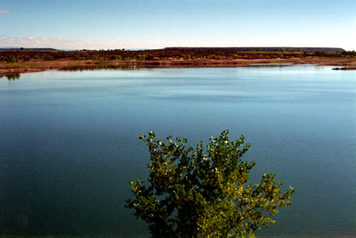
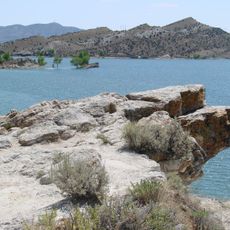
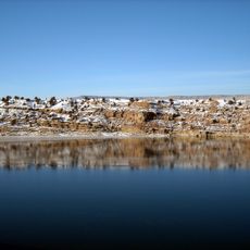
Big Sand Wash Reservoir, reservoir in Duchesne, County, Utah, United States

Big Sand Wash Reservoir is a large body of water in Duchesne County surrounded by open land with sparse trees and wide sky above. The water is bordered by expansive shorelines that make it easy to find spots for fishing, boating, swimming, and walking, with no large buildings nearby to interrupt the simple natural setting.

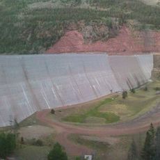
The reservoir developed from a natural wash that was enlarged over time to create the water body as it exists today. In 2007 the site underwent significant expansion work and water treatment with chemicals to manage the fish populations and maintain the fishery.

The reservoir serves as a gathering place for anglers and outdoor enthusiasts from the region who come to fish, camp, and spend time by the water. Local visitors respect the natural setting and maintain simple habits like early morning fishing trips and picnicking along the shoreline.

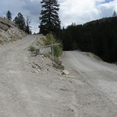
Access from Duchesne is straightforward by taking Highway 40 and following local roads until you reach the water, and new campgrounds and access areas are being developed to make visiting easier. Some private property borders the shoreline, so visitors should stay on public areas and be respectful of land boundaries.

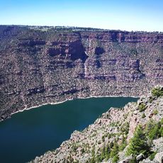
Spearfishing is permitted year-round here, an unusual practice that draws visitors interested in trying this traditional hunting method. The regulation reflects local fishing traditions and offers a different way to experience the water compared to standard rod and reel fishing.

The community of curious travelers

AroundUs brings together thousands of curated places, local tips, and hidden gems, enriched daily by 60,000 contributors worldwide.

Start exploring
Location
GPS coordinates
40.29806,-110.22611
Latest update
February 9, 2026 07:45
Around this place
Skinwalker Ranch
United States of America

Skinwalker Ranch

29 km
King's Peak
United States of America

King's Peak

54.7 km
High Uintas Wilderness
United States of America

High Uintas Wilderness

54.1 km
Ninemile Canyon
United States of America

Ninemile Canyon

62.6 km
Lone Rock
United States of America

Lone Rock

49.4 km
Steinaker State Park
United States of America

Steinaker State Park

63.9 km
Upper Stillwater Reservoir
United States of America

Upper Stillwater Reservoir

50.3 km
Ouray National Wildlife Refuge
United States of America

Ouray National Wildlife Refuge

55.8 km
Utah Field House of Natural History State Park Museum
United States of America

Utah Field House of Natural History State Park Museum

62.5 km
Dinah the Pink Dinosaur
United States of America

Dinah the Pink Dinosaur

63.1 km
Mount Agassiz
United States of America

Mount Agassiz

68.4 km
Fred Hayes State Park at Starvation
United States of America

Fred Hayes State Park at Starvation

21.6 km
Utah Field House of Natural History State Park Museum
United States of America

Utah Field House of Natural History State Park Museum

62.4 km
United States of America

South Kings Peak

53.6 km
Mount Emmons
United States of America

Mount Emmons

46.5 km
Lewis Curry House
United States of America

Lewis Curry House

61.4 km
Stockmore Ranger Station
United States of America

Stockmore Ranger Station

55.5 km
Mount Powell
United States of America

Mount Powell

58.2 km
Manfred and Ethel Martin House
United States of America

Manfred and Ethel Martin House

61.8 km
St. Paul's Episcopal Church and Lodge
United States of America

St. Paul's Episcopal Church and Lodge

61.4 km
Gibson-Sowards House
United States of America

Gibson-Sowards House

63 km
Vernal Tithing Office
United States of America

Vernal Tithing Office

60.9 km
Moonshine Arch
United States of America

Moonshine Arch

64.4 km
Starvation Reservoir
United States of America

Starvation Reservoir

23.6 km
Argyle Canyon
United States of America

Argyle Canyon

56.2 km
Kweeyahgut Peak
United States of America

Kweeyahgut Peak

57.1 km
Hole in the Wall Canyon
United States of America

Hole in the Wall Canyon

71.9 km
Fenn-Bullock House
United States of America

Fenn-Bullock House

61.2 km
Show the full map
« Big Sand Wash Reservoir - reservoir in Duchesne, County, Utah, United States » is provided by Around Us (aroundus.com). Images and texts are derived from Wikimedia project under a Creative Commons license. You are allowed to copy, distribute, and modify copies of this page, under the conditions set by the license, as long as this note is clearly visible.

Discover hidden gems everywhere you go!

From secret cafés to breathtaking viewpoints, skip the crowded tourist spots and find places that match your style. Our app makes it easy with voice search, smart filtering, route optimization, and insider tips from travelers worldwide. Download now for the complete mobile experience.

Around Us App Screenshot

A unique approach to discovering new places

Le Figaro

All the places worth exploring

France Info

A tailor-made excursion in just a few clicks

20 Minutes

Around Us
Travel Guide & Maps
Download

Send to your phone

QR Code
1

Open the camera app on your mobile.

2

Point at the QR code with your camera. A notification will appear.

3

Tap the notification to open the link.