Chest opened
+${chestReward.xp} XP
Explorer
NOUVEAU ×${chestReward.collectible.quantity}
tapez pour fermer
Chest locked

Open chests in the app

Around Us is built for your phone — chests unlock when you walk, explore and capture nearby places.

Enable Location

We need your location to show you interesting places around you

Discover nearby places

Find interesting locations and hidden gems around you

Precise directions

Get accurate directions and distances to places

Your location is never shared with other users. It's only used when you tap the location button.

Log in to your account

Start exploring — it's free

Trusted by 72,888 travelers worldwide

Continue with Google
Continue with Apple
or

We will send you a code to connect

By continuing, you accept our Terms and Conditions and our Privacy Policy

Check your inbox

We've sent a pincode in your inbox. Please enter the code below.

Piceance Basin
Discussion Reviews Photo
9.4k Popularity

Piceance Basin, Geological structural basin in northwestern Colorado, United States.

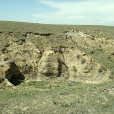
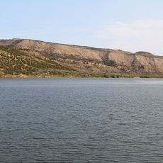
The Piceance Basin is a geological structural basin in northwestern Colorado composed of layered sedimentary rock formations. It holds substantial deposits of coal, natural gas, and oil shale accumulated over millions of years.

The basin formed during the Cretaceous period through tectonic activity that deposited layers of sediment. In the late 1960s, experimental gas extraction techniques were tested in the formation, marking an important phase in energy development.

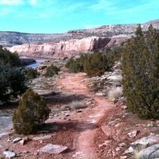
The name Piceance comes from the Shoshoni language, derived from piasonittsi meaning tall grass. This reflects the native vegetation that once covered the high plateaus before industrial development reshaped the landscape.

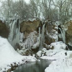
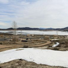
The region is accessible by road across the high plateaus, though some areas may have restricted access due to active resource development. Weather changes quickly in the mountains, so visitors should prepare for variable conditions.

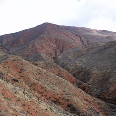
The Williams Fork Formation contains multiple distinct layers of shale, sandstone, and coal from the Cretaceous period stacked vertically. This layering creates a complex geological puzzle that has attracted energy exploration for decades.

The community of curious travelers

AroundUs brings together thousands of curated places, local tips, and hidden gems, enriched daily by 60,000 contributors worldwide.

Start exploring
Location
GPS coordinates
39.86230,-108.33200
Latest update
December 10, 2025 15:58
Around this place
Rifle Falls State Park
United States of America

Rifle Falls State Park

58 km
Laramie Formation
United States of America

Laramie Formation

81.9 km
Highline Lake State Park
United States of America

Highline Lake State Park

78.9 km
Rifle Gap State Park
United States of America

Rifle Gap State Park

55.5 km
Vega State Park
United States of America

Vega State Park

84.8 km
Harvey Gap State Park
United States of America

Harvey Gap State Park

64.1 km
Ralph Stocker Stadium
United States of America

Ralph Stocker Stadium

89.5 km
Value Place
United States of America

Value Place

88 km
Storm King Mountain
United States of America

Storm King Mountain

85.3 km
Kokopelli's Trail
United States of America

Kokopelli's Trail

87.3 km
CAF Rocky Mountain Wing Museum
United States of America

CAF Rocky Mountain Wing Museum

84.5 km
Western Colorado Center for the Arts
United States of America

Western Colorado Center for the Arts

88.9 km
South Canon Bridge
United States of America

South Canon Bridge

86 km
Cross Orchards Historic Site
United States of America

Cross Orchards Historic Site

86.8 km
St. James Episcopal Church
United States of America

St. James Episcopal Church

41 km
Rifle Bridge
United States of America

Rifle Bridge

60.1 km
Clifton Community Center and Church
United States of America

Clifton Community Center and Church

86.4 km
IOOF Hall
United States of America

IOOF Hall

59.7 km
Fruita Museum
United States of America

Fruita Museum

86.3 km
Wasson-McKay Place
United States of America

Wasson-McKay Place

51.9 km
Hay's Ranch Bridge
United States of America

Hay's Ranch Bridge

26.5 km
Meeker Historic District
United States of America

Meeker Historic District

40.7 km
Meeker I.O.O.F. Lodge—Valentine Lodge No. 47
United States of America

Meeker I.O.O.F. Lodge—Valentine Lodge No. 47

40.9 km
Mondi Cable Ski
United States of America

Mondi Cable Ski

86.1 km
The Art Center
United States of America

The Art Center

88.9 km
Horsethief Canyon
United States of America

Horsethief Canyon

87.4 km
Graff Dairy
United States of America

Graff Dairy

87.6 km
Kenney Reservoir
United States of America

Kenney Reservoir

43 km
Show the full map
Reviews
Share your experience

No review yet

Discussions
Start a discussion...

No discussion yet

« Piceance Basin - Geological structural basin in northwestern Colorado, United States » is provided by Around Us (aroundus.com). Images and texts are derived from Wikimedia project under a Creative Commons license. You are allowed to copy, distribute, and modify copies of this page, under the conditions set by the license, as long as this note is clearly visible.

Discover hidden gems everywhere you go!

From secret cafés to breathtaking viewpoints, skip the crowded tourist spots and find places that match your style. Our app makes it easy with voice search, smart filtering, route optimization, and insider tips from travelers worldwide. Download now for the complete mobile experience.

Around Us App Screenshot

A unique approach to discovering new places

Le Figaro

All the places worth exploring

France Info

A tailor-made excursion in just a few clicks

20 Minutes

Around Us
Travel Guide & Maps
Download

Send to your phone

QR Code
1

Open the camera app on your mobile.

2

Point at the QR code with your camera. A notification will appear.

3

Tap the notification to open the link.