McClure Pass

Log in to your account

AroundUs is a community-driven map of interesting places, built by curious explorers like you. It grows with every review, story, and photo you share.
Connect to save your favorite spots, contribute locations, and create personalized routes.
Continue with Google
Continue with Apple
Continue with X
Continue with Facebook
Continue with email
By continuing, you accept our Terms and Conditions and our Privacy Policy
Create an account
Add to collection
Map
Suggest a change
Share

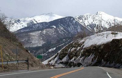
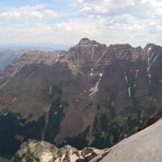
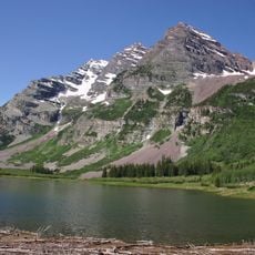
McClure Pass, Mountain pass between Pitkin and Gunnison counties, United States.

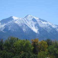
McClure Pass is a mountain crossing in western Colorado that rises to 2,671 meters (8,763 feet) along State Highway 133 between Carbondale and Somerset. The paved road links the two valley communities through a continuous route along the mountainside.

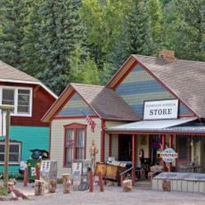
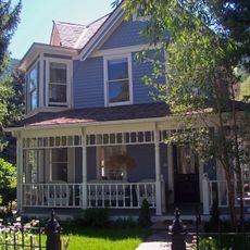
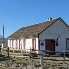
The pass took its name from Thomas McClure, who ran a lodging house for travelers at the eastern base during the late 1800s. The route became an important connection between the two valley communities as transportation developed.

Native peoples traveled this mountain corridor for generations to move between lowland valleys. The route became a natural meeting point for trade and seasonal movement across the region.

The paved road maintains a steady grade and stays open year-round except during severe winter storms. Travelers should watch for changing weather conditions at higher elevations and have a vehicle suitable for mountain driving.

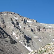
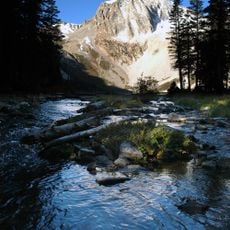
At the summit sits a free campground with fire pits and picnic tables open to visitors. From this spot, people can access the Ragged Mountain Road, a trail offering views across the surrounding peaks.

Location: Gunnison County

Location: Pitkin County

Elevation above the sea: 2,671 m

GPS coordinates: 39.12900,-107.28400

Latest update: December 10, 2025 20:04

Photos
Around this place
Maroon Bells
United States of America

Maroon Bells

26.3 km
Capitol Peak
United States of America

Capitol Peak

17.5 km
Castle Peak
United States of America

Castle Peak

38.9 km
Pyramid Peak
United States of America

Pyramid Peak

29.5 km
Redstone Coke Oven Historic District
United States of America

Redstone Coke Oven Historic District

6.9 km
Redstone Castle
United States of America

Redstone Castle

5.8 km
Maroon Bells–Snowmass Wilderness
United States of America

Maroon Bells–Snowmass Wilderness

25.1 km
Redstone Historic District
United States of America

Redstone Historic District

6.9 km
Snowmass Peak
United States of America

Snowmass Peak

19.8 km
Pioneer Park
United States of America

Pioneer Park

40.1 km
United States of America

Cathedral Peak

38.2 km
Maroon Creek Bridge
United States of America

Maroon Creek Bridge

38.4 km
Wheeler–Stallard House
United States of America

Wheeler–Stallard House

39.9 km
D.E. Frantz House
United States of America

D.E. Frantz House

40.2 km
Holden/Marolt Mining and Ranching Museum
United States of America

Holden/Marolt Mining and Ranching Museum

39.4 km
Davis Waite House
United States of America

Davis Waite House

40.4 km
Marble Community Church
United States of America

Marble Community Church

10.4 km
Matthew Callahan Log Cabin
United States of America

Matthew Callahan Log Cabin

40.1 km
Osgood Gamekeeper's Lodge
United States of America

Osgood Gamekeeper's Lodge

5.7 km
Marble High School
United States of America

Marble High School

10.2 km
Samuel I. Hallett House
United States of America

Samuel I. Hallett House

40.2 km
Smith–Elisha House
United States of America

Smith–Elisha House

40.2 km
Osgood–Kuhnhausen House
United States of America

Osgood–Kuhnhausen House

7.7 km
Paonia First Christian Church
United States of America

Paonia First Christian Church

39.5 km
Dixon–Markle House
United States of America

Dixon–Markle House

40.4 km
Missouri Heights School
United States of America

Missouri Heights School

36 km
Mount Sopris
United States of America

Mount Sopris

18 km
Satank Bridge
United States of America

Satank Bridge

32.4 km
Show the full map
Reviews

Visited this place? Tap the stars to rate it and share your experience / photos with the community! Try now! You can cancel it anytime.

« McClure Pass - Mountain pass between Pitkin and Gunnison counties, United States » is provided by Around Us (aroundus.com). Images and texts are derived from Wikimedia project under a Creative Commons license. You are allowed to copy, distribute, and modify copies of this page, under the conditions set by the license, as long as this note is clearly visible.

Discover hidden gems everywhere you go!

From secret cafés to breathtaking viewpoints, skip the crowded tourist spots and find places that match your style. Our app makes it easy with voice search, smart filtering, route optimization, and insider tips from travelers worldwide. Download now for the complete mobile experience.

Around Us App Screenshot

A unique approach to discovering new places

Le Figaro

All the places worth exploring

France Info

A tailor-made excursion in just a few clicks

20 Minutes