Enable Location

We need your location to show you interesting places around you

Discover nearby places

Find interesting locations and hidden gems around you

Precise directions

Get accurate directions and distances to places

Your location is never shared with other users. It's only used when you tap the location button.

Log in to your account

Start exploring — it's free

Trusted by 62,844 travelers worldwide

Continue with Google
Continue with Apple
or

We will send you a code to connect

By continuing, you accept our Terms and Conditions and our Privacy Policy

Check your inbox

We've sent a pincode in your inbox. Please enter the code below.

Flaming Gorge-Uintas Scenic Byway

Flaming Gorge-Uintas Scenic Byway, scenic byway in Uintah and Daggett counties in Utah, United States

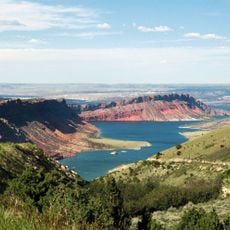
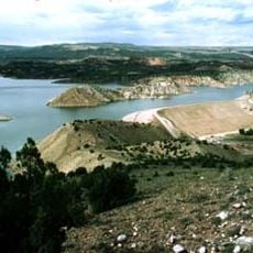
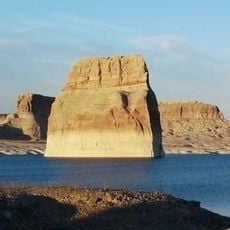
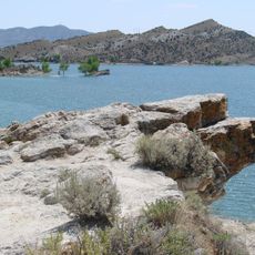
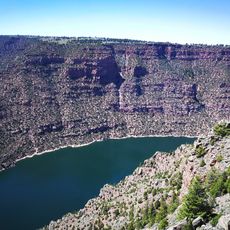
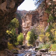
The Flaming Gorge-Uintas Scenic Byway is a 150-mile road between Vernal and Manila that winds over the eastern Uinta Mountains and past the Flaming Gorge Reservoir. Following US Highway 191 and Utah Highway 44, the route passes through rugged terrain, deep canyons, pine and aspen forests, and several viewpoints where visitors can see the colorful water below dramatic rock walls.

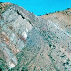
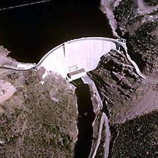
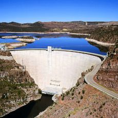
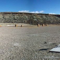
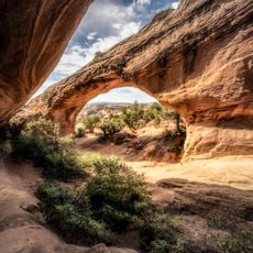
The byway passes through rocks that date back over a billion years, showing the earth's deepest history in exposed layers and formations. The construction of Flaming Gorge Dam in the 1950s transformed the landscape, creating the large reservoir and the town of Dutch John to support the workers who built it.

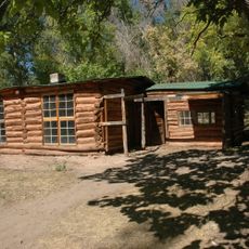
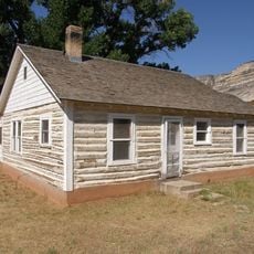
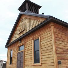
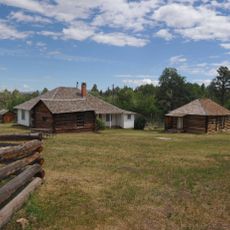
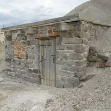
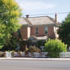
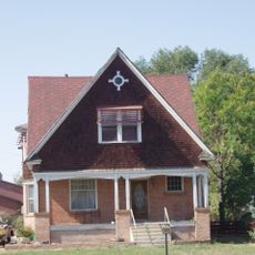
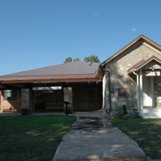
The road tells stories of how people have lived in this land for generations. Along the drive, information signs and historic sites like Swett Ranch and the John Jarvie Historic Site show how settlers and indigenous peoples shaped life here over time.

All roads are paved or well-maintained, making the drive manageable year-round, though winter snow can create hazards so check conditions before visiting. Plan for several hours to stop at viewpoints, interpretive sites, and short trails scattered along the route.

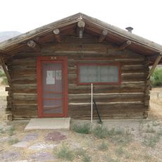
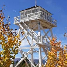
Along the Sheep Creek Loop, visitors can climb the Ute Tower Fire Lookout, a tower restored from the 1930s that once spotted wildfires for the forest service. Today it stands as a piece of history offering views of the mountains and canyons below.

The community of curious travelers

AroundUs brings together thousands of curated places, local tips, and hidden gems, enriched daily by 60,000 contributors worldwide.

Start exploring
Location
Location
Inception
1988
GPS coordinates
40.86420,-109.48300
Latest update
February 9, 2026 08:19
Around this place
Morrison Formation
United States of America

Morrison Formation

49.5 km
Flaming Gorge Reservoir
United States of America

Flaming Gorge Reservoir

33.6 km
Flaming Gorge Dam
United States of America

Flaming Gorge Dam

7.6 km
Flaming Gorge National Recreation Area
United States of America

Flaming Gorge National Recreation Area

7.6 km
Red Fleet State Park
United States of America

Red Fleet State Park

31.7 km
Lone Rock
United States of America

Lone Rock

42.1 km
Josie Bassett Morris Ranch Complex
United States of America

Josie Bassett Morris Ranch Complex

55.4 km
Steinaker State Park
United States of America

Steinaker State Park

38.8 km
Quarry Visitor Center
United States of America

Quarry Visitor Center

49.6 km
Utah Field House of Natural History State Park Museum
United States of America

Utah Field House of Natural History State Park Museum

45.6 km
Dinah the Pink Dinosaur
United States of America

Dinah the Pink Dinosaur

45.5 km
Quarry Exhibit Hall
United States of America

Quarry Exhibit Hall

49.6 km
Rial Chew Ranch Complex
United States of America

Rial Chew Ranch Complex

56.8 km
Utah Field House of Natural History State Park Museum
United States of America

Utah Field House of Natural History State Park Museum

45.6 km
Old Ladore School
United States of America

Old Ladore School

50.6 km
Upper Wade and Curtis Cabin
United States of America

Upper Wade and Curtis Cabin

53.4 km
Ute Mountain Fire Tower
United States of America

Ute Mountain Fire Tower

26.1 km
Scott's Bottom Nature Area
United States of America

Scott's Bottom Nature Area

70.5 km
Swett Ranch
United States of America

Swett Ranch

1.7 km
Earl Douglass Workshop-Laboratory
United States of America

Earl Douglass Workshop-Laboratory

49.6 km
Lewis Curry House
United States of America

Lewis Curry House

46.9 km
Manfred and Ethel Martin House
United States of America

Manfred and Ethel Martin House

45.4 km
St. Paul's Episcopal Church and Lodge
United States of America

St. Paul's Episcopal Church and Lodge

45.7 km
Gibson-Sowards House
United States of America

Gibson-Sowards House

40.6 km
Vernal Tithing Office
United States of America

Vernal Tithing Office

46 km
Moonshine Arch
United States of America

Moonshine Arch

34.7 km
Hole in the Wall Canyon
United States of America

Hole in the Wall Canyon

28.3 km
Fenn-Bullock House
United States of America

Fenn-Bullock House

45.5 km
Show the full map
« Flaming Gorge-Uintas Scenic Byway - scenic byway in Uintah and Daggett counties in Utah, United States » is provided by Around Us (aroundus.com). Images and texts are derived from Wikimedia project under a Creative Commons license. You are allowed to copy, distribute, and modify copies of this page, under the conditions set by the license, as long as this note is clearly visible.

Discover hidden gems everywhere you go!

From secret cafés to breathtaking viewpoints, skip the crowded tourist spots and find places that match your style. Our app makes it easy with voice search, smart filtering, route optimization, and insider tips from travelers worldwide. Download now for the complete mobile experience.

Around Us App Screenshot

A unique approach to discovering new places

Le Figaro

All the places worth exploring

France Info

A tailor-made excursion in just a few clicks

20 Minutes

Around Us
Travel Guide & Maps
Download

Send to your phone

QR Code
1

Open the camera app on your mobile.

2

Point at the QR code with your camera. A notification will appear.

3

Tap the notification to open the link.