Chest opened
+${chestReward.xp} XP
Explorer
NOUVEAU ×${chestReward.collectible.quantity}
tapez pour fermer
Chest locked

Open chests in the app

Around Us is built for your phone — chests unlock when you walk, explore and capture nearby places.

Enable Location

We need your location to show you interesting places around you

Discover nearby places

Find interesting locations and hidden gems around you

Precise directions

Get accurate directions and distances to places

Your location is never shared with other users. It's only used when you tap the location button.

Log in to your account

Start exploring — it's free

Trusted by 72,929 travelers worldwide

Continue with Google
Continue with Apple
or

We will send you a code to connect

By continuing, you accept our Terms and Conditions and our Privacy Policy

Check your inbox

We've sent a pincode in your inbox. Please enter the code below.

Colorado Territory
Discussion Reviews Photo
35.2k Popularity

Colorado Territory, Historical territory in western United States.

Colorado Territory was a region in the western United States that covered the central Rocky Mountains and surrounding plains. It stretched across land between present-day Kansas and Utah, serving as a pathway for settlers moving westward.

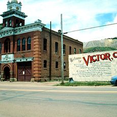
The territory was established in 1861 when gold discoveries triggered a rush of prospectors to the region. It remained a territory for 15 years before becoming a state in 1876.

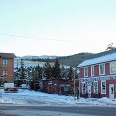
The territorial period brought together Native American tribes, Hispanic settlers, and Anglo-American miners who shaped regional development through their interactions.

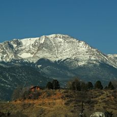
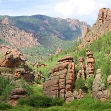
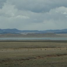
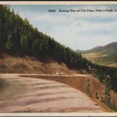
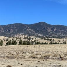
The eastern portion was flat and more settled, while the western part was mountainous and harder to reach. Travelers crossing the territory needed to prepare for varying conditions depending on which direction they were heading.

The boundaries between this territory and its neighbors followed straight lines that barely reflected the geography on the ground. This created confusion in border areas where residents were unsure which jurisdiction they fell under.

The community of curious travelers

AroundUs brings together thousands of curated places, local tips, and hidden gems, enriched daily by 60,000 contributors worldwide.

Start exploring
Inception
1861
GPS coordinates
39.00000,-105.50000
Latest update
December 19, 2025 22:10
Around this place
Pikes Peak
United States of America

Pikes Peak

43.3 km
Eleven Mile State Park
United States of America

Eleven Mile State Park

7.2 km
Mueller State Park
United States of America

Mueller State Park

30.7 km
Lost Creek Wilderness
United States of America

Lost Creek Wilderness

30 km
Antero Reservoir
United States of America

Antero Reservoir

34.3 km
Cripple Creek and Victor Narrow Gauge Railroad
United States of America

Cripple Creek and Victor Narrow Gauge Railroad

39.9 km
Rocky Mountain Dinosaur Resource Center
United States of America

Rocky Mountain Dinosaur Resource Center

38.8 km
Pikes Peak
United States of America

Pikes Peak

43.4 km
Ute Pass
United States of America

Ute Pass

30.4 km
Spinney Mountain State Park
United States of America

Spinney Mountain State Park

11.3 km
Victor Hotel
United States of America

Victor Hotel

44.8 km
Cripple Creek Historic District
United States of America

Cripple Creek Historic District

39.4 km
Wilkerson Pass
United States of America

Wilkerson Pass

4.8 km
Buffalo Peak
United States of America

Buffalo Peak

32.7 km
Thirtynine Mile Mountain
United States of America

Thirtynine Mile Mountain

19.3 km
United States Army Pike's Peak Research Laboratory
United States of America

United States Army Pike's Peak Research Laboratory

43.2 km
Badger Mountain
United States of America

Badger Mountain

5.6 km
Green Mountain
United States of America

Green Mountain

38.1 km
Cripple Creek District Museum
United States of America

Cripple Creek District Museum

40 km
Victor Downtown Historic District
United States of America

Victor Downtown Historic District

44.8 km
Hornbek House
United States of America

Hornbek House

20.5 km
Western Federation of Miners union hall
United States of America

Western Federation of Miners union hall

44.8 km
Colorado Consistory No. 1
United States of America

Colorado Consistory No. 1

42.3 km
South Platte River Bridge
United States of America

South Platte River Bridge

11.9 km
Outlaws And Lawmen Jail Museum
United States of America

Outlaws And Lawmen Jail Museum

39.5 km
Tarryall School
United States of America

Tarryall School

13.6 km
Colorado Wolf and Wildlife Center
United States of America

Colorado Wolf and Wildlife Center

26 km
Florissant Fossil Beds Visitors Center
United States of America

Florissant Fossil Beds Visitors Center

20.9 km
Show the full map
Reviews
Share your experience

No review yet

Discussions
Start a discussion...

No discussion yet

« Colorado Territory - Historical territory in western United States » is provided by Around Us (aroundus.com). Images and texts are derived from Wikimedia project under a Creative Commons license. You are allowed to copy, distribute, and modify copies of this page, under the conditions set by the license, as long as this note is clearly visible.

Discover hidden gems everywhere you go!

From secret cafés to breathtaking viewpoints, skip the crowded tourist spots and find places that match your style. Our app makes it easy with voice search, smart filtering, route optimization, and insider tips from travelers worldwide. Download now for the complete mobile experience.

Around Us App Screenshot

A unique approach to discovering new places

Le Figaro

All the places worth exploring

France Info

A tailor-made excursion in just a few clicks

20 Minutes

Around Us
Travel Guide & Maps
Download

Send to your phone

QR Code
1

Open the camera app on your mobile.

2

Point at the QR code with your camera. A notification will appear.

3

Tap the notification to open the link.