Enable Location

We need your location to show you interesting places around you

Discover nearby places

Find interesting locations and hidden gems around you

Precise directions

Get accurate directions and distances to places

Your location is never shared with other users. It's only used when you tap the location button.

Mueller State Park

Log in to your account

Start exploring — it's free

Trusted by 62,572 travelers worldwide

Continue with Google
Continue with Apple
or

We will send you a code to connect

By continuing, you accept our Terms and Conditions and our Privacy Policy

Check your inbox

We've sent a pincode in your inbox. Please enter the code below.

Mueller State Park

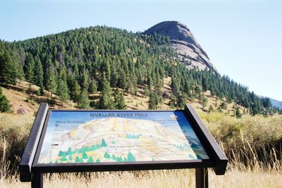
Mueller State Park, Mountain state park in Teller County, Colorado, US

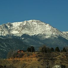
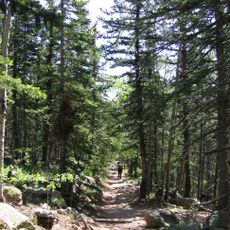
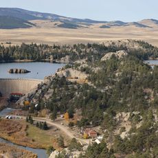
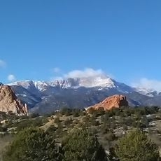
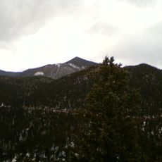
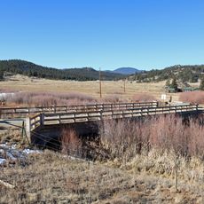
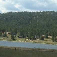
Mueller State Park is a mountain preserve covering over 5,000 acres of high-elevation terrain with coniferous forests, open meadows, and granite rock formations. The landscape features varying elevations and diverse habitats that support different plant and animal communities.

The area served as hunting grounds for the Ute people until the 1850s gold rush brought settlers to the region. In the 20th century, the land operated as a working ranch before becoming a protected park.

The park is named after Richard Mueller, a rancher who managed the land in the 20th century. The area held deep significance for the Ute people as a hunting and gathering ground for generations.

The park is most accessible from spring through fall when trails are in good condition and weather is reliable. Visitors should prepare for variable conditions since the high elevation brings rapid weather changes.

More than 150 bird species breed or pass through the area, including rare varieties like Canada Jay and American Kestrel. This bird diversity makes the park a destination for birdwatchers and wildlife observers.

The community of curious travelers

AroundUs brings together thousands of curated places, local tips, and hidden gems, enriched daily by 60,000 contributors worldwide.

Start exploring
Location
Inception
1988
GPS coordinates
38.87970,-105.18100
Latest update
December 8, 2025 13:42
Around this place
Pikes Peak
United States of America

Pikes Peak

12.7 km
Manitou Incline
United States of America

Manitou Incline

21.7 km
Barr Trail
United States of America

Barr Trail

14.6 km
Eleven Mile State Park
United States of America

Eleven Mile State Park

28.4 km
Cripple Creek and Victor Narrow Gauge Railroad
United States of America

Cripple Creek and Victor Narrow Gauge Railroad

14.7 km
Rainbow Falls
United States of America

Rainbow Falls

22.1 km
The Broadmoor Manitou and Pikes Peak Cog Railway
United States of America

The Broadmoor Manitou and Pikes Peak Cog Railway

21.8 km
Rocky Mountain Dinosaur Resource Center
United States of America

Rocky Mountain Dinosaur Resource Center

17 km
Pikes Peak
United States of America

Pikes Peak

12.8 km
Ute Pass
United States of America

Ute Pass

7.2 km
Santa's Workshop
United States of America

Santa's Workshop

17.9 km
North Pole Colorado
United States of America

North Pole Colorado

17.9 km
Victor Hotel
United States of America

Victor Hotel

19.2 km
Cripple Creek Historic District
United States of America

Cripple Creek Historic District

14.2 km
Stratton's Independence Mine and Mill
United States of America

Stratton's Independence Mine and Mill

19 km
Mount Rosa
United States of America

Mount Rosa

24.6 km
United States Army Pike's Peak Research Laboratory
United States of America

United States Army Pike's Peak Research Laboratory

12.6 km
Eastholme
United States of America

Eastholme

18.5 km
Victor Downtown Historic District
United States of America

Victor Downtown Historic District

19.1 km
Cripple Creek District Museum
United States of America

Cripple Creek District Museum

14.8 km
Hornbek House
United States of America

Hornbek House

10.2 km
Western Federation of Miners union hall
United States of America

Western Federation of Miners union hall

19.1 km
Bridge over Fountain Creek
United States of America

Bridge over Fountain Creek

22.2 km
South Platte River Bridge
United States of America

South Platte River Bridge

19.8 km
Outlaws And Lawmen Jail Museum
United States of America

Outlaws And Lawmen Jail Museum

14.9 km
Colorado Wolf and Wildlife Center
United States of America

Colorado Wolf and Wildlife Center

6.4 km
Lake George
United States of America

Lake George

19.3 km
Florissant Fossil Beds Visitors Center
United States of America

Florissant Fossil Beds Visitors Center

9.8 km
Show the full map
« Mueller State Park - Mountain state park in Teller County, Colorado, US » is provided by Around Us (aroundus.com). Images and texts are derived from Wikimedia project under a Creative Commons license. You are allowed to copy, distribute, and modify copies of this page, under the conditions set by the license, as long as this note is clearly visible.

Discover hidden gems everywhere you go!

From secret cafés to breathtaking viewpoints, skip the crowded tourist spots and find places that match your style. Our app makes it easy with voice search, smart filtering, route optimization, and insider tips from travelers worldwide. Download now for the complete mobile experience.

Around Us App Screenshot

A unique approach to discovering new places

Le Figaro

All the places worth exploring

France Info

A tailor-made excursion in just a few clicks

20 Minutes

Around Us
Travel Guide & Maps
Download

Send to your phone

QR Code
1

Open the camera app on your mobile.

2

Point at the QR code with your camera. A notification will appear.

3

Tap the notification to open the link.