Enable Location

We need your location to show you interesting places around you

Discover nearby places

Find interesting locations and hidden gems around you

Precise directions

Get accurate directions and distances to places

Your location is never shared with other users. It's only used when you tap the location button.

Teller County

Log in to your account

Join the adventure

Create your free account and start exploring (like 60k+ others)

We will send you a code to connect

or
Continue with Google
Continue with Apple
By continuing, you accept our Terms and Conditions and our Privacy Policy

Check your inbox

We've sent a pincode in your inbox. Please enter the code below.

Teller County, Administrative division in Colorado, United States

Description

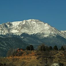
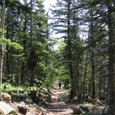
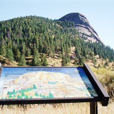
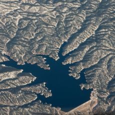
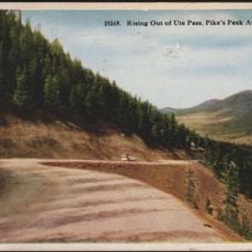
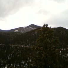
Teller County is an administrative region in central Colorado situated between Pike National Forest and the western slopes of Pikes Peak. The area encompasses several towns and unincorporated communities, creating a diverse landscape of mountains and valleys.

History

The region was established in 1899 and named after US Senator Henry M. Teller, an influential politician of that era. This naming reflects the state's political history and the significant role the area played in Colorado's development.

Culture

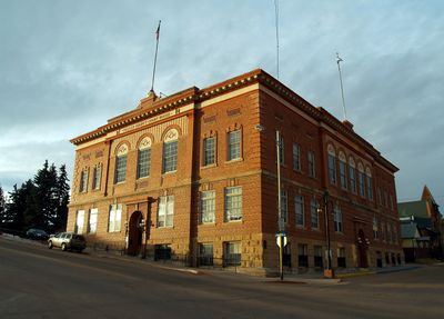
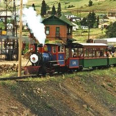
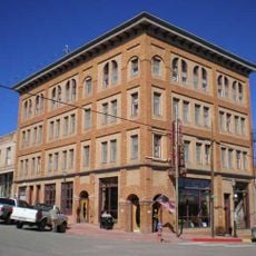
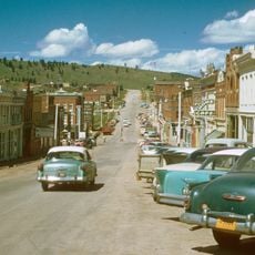
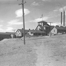
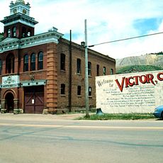
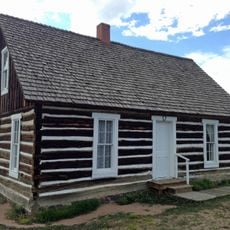
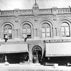
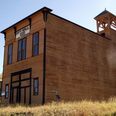
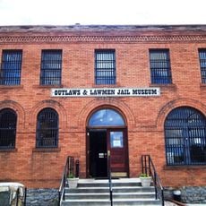
The area displays its heritage through two notable sites: the Cripple Creek National Historic District with its old mining structures and the Florissant Fossil Beds, where you can see ancient fossilized remains. These places shape how the region looks and how people understand its identity today.

Practical

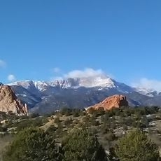
Visitors should know that the terrain is mountainous and at higher elevation, so the air is thinner and weather conditions can change quickly. It is wise to adapt to local conditions and bring appropriate clothing and plenty of water.

Did you know?

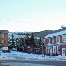
Three separate towns within this county manage their own building permits independently, meaning Woodland Park, Cripple Creek, and Victor each follow different local construction rules. This decentralized structure is unusual for a large administrative area and shows strong local independence in the region.

Location
Inception
1899
Capital city
Cripple Creek
Shares border with
Douglas County, Fremont County, Park County, El Paso County, Jefferson County
GPS coordinates
38.88000,-105.15000
Latest update
December 22, 2025 12:23

AroundUs brings together thousands of curated places, local tips, and hidden gems, enriched daily by 60,000 contributors worldwide. Discover all places nearby (Colorado).

Around this place
Pikes Peak
United States of America

Pikes Peak

10.2 km
Barr Trail
United States of America

Barr Trail

12.1 km
Mueller State Park
United States of America

Mueller State Park

2.7 km
Rampart Reservoir
United States of America

Rampart Reservoir

19.2 km
Cripple Creek and Victor Narrow Gauge Railroad
United States of America

Cripple Creek and Victor Narrow Gauge Railroad

14.8 km
Rocky Mountain Dinosaur Resource Center
United States of America

Rocky Mountain Dinosaur Resource Center

15.3 km
Pikes Peak
United States of America

Pikes Peak

10.3 km
Ute Pass
United States of America

Ute Pass

6.9 km
Santa's Workshop
United States of America

Santa's Workshop

15.2 km
United States of America

Crystal Creek Reservoir

11.1 km
North Pole Colorado
United States of America

North Pole Colorado

15.3 km
Victor Hotel
United States of America

Victor Hotel

18.9 km
Cripple Creek Historic District
United States of America

Cripple Creek Historic District

14.4 km
Stratton's Independence Mine and Mill
United States of America

Stratton's Independence Mine and Mill

18.7 km
Mount Rosa
United States of America

Mount Rosa

22.4 km
United States Army Pike's Peak Research Laboratory
United States of America

United States Army Pike's Peak Research Laboratory

10.1 km
Eastholme
United States of America

Eastholme

15.8 km
United States of America

Englemann Canyon

16.7 km
United States of America

Las Brisas Observatory

11 km
Cripple Creek District Museum
United States of America

Cripple Creek District Museum

14.9 km
Victor Downtown Historic District
United States of America

Victor Downtown Historic District

18.9 km
Hornbek House
United States of America

Hornbek House

12.6 km
Western Federation of Miners union hall
United States of America

Western Federation of Miners union hall

18.9 km
Goldfield City Hall and Fire Station
United States of America

Goldfield City Hall and Fire Station

18.1 km
Outlaws And Lawmen Jail Museum
United States of America

Outlaws And Lawmen Jail Museum

15.2 km
United States of America

Ute Pass Historical Society

15.5 km
Colorado Wolf and Wildlife Center
United States of America

Colorado Wolf and Wildlife Center

8 km
United States of America

Pikes Peak Historical Society

14 km
Show the full map
« Teller County - Administrative division in Colorado, United States » is provided by Around Us (aroundus.com). Images and texts are derived from Wikimedia project under a Creative Commons license. You are allowed to copy, distribute, and modify copies of this page, under the conditions set by the license, as long as this note is clearly visible.

Discover hidden gems everywhere you go!

From secret cafés to breathtaking viewpoints, skip the crowded tourist spots and find places that match your style. Our app makes it easy with voice search, smart filtering, route optimization, and insider tips from travelers worldwide. Download now for the complete mobile experience.

Around Us App Screenshot

A unique approach to discovering new places

Le Figaro

All the places worth exploring

France Info

A tailor-made excursion in just a few clicks

20 Minutes

Around Us
Travel Guide & Maps
Download

Send to your phone

QR Code
1

Open the camera app on your mobile.

2

Point at the QR code with your camera. A notification will appear.

3

Tap the notification to open the link.