Enable Location

We need your location to show you interesting places around you

Discover nearby places

Find interesting locations and hidden gems around you

Precise directions

Get accurate directions and distances to places

Your location is never shared with other users. It's only used when you tap the location button.

Log in to your account

Join the adventure

Create your free account and start exploring (like 60k+ others)

We will send you a code to connect

or
Continue with Google
Continue with Apple
By continuing, you accept our Terms and Conditions and our Privacy Policy

Check your inbox

We've sent a pincode in your inbox. Please enter the code below.

Englemann Canyon

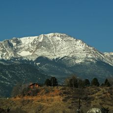
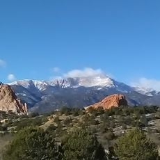
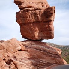
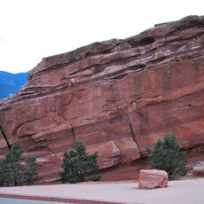
Englemann Canyon, Natural canyon in Colorado, United States

Description

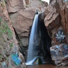
Englemann Canyon is a mountain valley in Colorado carved by Ruxton Creek through steep rock walls studded with large boulders. The canyon supports diverse tree species including Ponderosa pine and Engelmann spruce, with several marked trails and viewpoints such as Artist's Glen, Minnehaha Falls, and Ruxton Park accessible throughout.

History

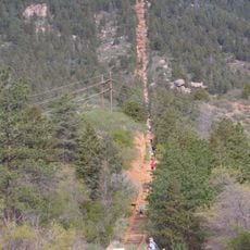
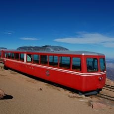
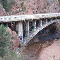
The Manitou Trail was established through the canyon in 1880, creating an important passage through the mountains. A decade later, this route led to the construction of the Manitou and Pike's Peak Railway in 1890, connecting the valley to higher elevations.

Culture

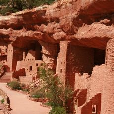
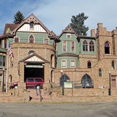
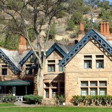
The canyon housed the small settlement of Minnehaha in the late 19th century, where people lived in scattered cabins throughout the valley. This community reflects early settlement patterns in the Colorado mountains and how residents adapted to life in this remote location.

Practical

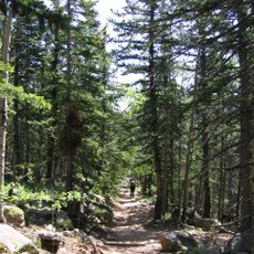
The canyon has several accessible points of interest including Artist's Glen, Minnehaha Falls, and Hells Gate that visitors can reach via marked trails. Sturdy footwear is recommended as the terrain varies, and it is wise to check conditions before heading out since elevation and weather can change quickly in mountain areas.

Did you know?

A hydroelectric power plant built in 1925 continues to generate electricity by harnessing the natural flow of Ruxton Creek for nearby Manitou Springs. This engineering facility demonstrates how early renewable energy solutions tapped into the canyon's water resources.

Location
GPS coordinates
38.84830,-104.96200
Latest update
December 9, 2025 20:25

AroundUs brings together thousands of curated places, local tips, and hidden gems, enriched daily by 60,000 contributors worldwide. Discover all places nearby (Colorado).

Around this place
Pikes Peak
United States of America

Pikes Peak

7.2 km
Manitou Incline
United States of America

Manitou Incline

2.8 km
Manitou Cliff Dwellings
United States of America

Manitou Cliff Dwellings

4.6 km
Cave of the Winds
United States of America

Cave of the Winds

4.4 km
Barr Trail
United States of America

Barr Trail

4.8 km
Miramont Castle
United States of America

Miramont Castle

3.7 km
Manitou Cliff Dwellings
United States of America

Manitou Cliff Dwellings

4.6 km
Manitou Mineral Springs
United States of America

Manitou Mineral Springs

3.7 km
Rainbow Falls
United States of America

Rainbow Falls

4 km
The Broadmoor Manitou and Pikes Peak Cog Railway
United States of America

The Broadmoor Manitou and Pikes Peak Cog Railway

2.8 km
Pikes Peak
United States of America

Pikes Peak

7 km
Manitou Springs Historic District
United States of America

Manitou Springs Historic District

3.7 km
Santa's Workshop
United States of America

Santa's Workshop

6.4 km
North Pole Colorado
United States of America

North Pole Colorado

6.3 km
Cliff House (Manitou Springs, Colorado)
United States of America

Cliff House (Manitou Springs, Colorado)

4.1 km
Briarhurst
United States of America

Briarhurst

5.1 km
Balanced Rock
United States of America

Balanced Rock

5.9 km
Steamboat Rock
United States of America

Steamboat Rock

5.9 km
Barker House (Manitou Springs, Colorado)
United States of America

Barker House (Manitou Springs, Colorado)

4 km
United States Army Pike's Peak Research Laboratory
United States of America

United States Army Pike's Peak Research Laboratory

7.2 km
Crystal Valley Cemetery
United States of America

Crystal Valley Cemetery

5.1 km
Manitou Bathhouse
United States of America

Manitou Bathhouse

4 km
Eastholme
United States of America

Eastholme

5.5 km
First Congregational Church
United States of America

First Congregational Church

4.3 km
Stockbridge House
United States of America

Stockbridge House

8.2 km
Wheeler Bank
United States of America

Wheeler Bank

4.2 km
Bridge over Fountain Creek
United States of America

Bridge over Fountain Creek

4.6 km
Bridge over Fountain Creek
United States of America

Bridge over Fountain Creek

4 km
Show the full map
« Englemann Canyon - Natural canyon in Colorado, United States » is provided by Around Us (aroundus.com). Images and texts are derived from Wikimedia project under a Creative Commons license. You are allowed to copy, distribute, and modify copies of this page, under the conditions set by the license, as long as this note is clearly visible.

Discover hidden gems everywhere you go!

From secret cafés to breathtaking viewpoints, skip the crowded tourist spots and find places that match your style. Our app makes it easy with voice search, smart filtering, route optimization, and insider tips from travelers worldwide. Download now for the complete mobile experience.

Around Us App Screenshot

A unique approach to discovering new places

Le Figaro

All the places worth exploring

France Info

A tailor-made excursion in just a few clicks

20 Minutes

Around Us
Travel Guide & Maps
Download

Send to your phone

QR Code
1

Open the camera app on your mobile.

2

Point at the QR code with your camera. A notification will appear.

3

Tap the notification to open the link.