Enable Location

We need your location to show you interesting places around you

Discover nearby places

Find interesting locations and hidden gems around you

Precise directions

Get accurate directions and distances to places

Your location is never shared with other users. It's only used when you tap the location button.

Ute Pass

Log in to your account

Start exploring — it's free

Trusted by 66,316 travelers worldwide

Continue with Google
Continue with Apple
or

We will send you a code to connect

By continuing, you accept our Terms and Conditions and our Privacy Policy

Check your inbox

We've sent a pincode in your inbox. Please enter the code below.

Ute Pass
Discussion Reviews 1 Photos
4.4k Popularity

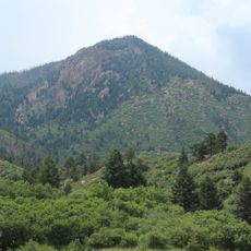
Ute Pass, Mountain pass in Teller County, Colorado, US.

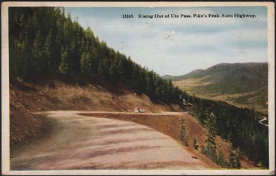
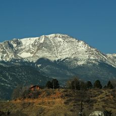
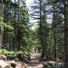
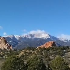
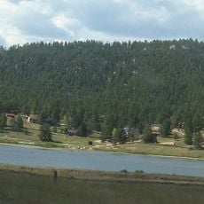
Ute Pass is a mountain pass west of Colorado Springs, in Teller County, Colorado, linking the valley with the mountain communities of Florissant and Woodland Park at an elevation of around 9,200 feet (2,805 meters). The paved U.S. Highway 24 runs through it and provides access to the Ute Pass Regional Trail, which branches into several hiking routes along the way.

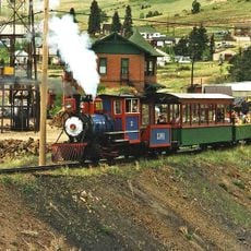
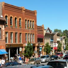
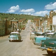
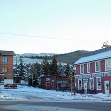
Ute tribes used this passage for centuries, moving between the plains and the mountain hunting grounds with the seasons. The historic route was later paved and turned into a main road that shaped how the surrounding mountain communities grew and developed.

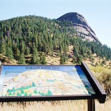
Nine interpretive panels along the Ute Pass Regional Trail explain Ute traditions, the geology of the area, and how the land has been managed over time. Walking the trail, visitors get a clear sense of how the Ute people used and moved through this landscape for generations.

The road is open year-round, with parking available at several stops along the pass, especially near trailheads. Weather can change quickly at this elevation, so it is worth checking conditions before driving in fall or winter when snow and ice are common.

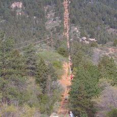
Along the Ute Pass Regional Trail, hikers have built stone cairns over time, particularly at a loop near the Manitou Incline trailhead. These informal stacks have quietly become part of what many people find when they walk the trail, even if they were not expecting them.

The community of curious travelers

AroundUs brings together thousands of curated places, local tips, and hidden gems, enriched daily by 60,000 contributors worldwide.

Start exploring
Location
GPS coordinates
38.94170,-105.15700
Latest update
March 3, 2026 10:06
Around this place
Pikes Peak
United States of America

Pikes Peak

14.9 km
Manitou Incline
United States of America

Manitou Incline

21.7 km
Cave of the Winds
United States of America

Cave of the Winds

21.7 km
Barr Trail
United States of America

Barr Trail

16 km
Mueller State Park
United States of America

Mueller State Park

7.2 km
Miramont Castle
United States of America

Miramont Castle

22.3 km
Manitou Mineral Springs
United States of America

Manitou Mineral Springs

22.5 km
Rampart Reservoir
United States of America

Rampart Reservoir

16.8 km
Cripple Creek and Victor Narrow Gauge Railroad
United States of America

Cripple Creek and Victor Narrow Gauge Railroad

21.6 km
Rainbow Falls
United States of America

Rainbow Falls

21.5 km
The Broadmoor Manitou and Pikes Peak Cog Railway
United States of America

The Broadmoor Manitou and Pikes Peak Cog Railway

21.8 km
Rocky Mountain Dinosaur Resource Center
United States of America

Rocky Mountain Dinosaur Resource Center

10.8 km
Pikes Peak
United States of America

Pikes Peak

15 km
Manitou Springs Historic District
United States of America

Manitou Springs Historic District

22.5 km
Santa's Workshop
United States of America

Santa's Workshop

16.1 km
Blodgett Peak
United States of America

Blodgett Peak

21.7 km
Cripple Creek Historic District
United States of America

Cripple Creek Historic District

21.2 km
United States Army Pike's Peak Research Laboratory
United States of America

United States Army Pike's Peak Research Laboratory

14.9 km
Eastholme
United States of America

Eastholme

17 km
Cripple Creek District Museum
United States of America

Cripple Creek District Museum

21.7 km
Hornbek House
United States of America

Hornbek House

11 km
Bridge over Fountain Creek
United States of America

Bridge over Fountain Creek

21.6 km
South Platte River Bridge
United States of America

South Platte River Bridge

18.5 km
Outlaws And Lawmen Jail Museum
United States of America

Outlaws And Lawmen Jail Museum

21.9 km
Colorado Wolf and Wildlife Center
United States of America

Colorado Wolf and Wildlife Center

5 km
Lake George
United States of America

Lake George

18.4 km
Florissant Fossil Beds Visitors Center
United States of America

Florissant Fossil Beds Visitors Center

11.6 km
Stump Shelter Amphitheater
United States of America

Stump Shelter Amphitheater

11.6 km
Show the full map
Reviews
Share your experience

No review yet

Discussions
Start a discussion...

No discussion yet

« Ute Pass - Mountain pass in Teller County, Colorado, US » is provided by Around Us (aroundus.com). Images and texts are derived from Wikimedia project under a Creative Commons license. You are allowed to copy, distribute, and modify copies of this page, under the conditions set by the license, as long as this note is clearly visible.

Discover hidden gems everywhere you go!

From secret cafés to breathtaking viewpoints, skip the crowded tourist spots and find places that match your style. Our app makes it easy with voice search, smart filtering, route optimization, and insider tips from travelers worldwide. Download now for the complete mobile experience.

Around Us App Screenshot

A unique approach to discovering new places

Le Figaro

All the places worth exploring

France Info

A tailor-made excursion in just a few clicks

20 Minutes

Around Us
Travel Guide & Maps
Download

Send to your phone

QR Code
1

Open the camera app on your mobile.

2

Point at the QR code with your camera. A notification will appear.

3

Tap the notification to open the link.