Enable Location

We need your location to show you interesting places around you

Discover nearby places

Find interesting locations and hidden gems around you

Precise directions

Get accurate directions and distances to places

Your location is never shared with other users. It's only used when you tap the location button.

Buffalo Peak

Log in to your account

Start exploring — it's free

Trusted by 62,198 travelers worldwide

Continue with Google
Continue with Apple
or

We will send you a code to connect

By continuing, you accept our Terms and Conditions and our Privacy Policy

Check your inbox

We've sent a pincode in your inbox. Please enter the code below.

Buffalo Peak

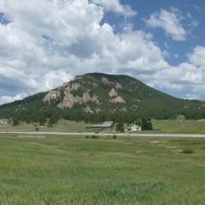
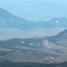
Buffalo Peak, Mountain peak in Colorado, US

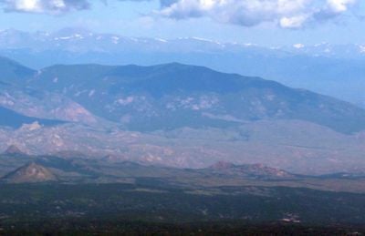
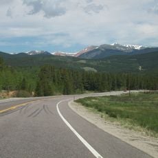
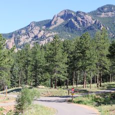
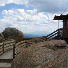
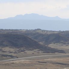
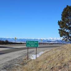
Buffalo Peak is a mountain summit in the Kenosha Mountains within the Lost Creek Wilderness of Pike National Forest, reaching an elevation of 11,594 feet. The peak sits in southern Colorado and is accessible via established hiking trails that wind through subalpine forests and open ridges.

The mountain was originally called Freemans Peak before being renamed Buffalo Peak in the early 1900s. This change in name reflects the shifting geography and local usage that occurred as the region became more widely explored and mapped.

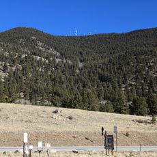
The summit serves as a destination for mountaineers who document their achievements in climbing logs, contributing to the local outdoor recreation community.

This peak is best visited during summer months from June to September when weather is more stable and snow has melted from lower elevations. Hikers should be prepared for altitude and expect afternoon thunderstorms that can develop quickly in this region.

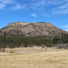
The summit has a distinctive topographic feature with a prominence of about 929 meters, which sets it apart from neighboring peaks in the area. This measurement shows how prominently this mountain rises from the surrounding terrain.

The community of curious travelers

AroundUs brings together thousands of curated places, local tips, and hidden gems, enriched daily by 60,000 contributors worldwide.

Start exploring
Location
GPS coordinates
39.27555,-105.36805
Latest update
December 14, 2025 09:45
Around this place
Eleven Mile State Park
United States of America

Eleven Mile State Park

39.5 km
Chatfield State Park
United States of America

Chatfield State Park

38.8 km
Roxborough State Park
United States of America

Roxborough State Park

30.9 km
Kenosha Pass
United States of America

Kenosha Pass

36.8 km
Chatfield Reservoir
United States of America

Chatfield Reservoir

39.9 km
Lost Creek Wilderness
United States of America

Lost Creek Wilderness

8.6 km
Staunton State Park
United States of America

Staunton State Park

27 km
Devil's Head Lookout
United States of America

Devil's Head Lookout

23.1 km
Devils Head
United States of America

Devils Head

23.1 km
Spinney Mountain State Park
United States of America

Spinney Mountain State Park

38 km
Platte Canyon
United States of America

Platte Canyon

32.4 km
Wilkerson Pass
United States of America

Wilkerson Pass

29.7 km
Dawson Butte
United States of America

Dawson Butte

37.2 km
Berrian Mountain
United States of America

Berrian Mountain

31.8 km
Badger Mountain
United States of America

Badger Mountain

28.2 km
Green Mountain
United States of America

Green Mountain

6.7 km
Hornbek House
United States of America

Hornbek House

39.6 km
Hildebrand Ranch
United States of America

Hildebrand Ranch

38.4 km
Church of St. Philip-in-the-Field and Bear Canon Cemetery
United States of America

Church of St. Philip-in-the-Field and Bear Canon Cemetery

36.7 km
Colorado Consistory No. 1
United States of America

Colorado Consistory No. 1

14.5 km
Reginald Sinclaire House
United States of America

Reginald Sinclaire House

36.8 km
Santa Fe Railway Water Tank
United States of America

Santa Fe Railway Water Tank

39.2 km
South Platte River Bridge
United States of America

South Platte River Bridge

32.2 km
Fraser Experimental Forest
United States of America

Fraser Experimental Forest

32.6 km
Conifer Junction Schoolhouse
United States of America

Conifer Junction Schoolhouse

29.3 km
John Kinner House
United States of America

John Kinner House

35.4 km
John C. Shaffer Barn
United States of America

John C. Shaffer Barn

38.7 km
Lake George
United States of America

Lake George

33 km
Show the full map
« Buffalo Peak - Mountain peak in Colorado, US » is provided by Around Us (aroundus.com). Images and texts are derived from Wikimedia project under a Creative Commons license. You are allowed to copy, distribute, and modify copies of this page, under the conditions set by the license, as long as this note is clearly visible.

Discover hidden gems everywhere you go!

From secret cafés to breathtaking viewpoints, skip the crowded tourist spots and find places that match your style. Our app makes it easy with voice search, smart filtering, route optimization, and insider tips from travelers worldwide. Download now for the complete mobile experience.

Around Us App Screenshot

A unique approach to discovering new places

Le Figaro

All the places worth exploring

France Info

A tailor-made excursion in just a few clicks

20 Minutes

Around Us
Travel Guide & Maps
Download

Send to your phone

QR Code
1

Open the camera app on your mobile.

2

Point at the QR code with your camera. A notification will appear.

3

Tap the notification to open the link.