Enable Location

We need your location to show you interesting places around you

Discover nearby places

Find interesting locations and hidden gems around you

Precise directions

Get accurate directions and distances to places

Your location is never shared with other users. It's only used when you tap the location button.

Devils Head

Log in to your account

Start exploring — it's free

Trusted by 62,189 travelers worldwide

Continue with Google
Continue with Apple
or

We will send you a code to connect

By continuing, you accept our Terms and Conditions and our Privacy Policy

Check your inbox

We've sent a pincode in your inbox. Please enter the code below.

Devils Head

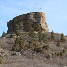
Devils Head, Mountain summit in Pike National Forest, Colorado, US

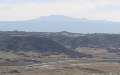
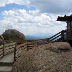
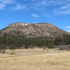
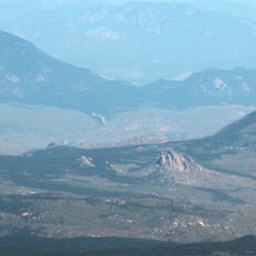
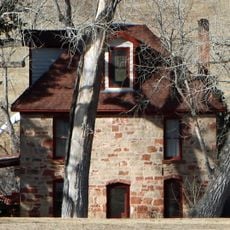
Devils Head is a mountain summit in the Rampart Range of the Rocky Mountains, rising to 9,749 feet and marked by distinctive rock formations at its peak. The area sits within Pike National Forest and offers clear views across the surrounding mountain landscape.

The mountain received its name from 19th-century prospectors who saw a profile resembling a face with horns when viewed from the southwest. In 1912, the United States Forest Service built a fire lookout tower at the summit to monitor the region.

The mountain received its name from 19th-century prospectors who observed a profile resembling a face with horns when viewed from the southwest.

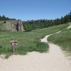
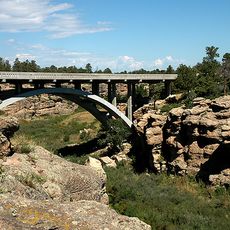
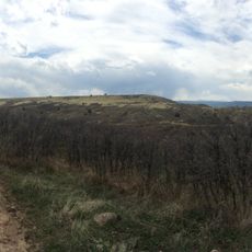
Access comes through the Devils Head National Recreation Trail, where visitors climb about 940 feet over roughly 1.4 miles to reach the summit. The path is well marked, but conditions vary with the season, so sturdy footwear is recommended.

Helen Dowe was hired as a fire lookout on Devils Head in 1925, becoming the first woman in this role within the United States Forest Service. Her position opened doors for many women who followed in this traditionally male profession.

The community of curious travelers

AroundUs brings together thousands of curated places, local tips, and hidden gems, enriched daily by 60,000 contributors worldwide.

Start exploring
Location
GPS coordinates
39.26027,-105.10110
Latest update
December 10, 2025 15:51
Around this place
United States Air Force Academy Cadet Chapel
United States of America

United States Air Force Academy Cadet Chapel

33.4 km
Castlewood Canyon State Park
United States of America

Castlewood Canyon State Park

32.1 km
Chatfield State Park
United States of America

Chatfield State Park

30.9 km
Roxborough State Park
United States of America

Roxborough State Park

19.1 km
Chatfield Reservoir
United States of America

Chatfield Reservoir

32.1 km
Lost Creek Wilderness
United States of America

Lost Creek Wilderness

31.6 km
Devil's Head Lookout
United States of America

Devil's Head Lookout

17 m
Castle Rock
United States of America

Castle Rock

24.9 km
Rampart Reservoir
United States of America

Rampart Reservoir

33.1 km
United States Air Force Academy, Cadet Area
United States of America

United States Air Force Academy, Cadet Area

33.4 km
Rocky Mountain Dinosaur Resource Center
United States of America

Rocky Mountain Dinosaur Resource Center

30 km
Platte Canyon
United States of America

Platte Canyon

25 km
Buffalo Peak
United States of America

Buffalo Peak

23.1 km
Tri-Lakes, Colorado
United States of America

Tri-Lakes, Colorado

26.8 km
Dawson Butte
United States of America

Dawson Butte

14.8 km
Cherry Creek Bridge
United States of America

Cherry Creek Bridge

32.5 km
Cherokee Ranch
United States of America

Cherokee Ranch

26 km
Green Mountain
United States of America

Green Mountain

17.9 km
Ridgeline Open Space
United States of America

Ridgeline Open Space

21.1 km
Castle Rock Depot
United States of America

Castle Rock Depot

24.2 km
Hildebrand Ranch
United States of America

Hildebrand Ranch

32.4 km
Church of St. Philip-in-the-Field and Bear Canon Cemetery
United States of America

Church of St. Philip-in-the-Field and Bear Canon Cemetery

17.1 km
Colorado Consistory No. 1
United States of America

Colorado Consistory No. 1

10 km
Reginald Sinclaire House
United States of America

Reginald Sinclaire House

13.9 km
Inez Johnson Lewis School
United States of America

Inez Johnson Lewis School

27.4 km
Santa Fe Railway Water Tank
United States of America

Santa Fe Railway Water Tank

23.2 km
First National Bank of Douglas County
United States of America

First National Bank of Douglas County

24.2 km
John Kinner House
United States of America

John Kinner House

12.4 km
Show the full map
« Devils Head - Mountain summit in Pike National Forest, Colorado, US » is provided by Around Us (aroundus.com). Images and texts are derived from Wikimedia project under a Creative Commons license. You are allowed to copy, distribute, and modify copies of this page, under the conditions set by the license, as long as this note is clearly visible.

Discover hidden gems everywhere you go!

From secret cafés to breathtaking viewpoints, skip the crowded tourist spots and find places that match your style. Our app makes it easy with voice search, smart filtering, route optimization, and insider tips from travelers worldwide. Download now for the complete mobile experience.

Around Us App Screenshot

A unique approach to discovering new places

Le Figaro

All the places worth exploring

France Info

A tailor-made excursion in just a few clicks

20 Minutes

Around Us
Travel Guide & Maps
Download

Send to your phone

QR Code
1

Open the camera app on your mobile.

2

Point at the QR code with your camera. A notification will appear.

3

Tap the notification to open the link.