·

Enable Location

We need your location to show you interesting places around you

Discover nearby places

Find interesting locations and hidden gems around you

Precise directions

Get accurate directions and distances to places

Your location is never shared with other users. It's only used when you tap the location button.

Castlewood Canyon State Park

Log in to your account

Start exploring — it's free

Trusted by 62,651 travelers worldwide

Continue with Google
Continue with Apple
or

We will send you a code to connect

By continuing, you accept our Terms and Conditions and our Privacy Policy

Check your inbox

We've sent a pincode in your inbox. Please enter the code below.

Castlewood Canyon State Park, State park in Franktown, Colorado, US.

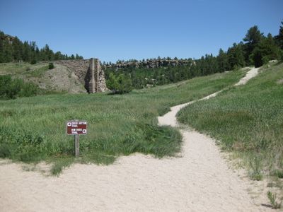
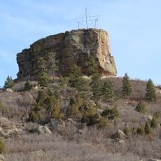
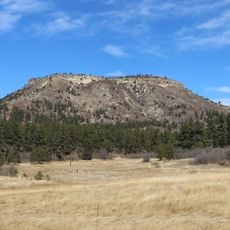
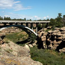
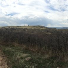
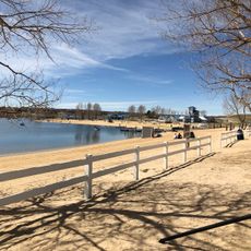
Castlewood Canyon State Park is a protected landscape in the Black Forest region featuring dramatic canyon formations, shrubland, and grassland across its terrain. The park displays distinct natural layers created by geological processes, with different plant communities distributed throughout the area.

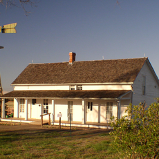
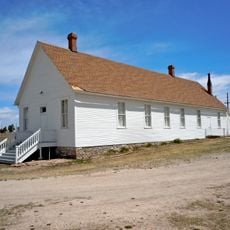
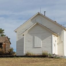
The land saw long occupation by indigenous peoples before later becoming protected as a state park. A major dam project built in 1890 shaped the region, though it later failed with significant consequences for downstream communities.

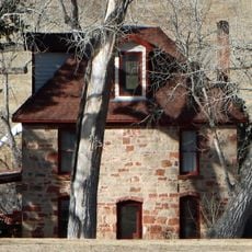
Native Americans utilized this land for over 5,000 years, establishing settlements near water sources and creating shelters within the natural canyon formations.

The grounds offer a network of trails of varying length and difficulty plus areas for outdoor activities like climbing. Visitors should prepare for changeable weather and wear comfortable shoes for hiking.

The site hosts five different ecosystem types that exist closely packed together in the same landscape. This tight clustering of diverse habitats makes it a living laboratory for nature observers.

The community of curious travelers

AroundUs brings together thousands of curated places, local tips, and hidden gems, enriched daily by 60,000 contributors worldwide.

Start exploring
Location
Inception
1964
Operator
Colorado Parks and Wildlife
GPS coordinates
39.32970,-104.73900
Latest update
December 7, 2025 20:21
Around this place
Roxborough State Park
United States of America

Roxborough State Park

30.5 km
Colorado Piedmont
United States of America

Colorado Piedmont

14.3 km
Aurora Reservoir
United States of America

Aurora Reservoir

32.9 km
Castle Rock
United States of America

Castle Rock

11.5 km
Rueter-Hess Reservoir
United States of America

Rueter-Hess Reservoir

19.2 km
Colorado Renaissance Festival
United States of America

Colorado Renaissance Festival

17.9 km
Tri-Lakes, Colorado
United States of America

Tri-Lakes, Colorado

28 km
Dawson Butte
United States of America

Dawson Butte

17.4 km
Cherry Creek Bridge
United States of America

Cherry Creek Bridge

466 m
Cherokee Ranch
United States of America

Cherokee Ranch

22.3 km
Seventeen Mile House
United States of America

Seventeen Mile House

26.9 km
Ridgeline Open Space
United States of America

Ridgeline Open Space

15.1 km
Pike's Peak Grange No. 163
United States of America

Pike's Peak Grange No. 163

9 km
Castle Rock Depot
United States of America

Castle Rock Depot

11.7 km
St. Mark United Presbyterian Church
United States of America

St. Mark United Presbyterian Church

21.2 km
J.G. Evans Barn
United States of America

J.G. Evans Barn

29 km
Church of St. Philip-in-the-Field and Bear Canon Cemetery
United States of America

Church of St. Philip-in-the-Field and Bear Canon Cemetery

19.4 km
Ruth Memorial Methodist Episcopal Church
United States of America

Ruth Memorial Methodist Episcopal Church

21 km
Reginald Sinclaire House
United States of America

Reginald Sinclaire House

18.4 km
Inez Johnson Lewis School
United States of America

Inez Johnson Lewis School

28.9 km
Santa Fe Railway Water Tank
United States of America

Santa Fe Railway Water Tank

22.9 km
Spring Valley School
United States of America

Spring Valley School

19.9 km
First National Bank of Douglas County
United States of America

First National Bank of Douglas County

11.4 km
John Kinner House
United States of America

John Kinner House

19.9 km
H2O'Brien Water Park
United States of America

H2O'Brien Water Park

21.3 km
The Country Club at Woodmoor
United States of America

The Country Club at Woodmoor

26.3 km
The Dr. Seuss Experience
United States of America

The Dr. Seuss Experience

29.2 km
Boat Beach
United States of America

Boat Beach

31.8 km
Show the full map
« Castlewood Canyon State Park - State park in Franktown, Colorado, US » is provided by Around Us (aroundus.com). Images and texts are derived from Wikimedia project under a Creative Commons license. You are allowed to copy, distribute, and modify copies of this page, under the conditions set by the license, as long as this note is clearly visible.

Discover hidden gems everywhere you go!

From secret cafés to breathtaking viewpoints, skip the crowded tourist spots and find places that match your style. Our app makes it easy with voice search, smart filtering, route optimization, and insider tips from travelers worldwide. Download now for the complete mobile experience.

Around Us App Screenshot

A unique approach to discovering new places

Le Figaro

All the places worth exploring

France Info

A tailor-made excursion in just a few clicks

20 Minutes

Around Us
Travel Guide & Maps
Download

Send to your phone

QR Code
1

Open the camera app on your mobile.

2

Point at the QR code with your camera. A notification will appear.

3

Tap the notification to open the link.