Enable Location

We need your location to show you interesting places around you

Discover nearby places

Find interesting locations and hidden gems around you

Precise directions

Get accurate directions and distances to places

Your location is never shared with other users. It's only used when you tap the location button.

Whitney

Log in to your account

Start exploring — it's free

Trusted by travelers worldwide

Continue with Google
Continue with Apple
or

We will send you a code to connect

By continuing, you accept our Terms and Conditions and our Privacy Policy

Check your inbox

We've sent a pincode in your inbox. Please enter the code below.

Whitney, human settlement in Oregon, United States of America

Description

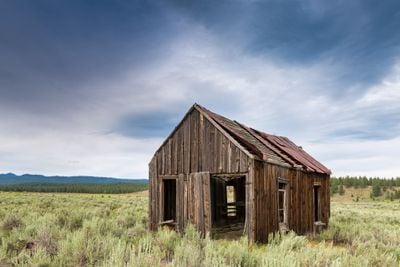
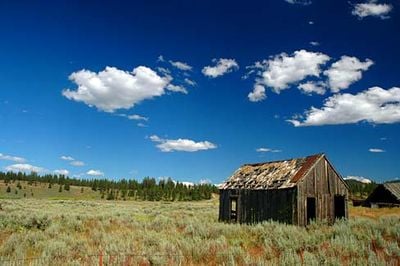
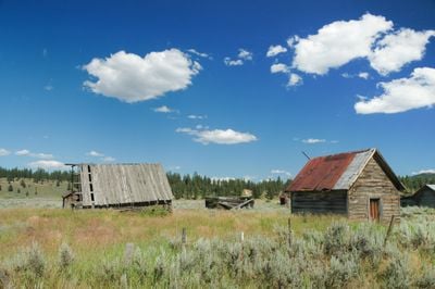
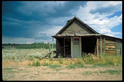
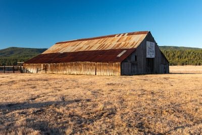
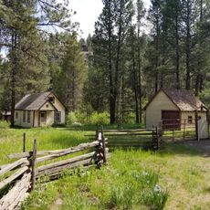
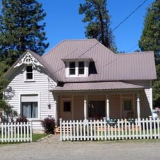
Whitney is an unincorporated ghost town in Baker County, Oregon, situated near the North Fork Burnt River and Blue Mountains. The former community contains scattered remains of old buildings and foundations that mark where the town once stood.

History

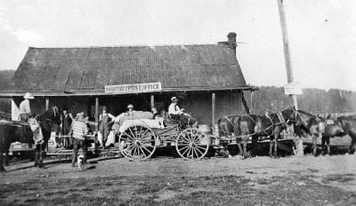
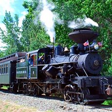
Whitney was established around 1900 as a logging center with a sawmill operated by the Oregon Lumber Company and served by the Sumpter Valley Railway. The first sawmill burned in 1918, and the town entered decline during the 1940s when logging operations slowed and rail service ceased.

Culture

Whitney takes its name from pioneer C. H. Whitney, who helped establish the area. The town reflects an era when logging and railways shaped community life and drew workers seeking opportunity in remote regions.

Practical

Whitney is a remote location with no active businesses or services. Visitors should arrive well prepared with supplies and explore the area with care and respect for the surroundings.

Did you know?

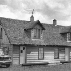
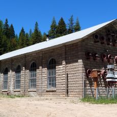
The nearby Antlers Guard Station, listed on the National Register of Historic Places, documents forest management efforts in the region. This site offers insight into the parallel work of protecting and managing forests alongside the logging industry.

Location
Elevation above the sea
1,270 m
Address
Co Hwy 529, Sumpter, OR 97877, USA
GPS coordinates
44.65940,-118.29000
Latest update
December 18, 2025 19:00

AroundUs brings together thousands of curated places, local tips, and hidden gems, enriched daily by 60,000 contributors worldwide. Discover all places nearby (Baker County).

The 100 notable ghost towns in the United States

The United States have hundreds of abandoned towns. This selection includes 100 of these places where time seems to stand still. Most grew rich in the 19th century through gold or silver finds. They attracted miners, traders, and whole families. When the veins were empty, people left. They left...

Around this place
Sumpter Valley Gold Dredge
United States of America

Sumpter Valley Gold Dredge

11.5 km
Sumpter Valley Railway
United States of America

Sumpter Valley Railway

14.2 km
North Fork John Day Wilderness
United States of America

North Fork John Day Wilderness

36.9 km
Unity Lake State Recreation Site
United States of America

Unity Lake State Recreation Site

19.6 km
Rock Creek Butte
United States of America

Rock Creek Butte

22.9 km
United States of America

Bates State Park

19 km
Baker City Tower
United States of America

Baker City Tower

38.6 km
United States of America

Unity Forest State Scenic Corridor

35 km
Unity Ranger Station
United States of America

Unity Ranger Station

26.2 km
Antlers Guard Station
United States of America

Antlers Guard Station

3 km
Baker Historic District
United States of America

Baker Historic District

38.7 km
Fremont Powerhouse
United States of America

Fremont Powerhouse

22.4 km
Churchill School
United States of America

Churchill School

37.3 km
United States of America

Ed Rand House

38.4 km
Superintendent's House
United States of America

Superintendent's House

11.7 km
McEwen
United States of America

McEwen

14.4 km
United States of America

Sumpter Valley Dredge State Heritage Area

11.5 km
United States of America

Phillips Lake

19 km
United States of America

Murray Reservoir

37.2 km
United States of America

Unity Reservoir

18.4 km
United States of America

Oregon Trail Monument

38.4 km
United States of America

Coyote Bluff

28 km
United States of America

Higgins Reservoir

26.9 km
United States of America

Baker City Golf Club

37.1 km
United States of America

Work of art, installation artwork

23.5 km
United States of America

Scenic viewpoint

33 km
United States of America

Mason Dam Viewpoint

23 km
United States of America

Waterfall

32.6 km
Show the full map
« Whitney - human settlement in Oregon, United States of America » is provided by Around Us (aroundus.com). Images and texts are derived from Wikimedia project under a Creative Commons license. You are allowed to copy, distribute, and modify copies of this page, under the conditions set by the license, as long as this note is clearly visible.

Discover hidden gems everywhere you go!

From secret cafés to breathtaking viewpoints, skip the crowded tourist spots and find places that match your style. Our app makes it easy with voice search, smart filtering, route optimization, and insider tips from travelers worldwide. Download now for the complete mobile experience.

Around Us App Screenshot

A unique approach to discovering new places

Le Figaro

All the places worth exploring

France Info

A tailor-made excursion in just a few clicks

20 Minutes

Around Us
Travel Guide & Maps
Download

Send to your phone

QR Code
1

Open the camera app on your mobile.

2

Point at the QR code with your camera. A notification will appear.

3

Tap the notification to open the link.