Enable Location

We need your location to show you interesting places around you

Discover nearby places

Find interesting locations and hidden gems around you

Precise directions

Get accurate directions and distances to places

Your location is never shared with other users. It's only used when you tap the location button.

Smoky Dome

Log in to your account

Start exploring — it's free

Trusted by 62,283 travelers worldwide

Continue with Google
Continue with Apple
or

We will send you a code to connect

By continuing, you accept our Terms and Conditions and our Privacy Policy

Check your inbox

We've sent a pincode in your inbox. Please enter the code below.

Smoky Dome

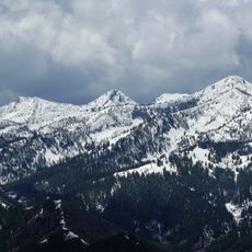
Smoky Dome, Mountain summit in Camas County, Idaho

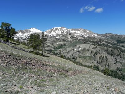
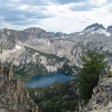
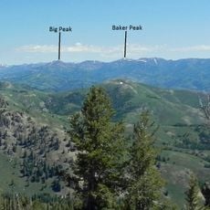
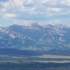
Smoky Dome is a mountain peak in the Soldier Mountains of central Idaho that rises 10,095 feet (3,077 m) above sea level. The summit sits within a larger range that includes multiple ridgelines and valleys, making it a prominent feature in the landscape.

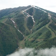
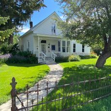
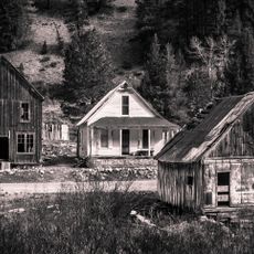
The peak shaped early development in the nearby Fairfield area, leading to the creation of facilities like the Soldier Mountain Ski Area that used the mountain's slopes. The presence of the mountain influenced where and how people built their community.

Local people in the area have long connected this peak to the region's pioneer heritage and use its name in many local business names and community references. The mountain has become a natural landmark that shapes how residents think about their landscape.

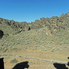
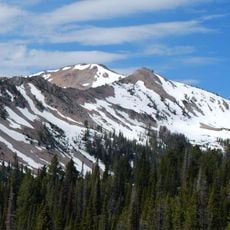
The route to the summit is a Class 2 scramble beginning from the Soldier Mountain Ski Area trailhead, requiring climbers to gain roughly 3,600 feet (1,100 m) in elevation. Expect rocky terrain throughout the climb and bring layers for changing weather conditions at high altitude.

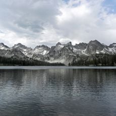
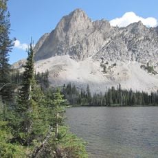
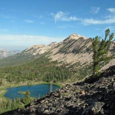
Four mountain lakes called Lower, Upper 1, Upper 2, and West Smoky Dome Lakes cluster northwest of the summit and offer water views within the alpine environment. These lakes provide scenic resting spots for hikers exploring the high elevation terrain.

The community of curious travelers

AroundUs brings together thousands of curated places, local tips, and hidden gems, enriched daily by 60,000 contributors worldwide.

Start exploring
Location
GPS coordinates
43.49351,-114.93646
Latest update
December 14, 2025 14:43
Around this place
Bald Mountain
United States of America

Bald Mountain

46.2 km
Sawtooth Wilderness
United States of America

Sawtooth Wilderness

57.3 km
Central Idaho Dark Sky Reserve
United States of America

Central Idaho Dark Sky Reserve

57 km
United States of America

Magic Reservoir

51 km
Homer Pound House
United States of America

Homer Pound House

50.6 km
Iron Mountain
United States of America

Iron Mountain

10.1 km
Sawtooth Botanical Garden
United States of America

Sawtooth Botanical Garden

49.7 km
El Capitan
United States of America

El Capitan

49.8 km
Gimlet Pegram Truss Railroad Bridge
United States of America

Gimlet Pegram Truss Railroad Bridge

49 km
Snowyside Peak
United States of America

Snowyside Peak

49.6 km
Little City of Rocks Wilderness Study Area
United States of America

Little City of Rocks Wilderness Study Area

46.2 km
Cold Springs Pegram Truss Railroad Bridge
United States of America

Cold Springs Pegram Truss Railroad Bridge

50.6 km
Boardman Peak
United States of America

Boardman Peak

5.2 km
Big Peak
United States of America

Big Peak

25.8 km
Parks Peak
United States of America

Parks Peak

52.7 km
Hailey Masonic Lodge
United States of America

Hailey Masonic Lodge

50.5 km
Baker Peak
United States of America

Baker Peak

28.5 km
McDonald Peak
United States of America

McDonald Peak

50.5 km
Payette Peak
United States of America

Payette Peak

55.7 km
South Boise Historic Mining District
United States of America

South Boise Historic Mining District

34.5 km
Atlanta Ranger Station Historic District
United States of America

Atlanta Ranger Station Historic District

38 km
Bellevue Historic District
United States of America

Bellevue Historic District

54.9 km
Eben S. and Elizabeth S. Chase House
United States of America

Eben S. and Elizabeth S. Chase House

50.4 km
Fox–Worswick House
United States of America

Fox–Worswick House

50.5 km
Blaine County Courthouse
United States of America

Blaine County Courthouse

50.5 km
Roundhouse Gondola
United States of America

Roundhouse Gondola

48.9 km
Bigwood Golf Course
United States of America

Bigwood Golf Course

51.1 km
Black Butte
United States of America

Black Butte

58.4 km
Show the full map
« Smoky Dome - Mountain summit in Camas County, Idaho » is provided by Around Us (aroundus.com). Images and texts are derived from Wikimedia project under a Creative Commons license. You are allowed to copy, distribute, and modify copies of this page, under the conditions set by the license, as long as this note is clearly visible.

Discover hidden gems everywhere you go!

From secret cafés to breathtaking viewpoints, skip the crowded tourist spots and find places that match your style. Our app makes it easy with voice search, smart filtering, route optimization, and insider tips from travelers worldwide. Download now for the complete mobile experience.

Around Us App Screenshot

A unique approach to discovering new places

Le Figaro

All the places worth exploring

France Info

A tailor-made excursion in just a few clicks

20 Minutes

Around Us
Travel Guide & Maps
Download

Send to your phone

QR Code
1

Open the camera app on your mobile.

2

Point at the QR code with your camera. A notification will appear.

3

Tap the notification to open the link.