Chest opened
+${chestReward.xp} XP
Explorer
NOUVEAU ×${chestReward.collectible.quantity}
tapez pour fermer
Chest locked

Open chests in the app

Around Us is built for your phone — chests unlock when you walk, explore and capture nearby places.

Enable Location

We need your location to show you interesting places around you

Discover nearby places

Find interesting locations and hidden gems around you

Precise directions

Get accurate directions and distances to places

Your location is never shared with other users. It's only used when you tap the location button.

Lolo

Log in to your account

Start exploring — it's free

Trusted by 72,885 travelers worldwide

Continue with Google
Continue with Apple
or

We will send you a code to connect

By continuing, you accept our Terms and Conditions and our Privacy Policy

Check your inbox

We've sent a pincode in your inbox. Please enter the code below.

Discussion Reviews 1 Photos
14.7k Popularity

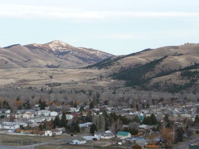
Lolo, Census-designated place in Missoula County, Montana, United States.

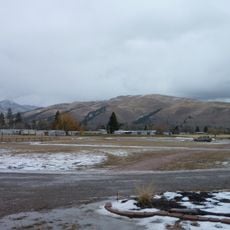
Lolo is a census-designated community in Missoula County situated at about 975 meters elevation. The area consists of residential neighborhoods that are administratively tracked without having their own city government.

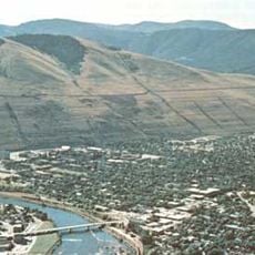
The settlement developed as a rural community in southern Missoula County along historic transportation corridors through the region. When the Census Bureau created the census-designated classification in 1980, this area became formally tracked for data collection.

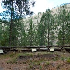
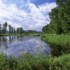
The community embraces outdoor living as part of its everyday rhythm, with residents spending considerable time in nearby forests and mountains. This bond with nature shapes how people here spend their days and define themselves.

The place sits roughly 20 kilometers south of Missoula and is easily accessible by car, typical for this rural area. The lack of city services means residents travel to Missoula for most municipal needs.

Though Lolo has no city government of its own, it functions as an established residential community with its own name and presence on maps. This shows how rural American areas often exist as social units without formal municipal boundaries.

The community of curious travelers

AroundUs brings together thousands of curated places, local tips, and hidden gems, enriched daily by 60,000 contributors worldwide.

Start exploring
Location
Elevation above the sea
975 m
Shares border with
Missoula
GPS coordinates
46.76528,-114.08583
Latest update
December 7, 2025 20:20
Around this place
Lake Missoula
United States of America

Lake Missoula

19.8 km
Washington–Grizzly Stadium
United States of America

Washington–Grizzly Stadium

13.6 km
Traveler's Rest
United States of America

Traveler's Rest

3 km
Wilma Theater
United States of America

Wilma Theater

13.5 km
Fort Fizzle
United States of America

Fort Fizzle

8 km
Lee Metcalf National Wildlife Refuge
United States of America

Lee Metcalf National Wildlife Refuge

23.8 km
Fort Owen State Park
United States of America

Fort Owen State Park

27.4 km
Missoula Public Library
United States of America

Missoula Public Library

13.7 km
Florence Hotel
United States of America

Florence Hotel

13.6 km
United States of America

Council Grove State Park

17.3 km
The Payne Family Native American Center
United States of America

The Payne Family Native American Center

13 km
KettleHouse Amphitheater
United States of America

KettleHouse Amphitheater

21.1 km
Millennium Building
United States of America

Millennium Building

13.5 km
Missoula County Courthouse
United States of America

Missoula County Courthouse

13.9 km
Masonic Lodge
United States of America

Masonic Lodge

13.9 km
Milltown State Park
United States of America

Milltown State Park

18.5 km
First Interstate Center
United States of America

First Interstate Center

13.5 km
Albert May House
United States of America

Albert May House

28.4 km
Splash Montana
United States of America

Splash Montana

10.4 km
Bass Mansion
United States of America

Bass Mansion

28.2 km
A Carousel for Missoula
United States of America

A Carousel for Missoula

13.5 km
Marent Gulch Trestle
United States of America

Marent Gulch Trestle

26.6 km
IOOF Hall
United States of America

IOOF Hall

28.4 km
Currents Water Park
United States of America

Currents Water Park

13.5 km
Fred T. Sterling House
United States of America

Fred T. Sterling House

12.5 km
Mrs. Lydia McCaffery's Furnished Rooms
United States of America

Mrs. Lydia McCaffery's Furnished Rooms

14.1 km
Bellows Residence
United States of America

Bellows Residence

12.1 km
Apartment Building at 116 Spruce Street
United States of America

Apartment Building at 116 Spruce Street

14.1 km
Show the full map
Reviews
Share your experience

No review yet

Discussions
Start a discussion...

No discussion yet

« Lolo - Census-designated place in Missoula County, Montana, United States » is provided by Around Us (aroundus.com). Images and texts are derived from Wikimedia project under a Creative Commons license. You are allowed to copy, distribute, and modify copies of this page, under the conditions set by the license, as long as this note is clearly visible.

Discover hidden gems everywhere you go!

From secret cafés to breathtaking viewpoints, skip the crowded tourist spots and find places that match your style. Our app makes it easy with voice search, smart filtering, route optimization, and insider tips from travelers worldwide. Download now for the complete mobile experience.

Around Us App Screenshot

A unique approach to discovering new places

Le Figaro

All the places worth exploring

France Info

A tailor-made excursion in just a few clicks

20 Minutes

Around Us
Travel Guide & Maps
Download

Send to your phone

QR Code
1

Open the camera app on your mobile.

2

Point at the QR code with your camera. A notification will appear.

3

Tap the notification to open the link.