Enable Location

We need your location to show you interesting places around you

Discover nearby places

Find interesting locations and hidden gems around you

Precise directions

Get accurate directions and distances to places

Your location is never shared with other users. It's only used when you tap the location button.

Union City, Montana

Log in to your account

Start exploring — it's free

Trusted by 62,340 travelers worldwide

Continue with Google
Continue with Apple
or

We will send you a code to connect

By continuing, you accept our Terms and Conditions and our Privacy Policy

Check your inbox

We've sent a pincode in your inbox. Please enter the code below.

Union City, Montana, human settlement in Madison County, Montana, United States of America

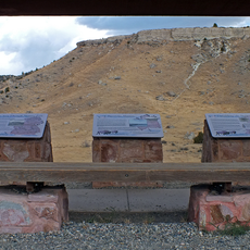
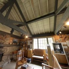
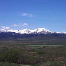
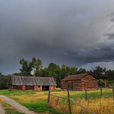
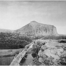
Union City is an abandoned settlement high in the mountains of Madison County, Montana, at about 7,580 feet (2,310 meters) in elevation. The site contained worker housing, storage sheds, and the remains of the Christenot Mill, which was equipped with Chilean rollers for crushing quartz.

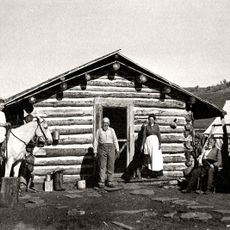
Union City emerged in 1867 following the discovery of gold in nearby Alder Gulch in 1863. An investor named Christenot built a modern mill with imported machinery that began processing quartz and extracting gold in 1867.

The site was named Union City and developed as a worker settlement centered on the Christenot Mill operation. Visitors can observe how the settlement was organized around resource processing and how daily life revolved around the mining work.

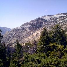
The site is located in the mountains and can be reached from the Virginia City area nearby. Visitors should expect rough terrain, windy conditions at this elevation, and limited access to some structures since many are in ruins or require careful footing.

The Christenot Mill used unusual Chilean roller technology instead of the stamping mills common at the time, making it innovative for its era. Equipment arrived in 52 ox-drawn wagons over the Bozeman Trail, a logistical feat that reflected the operation's ambitious scope.

The community of curious travelers

AroundUs brings together thousands of curated places, local tips, and hidden gems, enriched daily by 60,000 contributors worldwide.

Start exploring
Location
GPS coordinates
45.20833,-111.94250
Latest update
February 9, 2026 07:46
Around this place
Lewis and Clark Caverns
United States of America

Lewis and Clark Caverns

68.8 km
Hebgen Lake
United States of America

Hebgen Lake

61.3 km
Henrys Lake
United States of America

Henrys Lake

75.7 km
Madison Buffalo Jump State Park
United States of America

Madison Buffalo Jump State Park

75.2 km
Clark Canyon Dam
United States of America

Clark Canyon Dam

75.5 km
Hebgen Dam
United States of America

Hebgen Dam

61.2 km
Lee Metcalf Wilderness
United States of America

Lee Metcalf Wilderness

39.5 km
Red Rock Lakes National Wildlife Refuge
United States of America

Red Rock Lakes National Wildlife Refuge

68.9 km
Gallatin Gateway Inn
United States of America

Gallatin Gateway Inn

72.3 km
Big Sky Resort
United States of America

Big Sky Resort

41.7 km
Beaverhead Rock
United States of America

Beaverhead Rock

45.1 km
Hotel Metlen
United States of America

Hotel Metlen

54.1 km
Hilgard Peak
United States of America

Hilgard Peak

50 km
Doncaster Round Barn
United States of America

Doncaster Round Barn

49.6 km
Soldiers Chapel
United States of America

Soldiers Chapel

54.2 km
Virginia City Historic District
United States of America

Virginia City Historic District

9.2 km
Lewis & Clark Caverns State Park

Lewis & Clark Caverns State Park

69.9 km
Mount Jefferson
United States of America

Mount Jefferson

44.3 km
Crail Ranch Buildings
United States of America

Crail Ranch Buildings

51.2 km
St. Mary of the Assumption Church
United States of America

St. Mary of the Assumption Church

20.7 km
Hutchins Bridge
United States of America

Hutchins Bridge

45.6 km
Martin Barrett House
United States of America

Martin Barrett House

54.7 km
Ferris-Hermsmeyer-Fenton Ranch
United States of America

Ferris-Hermsmeyer-Fenton Ranch

35.3 km
Lewis and Clark Caverns State Park
United States of America

Lewis and Clark Caverns State Park

69.9 km
Nevada City Museum Entrance & Music Hall
United States of America

Nevada City Museum Entrance & Music Hall

11.2 km
Star Theatre
United States of America

Star Theatre

74.6 km
Cave Visitor Center
United States of America

Cave Visitor Center

70.4 km
Beaverhead Rock State Park
United States of America

Beaverhead Rock State Park

45.1 km
Show the full map
« Union City, Montana - human settlement in Madison County, Montana, United States of America » is provided by Around Us (aroundus.com). Images and texts are derived from Wikimedia project under a Creative Commons license. You are allowed to copy, distribute, and modify copies of this page, under the conditions set by the license, as long as this note is clearly visible.

Discover hidden gems everywhere you go!

From secret cafés to breathtaking viewpoints, skip the crowded tourist spots and find places that match your style. Our app makes it easy with voice search, smart filtering, route optimization, and insider tips from travelers worldwide. Download now for the complete mobile experience.

Around Us App Screenshot

A unique approach to discovering new places

Le Figaro

All the places worth exploring

France Info

A tailor-made excursion in just a few clicks

20 Minutes

Around Us
Travel Guide & Maps
Download

Send to your phone

QR Code
1

Open the camera app on your mobile.

2

Point at the QR code with your camera. A notification will appear.

3

Tap the notification to open the link.