Enable Location

We need your location to show you interesting places around you

Discover nearby places

Find interesting locations and hidden gems around you

Precise directions

Get accurate directions and distances to places

Your location is never shared with other users. It's only used when you tap the location button.

Clark Canyon Dam

Log in to your account

Start exploring — it's free

Trusted by 64,602 travelers worldwide

Continue with Google
Continue with Apple
or

We will send you a code to connect

By continuing, you accept our Terms and Conditions and our Privacy Policy

Check your inbox

We've sent a pincode in your inbox. Please enter the code below.

Clark Canyon Dam
Discussion Reviews 1 Photos
4.3k Popularity

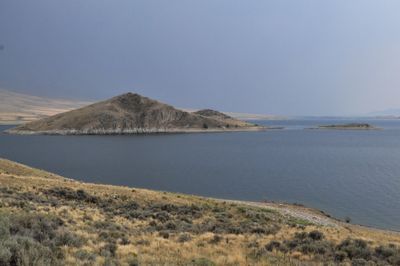
Clark Canyon Dam, Earthfill dam on Beaverhead River near Dillon, Montana.

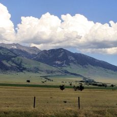
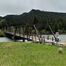
Clark Canyon Dam is an earthfill dam in southwestern Montana that holds back the Beaverhead River to form the Clark Canyon Reservoir. The stored water supplies irrigation for farmland in the surrounding valley and also serves as a recreation area open to the public.

The Bureau of Reclamation built the dam between 1961 and 1964 as part of a federal water development program for the region. Before the reservoir filled, both a railroad line and a main highway that ran through the valley had to be moved to higher ground.

The reservoir covers the former site called Camp Fortunate, where Sacagawea recognized her brother among the Lemhi Shoshoni people during the Lewis and Clark Expedition. A marker near the water today points to this meeting place, drawing visitors interested in that chapter of American history.

The reservoir is open for boating and fishing, with several marked access points along the shoreline that are easy to reach by car. Picnic areas and campsites are available nearby, so it is worth planning for at least a half day.

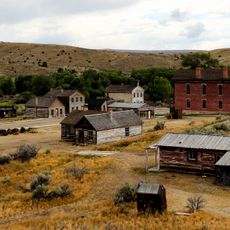
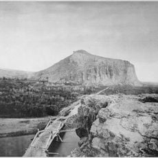
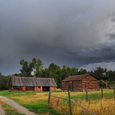
The small railroad town of Armstead was completely flooded when the reservoir filled, and it now lies beneath the water. In dry years, when the water level drops significantly, outlines of the old town can sometimes be seen from the shore.

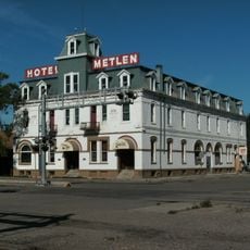
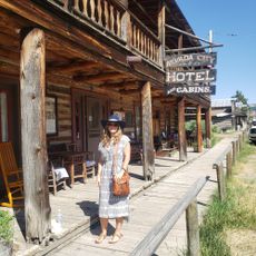
The community of curious travelers

AroundUs brings together thousands of curated places, local tips, and hidden gems, enriched daily by 60,000 contributors worldwide.

Start exploring
GPS coordinates
45.00000,-112.85700
Latest update
March 3, 2026 08:11
Around this place
Bannack
United States of America

Bannack

21 km
Big Hole National Battlefield
United States of America

Big Hole National Battlefield

95.1 km
Goldbug Hot Springs
United States of America

Goldbug Hot Springs

85.1 km
Monida Pass
United States of America

Monida Pass

65.7 km
Lee Metcalf Wilderness
United States of America

Lee Metcalf Wilderness

111.6 km
Red Rock Lakes National Wildlife Refuge
United States of America

Red Rock Lakes National Wildlife Refuge

95.9 km
Beaverhead Rock
United States of America

Beaverhead Rock

53.1 km
Leesburg, Idaho
United States of America

Leesburg, Idaho

101.8 km
Hotel Metlen
United States of America

Hotel Metlen

30.1 km
Hilgard Peak
United States of America

Hilgard Peak

110.5 km
Doncaster Round Barn
United States of America

Doncaster Round Barn

76.4 km
Butte-Anaconda Historic District
United States of America

Butte-Anaconda Historic District

113.1 km
Birch Creek Charcoal Kilns
United States of America

Birch Creek Charcoal Kilns

80.8 km
Virginia City Historic District
United States of America

Virginia City Historic District

78.7 km
Camas Meadows Battle Sites
United States of America

Camas Meadows Battle Sites

100.4 km
Mount Jefferson
United States of America

Mount Jefferson

94.6 km
Union City, Montana
United States of America

Union City, Montana

75.5 km
Silver Bow County Poor Farm Hospital
United States of America

Silver Bow County Poor Farm Hospital

113.4 km
St. Mary of the Assumption Church
United States of America

St. Mary of the Assumption Church

70.8 km
Odd Fellows Hall
United States of America

Odd Fellows Hall

83.7 km
Lemhi County Courthouse
United States of America

Lemhi County Courthouse

84.4 km
Hutchins Bridge
United States of America

Hutchins Bridge

101.3 km
Salmon City Hall and Library
United States of America

Salmon City Hall and Library

83.7 km
Martin Barrett House
United States of America

Martin Barrett House

29 km
Ferris-Hermsmeyer-Fenton Ranch
United States of America

Ferris-Hermsmeyer-Fenton Ranch

69.9 km
Nevada City Museum Entrance & Music Hall
United States of America

Nevada City Museum Entrance & Music Hall

77.7 km
Big Hole National Battlefield Visitor Center
United States of America

Big Hole National Battlefield Visitor Center

94.3 km
Star Theatre
United States of America

Star Theatre

113.5 km
Show the full map
Reviews
Share your experience

No review yet

Discussions
Start a discussion...

No discussion yet

« Clark Canyon Dam - Earthfill dam on Beaverhead River near Dillon, Montana » is provided by Around Us (aroundus.com). Images and texts are derived from Wikimedia project under a Creative Commons license. You are allowed to copy, distribute, and modify copies of this page, under the conditions set by the license, as long as this note is clearly visible.

Discover hidden gems everywhere you go!

From secret cafés to breathtaking viewpoints, skip the crowded tourist spots and find places that match your style. Our app makes it easy with voice search, smart filtering, route optimization, and insider tips from travelers worldwide. Download now for the complete mobile experience.

Around Us App Screenshot

A unique approach to discovering new places

Le Figaro

All the places worth exploring

France Info

A tailor-made excursion in just a few clicks

20 Minutes

Around Us
Travel Guide & Maps
Download

Send to your phone

QR Code
1

Open the camera app on your mobile.

2

Point at the QR code with your camera. A notification will appear.

3

Tap the notification to open the link.