Enable Location

We need your location to show you interesting places around you

Discover nearby places

Find interesting locations and hidden gems around you

Precise directions

Get accurate directions and distances to places

Your location is never shared with other users. It's only used when you tap the location button.

Beaverhead County

Log in to your account

Start exploring — it's free

Trusted by 62,614 travelers worldwide

Continue with Google
Continue with Apple
or

We will send you a code to connect

By continuing, you accept our Terms and Conditions and our Privacy Policy

Check your inbox

We've sent a pincode in your inbox. Please enter the code below.

Beaverhead County, Administrative division in southwestern Montana, United States.

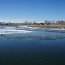
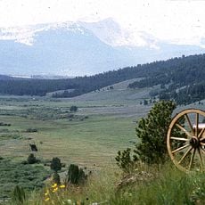
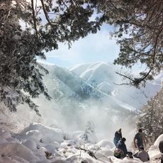
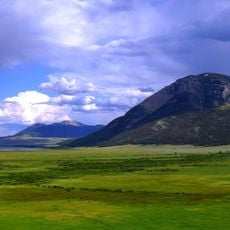
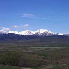
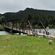
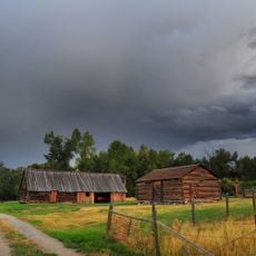
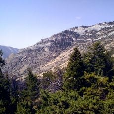
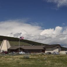
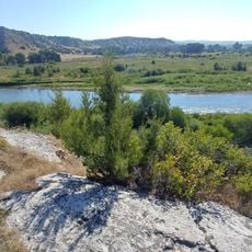
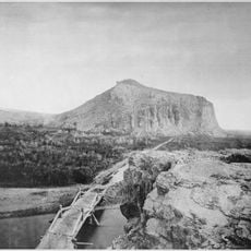
Beaverhead County is an administrative division in southwestern Montana covering mountainous terrain with elevations exceeding one mile above sea level. The region encompasses forested valleys, open plateaus, and numerous rivers that flow through the landscape.

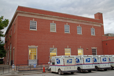
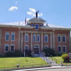
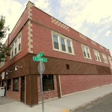
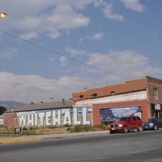
The county was established in 1865, with Bannack, a gold mining settlement, first serving as the administrative center. In 1881, administration relocated to Dillon as the region's economic focus shifted.

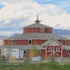
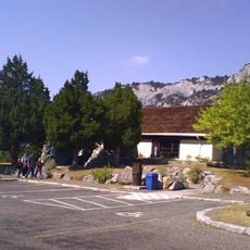
The annual Beaverhead County Fair and Dillon Jaycee's Rodeo reflect how ranching and farming remain central to life in this region. These gatherings bring communities together and celebrate practices that have shaped the area for generations.

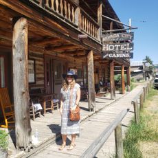
The area is sprawling and requires a car to navigate between towns and natural areas. Roads can be challenging during winter months, so it is helpful to check local conditions before traveling.

The Continental Divide forms nearly the entire border with Idaho, separating rivers that flow to the Atlantic and Pacific oceans. This geographic line shapes the region's ecology and water systems.

The community of curious travelers

AroundUs brings together thousands of curated places, local tips, and hidden gems, enriched daily by 60,000 contributors worldwide.

Start exploring
GPS coordinates
45.17084,-112.95376
Latest update
December 7, 2025 19:24
Around this place
Lewis and Clark Caverns
United States of America

Lewis and Clark Caverns

112.6 km
Missouri Headwaters State Park
United States of America

Missouri Headwaters State Park

140.9 km
Big Hole National Battlefield
United States of America

Big Hole National Battlefield

75.9 km
Goldbug Hot Springs
United States of America

Goldbug Hot Springs

82.2 km
Monida Pass
United States of America

Monida Pass

85.2 km
Red Rock Lakes National Wildlife Refuge
United States of America

Red Rock Lakes National Wildlife Refuge

112.1 km
Beaverhead Rock
United States of America

Beaverhead Rock

45.5 km
Doncaster Round Barn
United States of America

Doncaster Round Barn

66.9 km
Virginia City Historic District
United States of America

Virginia City Historic District

80.4 km
Lewis & Clark Caverns State Park

Lewis & Clark Caverns State Park

112.7 km
Camas Meadows Battle Sites
United States of America

Camas Meadows Battle Sites

119.1 km
Mount Jefferson
United States of America

Mount Jefferson

88.3 km
St. Mary of the Assumption Church
United States of America

St. Mary of the Assumption Church

69.4 km
Odd Fellows Hall
United States of America

Odd Fellows Hall

73.6 km
Lemhi County Courthouse
United States of America

Lemhi County Courthouse

74.3 km
Hutchins Bridge
United States of America

Hutchins Bridge

112.5 km
Salmon City Hall and Library
United States of America

Salmon City Hall and Library

73.6 km
Martin Barrett House
United States of America

Martin Barrett House

25 km
Adams Block
United States of America

Adams Block

135.7 km
Ferris-Hermsmeyer-Fenton Ranch
United States of America

Ferris-Hermsmeyer-Fenton Ranch

64.3 km
Lewis and Clark Caverns State Park
United States of America

Lewis and Clark Caverns State Park

112.7 km
Nevada City Museum Entrance & Music Hall
United States of America

Nevada City Museum Entrance & Music Hall

78.7 km
Big Hole National Battlefield Visitor Center
United States of America

Big Hole National Battlefield Visitor Center

75.2 km
Ling Rock - Ferry Crossing Headwaters State Park
United States of America

Ling Rock - Ferry Crossing Headwaters State Park

142.1 km
Star Theatre
United States of America

Star Theatre

102.5 km
Ruby Theatre
United States of America

Ruby Theatre

135.1 km
Cave Visitor Center
United States of America

Cave Visitor Center

112.7 km
Beaverhead Rock State Park
United States of America

Beaverhead Rock State Park

45.5 km
Show the full map
« Beaverhead County - Administrative division in southwestern Montana, United States » is provided by Around Us (aroundus.com). Images and texts are derived from Wikimedia project under a Creative Commons license. You are allowed to copy, distribute, and modify copies of this page, under the conditions set by the license, as long as this note is clearly visible.

Discover hidden gems everywhere you go!

From secret cafés to breathtaking viewpoints, skip the crowded tourist spots and find places that match your style. Our app makes it easy with voice search, smart filtering, route optimization, and insider tips from travelers worldwide. Download now for the complete mobile experience.

Around Us App Screenshot

A unique approach to discovering new places

Le Figaro

All the places worth exploring

France Info

A tailor-made excursion in just a few clicks

20 Minutes

Around Us
Travel Guide & Maps
Download

Send to your phone

QR Code
1

Open the camera app on your mobile.

2

Point at the QR code with your camera. A notification will appear.

3

Tap the notification to open the link.