Monida Pass

Log in to your account

AroundUs is a community-driven map of interesting places, built by curious explorers like you. It grows with every review, story, and photo you share.
Connect to save your favorite spots, contribute locations, and create personalized routes.
Continue with Google
Continue with Apple
Continue with X
Continue with Facebook
Continue with email
By continuing, you accept our Terms and Conditions and our Privacy Policy
Create an account
Add to collection
Map
Suggest a change
Share

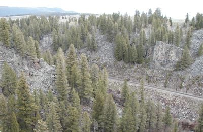
Monida Pass, Rail mountain pass in Montana, United States

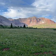
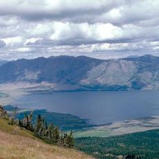
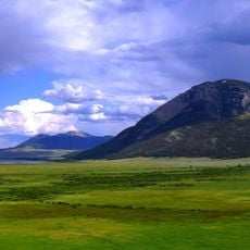
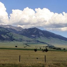
Monida Pass is a mountain passage in the Bitterroot Range of the Rocky Mountains, located at the border between Idaho and Montana. Interstate 15 runs through this pass as a paved highway, connecting Lima, Montana with Spencer, Idaho.

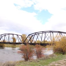
In the late 1800s, the Utah and Northern Railway built a route through Beaver Canyon on the Idaho side, which Union Pacific Railroad still operates today. This rail connection became crucial for regional commerce and settlement patterns.

The name of this pass combines the first letters of Montana with the last letters of Idaho, symbolizing the connection between these two states. This linguistic blend shows how geography has shaped the identity of the border region.

The highway is passable year-round but is regularly monitored by Montana Department of Transportation, especially during winter conditions. Drivers should check current weather conditions before crossing and can navigate the pass with standard vehicles.

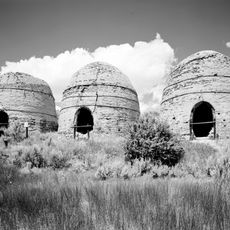
A Union Pacific ice plant once operated at Humphrey on the Idaho side, leaving behind an abandoned settlement visible today. This historic remnant shows how the railroad supported industrial activity in the remote mountain region.

Location: Montana

GPS coordinates: 44.55860,-112.30600

Latest update: December 10, 2025 16:20

Photos
Around this place
Huckleberry Ridge Tuff
United States of America

Huckleberry Ridge Tuff

81.6 km
Island Park Caldera
United States of America

Island Park Caldera

81.6 km
Hebgen Lake
United States of America

Hebgen Lake

84 km
Henry's Fork Caldera
United States of America

Henry's Fork Caldera

81.6 km
Mesa Falls Tuff
United States of America

Mesa Falls Tuff

81.6 km
Henrys Lake
United States of America

Henrys Lake

72 km
Upper Mesa Falls
United States of America

Upper Mesa Falls

87.9 km
Big Springs
United States of America

Big Springs

83.7 km
Red Rock Lakes National Wildlife Refuge
United States of America

Red Rock Lakes National Wildlife Refuge

41.8 km
Camas National Wildlife Refuge
United States of America

Camas National Wildlife Refuge

67.8 km
Lower Mesa Falls
United States of America

Lower Mesa Falls

89.7 km
Hilgard Peak
United States of America

Hilgard Peak

77.9 km
Birch Creek Charcoal Kilns
United States of America

Birch Creek Charcoal Kilns

74.7 km
Virginia City Historic District
United States of America

Virginia City Historic District

86.4 km
South Fremont High School
United States of America

South Fremont High School

81.7 km
Camas Meadows Battle Sites
United States of America

Camas Meadows Battle Sites

36.1 km
Johnny Sack Cabin
United States of America

Johnny Sack Cabin

83.7 km
Bishop Mountain Lookout
United States of America

Bishop Mountain Lookout

64.8 km
Lonesomehurst Cabin
United States of America

Lonesomehurst Cabin

88.3 km
St. Anthony Pegram Truss Railroad Bridge
United States of America

St. Anthony Pegram Truss Railroad Bridge

82.4 km
Fremont County Courthouse
United States of America

Fremont County Courthouse

82.4 km
Independent Order of Odd Fellows Hall
United States of America

Independent Order of Odd Fellows Hall

88.1 km
I.O.O.F. Building
United States of America

I.O.O.F. Building

78.9 km
Hutchins Bridge
United States of America

Hutchins Bridge

68.1 km
Martin Barrett House
United States of America

Martin Barrett House

77.2 km
Nevada City Museum Entrance & Music Hall
United States of America

Nevada City Museum Entrance & Music Hall

87.5 km
St. Anthony Sand Dunes
United States of America

St. Anthony Sand Dunes

73.3 km
Mesa Falls Scenic Byway
United States of America

Mesa Falls Scenic Byway

89 km
Show the full map
Reviews

Visited this place? Tap the stars to rate it and share your experience / photos with the community! Try now! You can cancel it anytime.

« Monida Pass - Rail mountain pass in Montana, United States » is provided by Around Us (aroundus.com). Images and texts are derived from Wikimedia project under a Creative Commons license. You are allowed to copy, distribute, and modify copies of this page, under the conditions set by the license, as long as this note is clearly visible.

Discover hidden gems everywhere you go!

From secret cafés to breathtaking viewpoints, skip the crowded tourist spots and find places that match your style. Our app makes it easy with voice search, smart filtering, route optimization, and insider tips from travelers worldwide. Download now for the complete mobile experience.

Around Us App Screenshot

A unique approach to discovering new places

Le Figaro

All the places worth exploring

France Info

A tailor-made excursion in just a few clicks

20 Minutes