Stevens County

Log in to your account

AroundUs is a community-driven map of interesting places, built by curious explorers like you. It grows with every review, story, and photo you share.
Connect to save your favorite spots, contribute locations, and create personalized routes.
Continue with Google
Continue with Apple
Continue with X
Continue with Facebook
Continue with email
By continuing, you accept our Terms and Conditions and our Privacy Policy
Create an account
Add to collection
Map
Suggest a change
Share

Stevens County, County in Washington, United States.

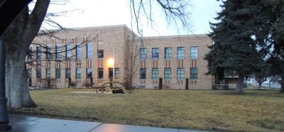
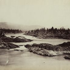
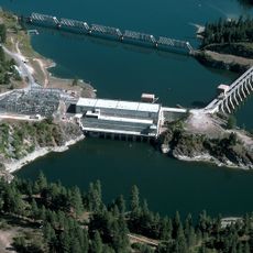
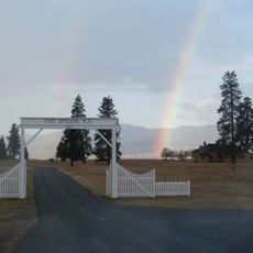
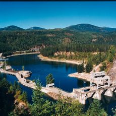
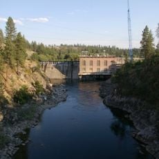
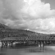
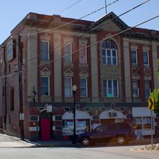
Stevens County is a county in northeastern Washington comprising forested terrain, mountain ridges, and river systems that define the landscape. Colville serves as the administrative hub and primary commercial center for the area.

The county was established in 1863 and named after Isaac Stevens, the first governor of Washington Territory. Its creation reflected the territorial expansion period in the northwestern United States.

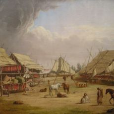
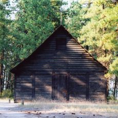
The Spokane Indian Reservation shapes a significant portion of this area, with its residents maintaining traditional practices visible in everyday life. This presence is reflected in local gatherings, crafts, and how communities use the landscape.

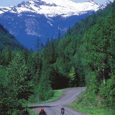
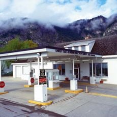
Visitors should expect to cover significant distances, making personal transportation the most practical way to explore the area. Seasonal conditions affect road and trail access, particularly in elevated areas during winter months.

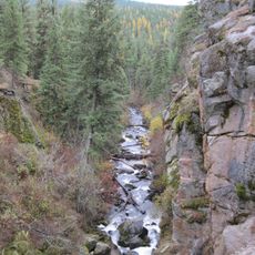
The Little Pend Oreille National Wildlife Refuge occupies the area and offers mixed forests and wetlands that many travelers overlook. This quiet nature preserve provides unexpected wildlife observation opportunities away from busier paths.

Location: Washington

Inception: 1863

Capital city: Colville

Shares border with: Pend Oreille County, Spokane County, Lincoln County, Ferry County, Regional District of Kootenay Boundary, Regional District of Central Kootenay

Website: http://co.stevens.wa.us

GPS coordinates: 48.40000,-117.85000

Latest update: December 14, 2025 20:25

Photos
Around this place
Kettle Falls
United States of America

Kettle Falls

32.8 km
Colville National Forest
United States of America

Colville National Forest

42.3 km
Albeni Falls Dam
United States of America

Albeni Falls Dam

67.6 km
Fort Spokane
United States of America

Fort Spokane

63.9 km
Fort Colvile
United States of America

Fort Colvile

15.3 km
Little Pend Oreille National Wildlife Refuge
United States of America

Little Pend Oreille National Wildlife Refuge

19.5 km
Crawford State Park Heritage Site
United States of America

Crawford State Park Heritage Site

75.1 km
Box Canyon Dam
United States of America

Box Canyon Dam

53.2 km
St. Paul's Mission
United States of America

St. Paul's Mission

31.5 km
Laurier-Cascade Border Crossing
Canada

Laurier-Cascade Border Crossing

72.2 km
Nine Mile Dam
United States of America

Nine Mile Dam

73.1 km
Kettle Falls Bridges
United States of America

Kettle Falls Bridges

31.9 km
Ferry County Carousel
United States of America

Ferry County Carousel

68.1 km
Kettle Falls Railroad Bridge
United States of America

Kettle Falls Railroad Bridge

31.9 km
Old Apple Warehouse
United States of America

Old Apple Warehouse

27.9 km
Creaser Hotel
United States of America

Creaser Hotel

70.8 km
Metaline Falls Bridge
United States of America

Metaline Falls Bridge

62.5 km
Spokane River Bridge at Long Lake Dam
United States of America

Spokane River Bridge at Long Lake Dam

62.5 km
Curlew Bridge
United States of America

Curlew Bridge

77.3 km
Northport Bridge
United States of America

Northport Bridge

58.4 km
Colville Opera House and Odd Fellows Hall
United States of America

Colville Opera House and Odd Fellows Hall

16.6 km
Orient Bridge
United States of America

Orient Bridge

57.9 km
Box Canyon Bridge
United States of America

Box Canyon Bridge

53.3 km
Dr. John and Viola Phillips House and Office
United States of America

Dr. John and Viola Phillips House and Office

64.4 km
Fairweather–Trevitt House
United States of America

Fairweather–Trevitt House

71.2 km
St. Andrew's United Church (Rossland, British Columbia)
Canada

St. Andrew's United Church (Rossland, British Columbia)

75.6 km
Rossland Court House
Canada

Rossland Court House

75.5 km
Spokane River Bridge at Fort Spokane
United States of America

Spokane River Bridge at Fort Spokane

64.8 km
Show the full map
Reviews

Visited this place? Tap the stars to rate it and share your experience / photos with the community! Try now! You can cancel it anytime.

Administrative divisions
« Stevens County - County in Washington, United States » is provided by Around Us (aroundus.com). Images and texts are derived from Wikimedia project under a Creative Commons license. You are allowed to copy, distribute, and modify copies of this page, under the conditions set by the license, as long as this note is clearly visible.

Discover hidden gems everywhere you go!

From secret cafés to breathtaking viewpoints, skip the crowded tourist spots and find places that match your style. Our app makes it easy with voice search, smart filtering, route optimization, and insider tips from travelers worldwide. Download now for the complete mobile experience.

Around Us App Screenshot

A unique approach to discovering new places

Le Figaro

All the places worth exploring

France Info

A tailor-made excursion in just a few clicks

20 Minutes