Chest opened
+${chestReward.xp} XP
Explorer
NOUVEAU ×${chestReward.collectible.quantity}
tapez pour fermer
Chest locked

Open chests in the app

Around Us is built for your phone — chests unlock when you walk, explore and capture nearby places.

Enable Location

We need your location to show you interesting places around you

Discover nearby places

Find interesting locations and hidden gems around you

Precise directions

Get accurate directions and distances to places

Your location is never shared with other users. It's only used when you tap the location button.

Flathead River

Log in to your account

Start exploring — it's free

Trusted by 72,888 travelers worldwide

Continue with Google
Continue with Apple
or

We will send you a code to connect

By continuing, you accept our Terms and Conditions and our Privacy Policy

Check your inbox

We've sent a pincode in your inbox. Please enter the code below.

Flathead River
Discussion Reviews 1 Photos
14.2k Popularity

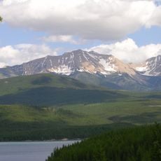
Flathead River, River system in Montana, United States

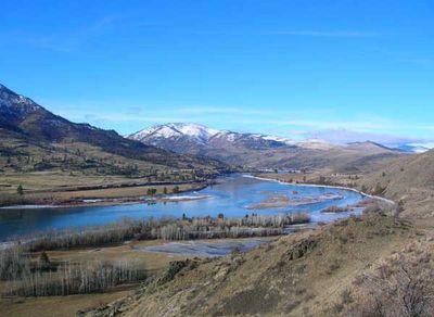
The Flathead River is a river system in Montana that flows through three counties and eventually reaches Flathead Lake. The waterway passes through valleys and varied terrain, forming an important drainage network across northwestern Montana.

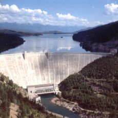
The river's course was studied in detail during the 1960s when the U.S. Geological Survey examined potential dam locations. These investigations reflected how people thought about water development and resource management in that era.

The Salish and Kootenai peoples have deep roots along this waterway and continue to rely on it as a central part of their relationship with the land. The river shapes how local communities view and care for their natural surroundings.

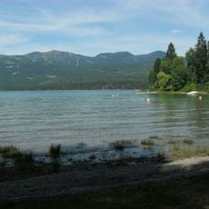
The river is accessible at several points along its course, though water conditions vary with the seasons. Late spring through early fall offers the best conditions for visiting the area.

At one location known as Knowles, a rock formation breaks through the valley floor, creating an unusual geological feature that many visitors miss. This natural outcrop shows how geological forces have shaped the landscape over time.

The community of curious travelers

AroundUs brings together thousands of curated places, local tips, and hidden gems, enriched daily by 60,000 contributors worldwide.

Start exploring
Location
Location
Location
Elevation above the sea
754 m
GPS coordinates
48.46722,-114.06944
Latest update
December 7, 2025 20:22
Around this place
Hungry Horse Dam
United States of America

Hungry Horse Dam

14.6 km
Lake McDonald Lodge
United States of America

Lake McDonald Lodge

21.8 km
Whitefish Lake State Park
United States of America

Whitefish Lake State Park

22.7 km
United States of America

Bad Rock Canyon

9.5 km
Belton Chalets
United States of America

Belton Chalets

7.7 km
South Fork Flathead River
United States of America

South Fork Flathead River

70.1 km
Kelly's Camp Historic District
United States of America

Kelly's Camp Historic District

21.6 km
Lake McDonald Lodge Historic District
United States of America

Lake McDonald Lodge Historic District

21.9 km
Lockridge Medical Clinic
United States of America

Lockridge Medical Clinic

20.7 km
Apgar Fire Lookout
United States of America

Apgar Fire Lookout

6.7 km
Headquarters Historic District
United States of America

Headquarters Historic District

7.6 km
Huckleberry Fire Lookout
United States of America

Huckleberry Fire Lookout

15.6 km
Soldiers' Home Historic District
United States of America

Soldiers' Home Historic District

16 km
International Larix Arboretum
United States of America

International Larix Arboretum

9.3 km
Loneman Fire Lookout
United States of America

Loneman Fire Lookout

22.3 km
West Entrance Station
United States of America

West Entrance Station

7.5 km
Nyack Ranger Station Historic District
United States of America

Nyack Ranger Station Historic District

20.4 km
First Presbyterian Church of Whitefish
United States of America

First Presbyterian Church of Whitefish

20.7 km
Amazing Fun Center
United States of America

Amazing Fun Center

5.1 km
Ray E. Taylor House
United States of America

Ray E. Taylor House

21.1 km
Glacier Distilling Company - The Whiskey Barn
United States of America

Glacier Distilling Company - The Whiskey Barn

5.3 km
Fish Creek Bay Boathouse
United States of America

Fish Creek Bay Boathouse

11.4 km
Glacier Lanes and Casino
United States of America

Glacier Lanes and Casino

13.1 km
Apgar Campground
United States of America

Apgar Campground

9 km
Apgar Visitor Center
United States of America

Apgar Visitor Center

8.6 km
Fish Creek Campground Amphitheater
United States of America

Fish Creek Campground Amphitheater

11.1 km
Fish Creek Campground
United States of America

Fish Creek Campground

10.9 km
Apgar Campground Amphitheater
United States of America

Apgar Campground Amphitheater

9.3 km
Show the full map
Reviews
Share your experience

No review yet

Discussions
Start a discussion...

No discussion yet

« Flathead River - River system in Montana, United States » is provided by Around Us (aroundus.com). Images and texts are derived from Wikimedia project under a Creative Commons license. You are allowed to copy, distribute, and modify copies of this page, under the conditions set by the license, as long as this note is clearly visible.

Discover hidden gems everywhere you go!

From secret cafés to breathtaking viewpoints, skip the crowded tourist spots and find places that match your style. Our app makes it easy with voice search, smart filtering, route optimization, and insider tips from travelers worldwide. Download now for the complete mobile experience.

Around Us App Screenshot

A unique approach to discovering new places

Le Figaro

All the places worth exploring

France Info

A tailor-made excursion in just a few clicks

20 Minutes

Around Us
Travel Guide & Maps
Download

Send to your phone

QR Code
1

Open the camera app on your mobile.

2

Point at the QR code with your camera. A notification will appear.

3

Tap the notification to open the link.