Sanders County

Log in to your account

AroundUs is a community-driven map of interesting places, built by curious explorers like you. It grows with every review, story, and photo you share.
Connect to save your favorite spots, contribute locations, and create personalized routes.
By continuing, you accept our Terms and Conditions and our Privacy Policy
Add to collection
Map
Suggest a change
Share

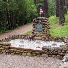
Sanders County, Administrative county in western Montana, US.

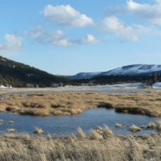
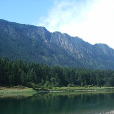
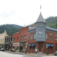
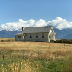
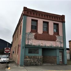
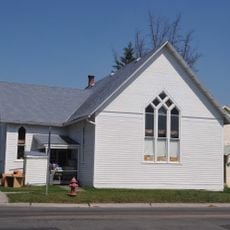
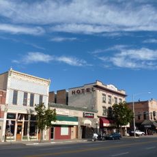
Sanders County is an administrative county in western Montana that extends between the Bitterroot Mountains to the south and Cabinet Mountains to the north. The territory is traversed by the Clark Fork River and contains several small communities, with Thompson Falls serving as the county seat.

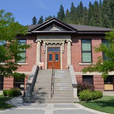
Montana established Sanders County in 1905 as a new administrative unit in the region. Thompson Falls was designated as the administrative center and has shaped county development since then.

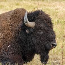
The Sanders County Fair in Plains presents annual rodeo events that demonstrate the local agricultural traditions and community connections.

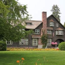
The administrative center in Thompson Falls provides public services for residents and visitors, including property records and document searches. Most visitors will find information about office hours and local services there.

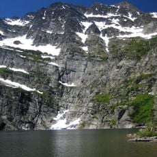
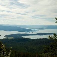
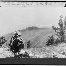
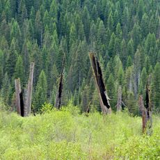
The Clark Fork River divides the territory into zones with different rainfall patterns, creating varied landscape types across the county. This natural division creates contrasting environments within the same administrative area.

Location: Montana

Inception: 1905

Capital city: Thompson Falls

Shares border with: Lincoln County, Mineral County, Flathead County, Lake County, Missoula County, Shoshone County, Bonner County

Website: http://co.sanders.mt.us

GPS coordinates: 47.66000,-115.13000

Latest update: December 7, 2025 20:41

Photos
Around this place
Show the full map
CSKT Bison Range
United States of America

CSKT Bison Range

78.6 km
Edward Pulaski Tunnel and Placer Creek Escape Route
United States of America

Edward Pulaski Tunnel and Placer Creek Escape Route

59.7 km
Snowshoe Peak
United States of America

Snowshoe Peak

75.3 km
Charles E. Conrad Mansion
United States of America

Charles E. Conrad Mansion

85.9 km
Lost Trail National Wildlife Refuge
United States of America

Lost Trail National Wildlife Refuge

60.3 km
Thompson Falls State Park
United States of America

Thompson Falls State Park

20.1 km
Chicago, Milwaukee, St. Paul and Pacific Railroad Company Historic District
United States of America

Chicago, Milwaukee, St. Paul and Pacific Railroad Company Historic District

51.7 km
Lake Mary Ronan State Park
United States of America

Lake Mary Ronan State Park

63.3 km
CSKT Bison Range
United States of America

CSKT Bison Range

73.1 km
Burke Canyon
United States of America

Burke Canyon

56.8 km
Wallace Historic District
United States of America

Wallace Historic District

63.3 km
West Shore State Park
United States of America

West Shore State Park

78.8 km
St. Joseph's Catholic Church
United States of America

St. Joseph's Catholic Church

76.6 km
Savenac Nursery Historic District
United States of America

Savenac Nursery Historic District

36.6 km
Tourist Hotel
United States of America

Tourist Hotel

17.7 km
Scandinavian Methodist Church
United States of America

Scandinavian Methodist Church

84.9 km
Cabinet National Forest
United States of America

Cabinet National Forest

75.2 km
Kalispell Main Street Historic District
United States of America

Kalispell Main Street Historic District

85.4 km
Dayton State Bank
United States of America

Dayton State Bank

67.7 km
Wallace 1910 Fire Memorial
United States of America

Wallace 1910 Fire Memorial

61.9 km
Courthouse Historic District
United States of America

Courthouse Historic District

85.1 km
Woll House
United States of America

Woll House

84.6 km
Wallace Carnegie Library
United States of America

Wallace Carnegie Library

63.3 km
A. J. Dean House
United States of America

A. J. Dean House

85.8 km
Sanders County Jail
United States of America

Sanders County Jail

18 km
Snyder House
United States of America

Snyder House

84.4 km
Charles Boles House
United States of America

Charles Boles House

84.2 km
Cedar Snags
United States of America

Cedar Snags

57.1 km
Show the full map
Reviews

Visited this place? Tap the stars to rate it and share your experience / photos with the community! Try now! You can cancel it anytime.

Administrative divisions
« Sanders County - Administrative county in western Montana, US » is provided by Around Us (aroundus.com). Images and texts are derived from Wikimedia project under a Creative Commons license. You are allowed to copy, distribute, and modify copies of this page, under the conditions set by the license, as long as this note is clearly visible.

Discover hidden gems everywhere you go!

From secret cafés to breathtaking viewpoints, skip the crowded tourist spots and find places that match your style. Our app makes it easy with voice search, smart filtering, route optimization, and insider tips from travelers worldwide. Download now for the complete mobile experience.

Around Us App Screenshot

A unique approach to discovering new places

Le Figaro

All the places worth exploring

France Info

A tailor-made excursion in just a few clicks

20 Minutes