Chest opened
+${chestReward.xp} XP
Explorer
NOUVEAU ×${chestReward.collectible.quantity}
tapez pour fermer
Chest locked

Open chests in the app

Around Us is built for your phone — chests unlock when you walk, explore and capture nearby places.

Enable Location

We need your location to show you interesting places around you

Discover nearby places

Find interesting locations and hidden gems around you

Precise directions

Get accurate directions and distances to places

Your location is never shared with other users. It's only used when you tap the location button.

Flathead Indian Reservation

Log in to your account

Start exploring — it's free

Trusted by 72,881 travelers worldwide

Continue with Google
Continue with Apple
or

We will send you a code to connect

By continuing, you accept our Terms and Conditions and our Privacy Policy

Check your inbox

We've sent a pincode in your inbox. Please enter the code below.

Discussion Reviews 4 Photos
42.4k Popularity

Flathead Indian Reservation, Native American reservation in Flathead County, United States

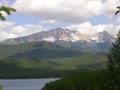
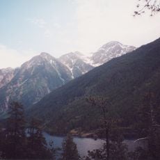
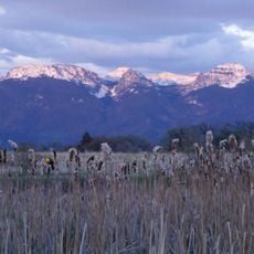
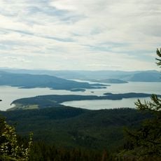
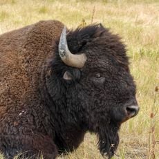
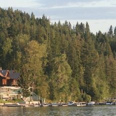
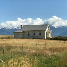
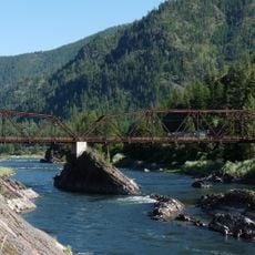
The Flathead Indian Reservation is a large tribal territory in western Montana that encompasses valleys, mountains, and the southern portion of Flathead Lake. The land provides diverse geography serving as homeland for three allied tribes.

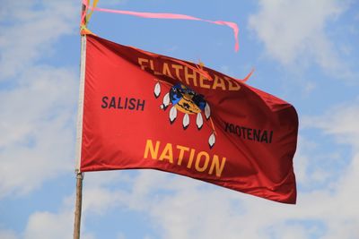
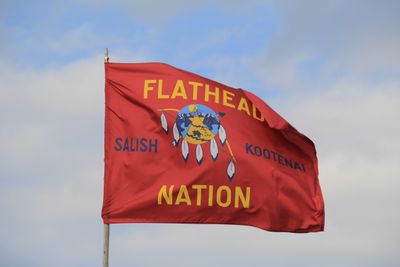
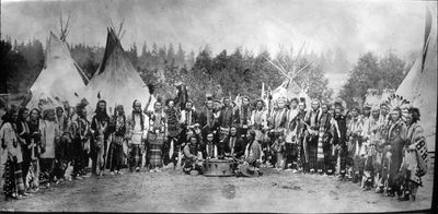
The Confederated Salish, Kootenai, and Pend d'Oreilles tribes were assigned this land as a permanent homeland through the Treaty of Hellgate in 1855. The agreement established the foundation for ongoing tribal sovereignty in the region.

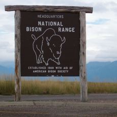
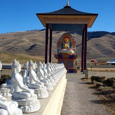
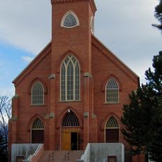
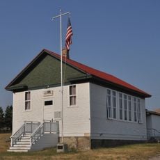
The reservation is governed by the Confederated Salish, Kootenai, and Pend d'Oreilles tribes, who maintain their languages, crafts, and hunting practices within the community. Visitors can experience traditional arts and learn about ongoing tribal governance at cultural centers and community events.

Visitors need tribal permits to participate in activities like fishing, boating, and wildlife watching within reservation boundaries. Check current access rules and conditions before your visit to ensure compliance with tribal regulations.

The tribal community took control of the Seli'š Ksanka Qlispe' Dam in 2015, making it one of the first Native American nations to operate a major hydroelectric facility. This achievement demonstrates the community's economic independence and technical capacity.

The community of curious travelers

AroundUs brings together thousands of curated places, local tips, and hidden gems, enriched daily by 60,000 contributors worldwide.

Start exploring
Location
Inception
1855
Website
GPS coordinates
47.49972,-114.27944
Latest update
December 17, 2025 07:46
Around this place
CSKT Bison Range
United States of America

CSKT Bison Range

20.4 km
The Garden of One Thousand Buddhas
United States of America

The Garden of One Thousand Buddhas

37.1 km
St. Ignatius Mission
United States of America

St. Ignatius Mission

24.5 km
McDonald Peak
United States of America

McDonald Peak

30.1 km
Ninepipe National Wildlife Refuge
United States of America

Ninepipe National Wildlife Refuge

13.7 km
United States of America

Rattlesnake National Recreation Area

59.7 km
United States of America

Mission Mountains Wilderness

33.8 km
Pablo National Wildlife Refuge
United States of America

Pablo National Wildlife Refuge

17.5 km
United States of America

Big Arm State Park

34.9 km
United States of America

Rattlesnake Wilderness

61.9 km
Finley Point State Park
United States of America

Finley Point State Park

32.1 km
CSKT Bison Range
United States of America

CSKT Bison Range

14.5 km
Yellow Bay State Park
United States of America

Yellow Bay State Park

45.8 km
United States of America

Frenchtown Pond State Park

52.9 km
Symes Hotel
United States of America

Symes Hotel

31.9 km
St. Joseph's Catholic Church
United States of America

St. Joseph's Catholic Church

14.3 km
Symes Hot Springs Hotel and Mineral Baths
United States of America

Symes Hot Springs Hotel and Mineral Baths

32 km
Alberton School
United States of America

Alberton School

57.2 km
United States of America

McDonald Glacier

30 km
United States of America

Fissure Glacier

36.2 km
Natural Pier Bridge
United States of America

Natural Pier Bridge

56.8 km
Don E. Olsson House and Garage
United States of America

Don E. Olsson House and Garage

13.8 km
United States of America

Gray Wolf Glacier

38.9 km
Miracle of America Museum and Pioneer Village
United States of America

Miracle of America Museum and Pioneer Village

23.6 km
Dayton State Bank
United States of America

Dayton State Bank

40.6 km
Big Arm School
United States of America

Big Arm School

33.1 km
United States of America

Point of Rocks Historic Transportation Corridor

58.4 km
Polson Feed Mill
United States of America

Polson Feed Mill

23.1 km
Show the full map
Reviews
Share your experience

No review yet

Discussions
Start a discussion...

No discussion yet

« Flathead Indian Reservation - Native American reservation in Flathead County, United States » is provided by Around Us (aroundus.com). Images and texts are derived from Wikimedia project under a Creative Commons license. You are allowed to copy, distribute, and modify copies of this page, under the conditions set by the license, as long as this note is clearly visible.

Discover hidden gems everywhere you go!

From secret cafés to breathtaking viewpoints, skip the crowded tourist spots and find places that match your style. Our app makes it easy with voice search, smart filtering, route optimization, and insider tips from travelers worldwide. Download now for the complete mobile experience.

Around Us App Screenshot

A unique approach to discovering new places

Le Figaro

All the places worth exploring

France Info

A tailor-made excursion in just a few clicks

20 Minutes

Around Us
Travel Guide & Maps
Download

Send to your phone

QR Code
1

Open the camera app on your mobile.

2

Point at the QR code with your camera. A notification will appear.

3

Tap the notification to open the link.