Chest opened
+${chestReward.xp} XP
Explorer
NOUVEAU ×${chestReward.collectible.quantity}
tapez pour fermer
Chest locked

Open chests in the app

Around Us is built for your phone — chests unlock when you walk, explore and capture nearby places.

Enable Location

We need your location to show you interesting places around you

Discover nearby places

Find interesting locations and hidden gems around you

Precise directions

Get accurate directions and distances to places

Your location is never shared with other users. It's only used when you tap the location button.

Log in to your account

Start exploring — it's free

Trusted by 72,890 travelers worldwide

Continue with Google
Continue with Apple
or

We will send you a code to connect

By continuing, you accept our Terms and Conditions and our Privacy Policy

Check your inbox

We've sent a pincode in your inbox. Please enter the code below.

Lake Great Falls
Discussion Reviews Photo
3.3k Popularity

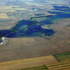
Lake Great Falls, Former glacial lake in central Montana, United States

Lake Great Falls was a glacial lake in central Montana that stretched between Cut Bank and Holter Lake. The water body filled a large basin that is now visible only through geological layers and ancient shoreline marks found across the region.

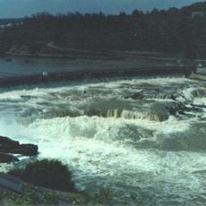
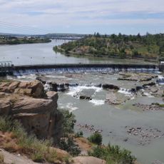
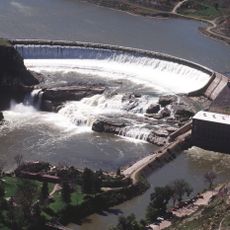
The lake formed around 15,000 years ago when the Laurentide Ice Sheet blocked the Missouri River and created a massive water basin. Thousands of years later, the ice dam failed and the water drained away in a catastrophic flood.

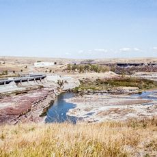
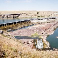
The geological formations and sedimentary layers from Lake Great Falls provide scientists with information about climate patterns during the last ice age period.

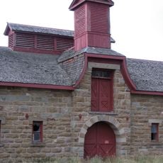
The remnants of the former lake are today mainly of interest to geologists and researchers who study ancient shorelines and sediment deposits in the landscape. Visitors can recognize these features with expert guidance, though they are easily overlooked without explanation.

The draining of the lake left behind a striking feature called Shonkin Sag, a deep meltwater channel that cuts through the Highwood Mountains. This geological scar reveals the enormous force of water movement that reshaped the land.

The community of curious travelers

AroundUs brings together thousands of curated places, local tips, and hidden gems, enriched daily by 60,000 contributors worldwide.

Start exploring
Location
GPS coordinates
47.50360,-111.28600
Latest update
December 12, 2025 09:00
Around this place
Great Falls
United States of America

Great Falls

14.3 km
Black Eagle Dam
United States of America

Black Eagle Dam

2.5 km
First Peoples Buffalo Jump State Park
United States of America

First Peoples Buffalo Jump State Park

18.3 km
C. M. Russell Museum Complex
United States of America

C. M. Russell Museum Complex

679 m
Great Falls
United States of America

Great Falls

14.2 km
490th Missile Squadron
United States of America

490th Missile Squadron

7.4 km
Rainbow Falls
United States of America

Rainbow Falls

7.1 km
Rainbow Dam
United States of America

Rainbow Dam

7 km
Great Falls Portage
United States of America

Great Falls Portage

10.6 km
Great Falls Air Defense Sector
United States of America

Great Falls Air Defense Sector

7.9 km
Benton Lake National Wildlife Refuge
United States of America

Benton Lake National Wildlife Refuge

18.3 km
J. C. Adams Stone Barn
United States of America

J. C. Adams Stone Barn

30.3 km
Paris Gibson Square Museum of Art
United States of America

Paris Gibson Square Museum of Art

356 m
St. Ann's Cathedral
United States of America

St. Ann's Cathedral

907 m
Montana ExpoPark
United States of America

Montana ExpoPark

2.7 km
Cascade County Courthouse
United States of America

Cascade County Courthouse

1.1 km
Timothy Edwards Collins Mansion
United States of America

Timothy Edwards Collins Mansion

3.3 km
Masonic Temple
United States of America

Masonic Temple

536 m
Tenth Street Bridge
United States of America

Tenth Street Bridge

2.1 km
Lee M. Ford House
United States of America

Lee M. Ford House

1.3 km
Margaret Block
United States of America

Margaret Block

1 km
Electric City Water Park
United States of America

Electric City Water Park

1.8 km
Our Savior's Lutheran Church (Great Falls)
United States of America

Our Savior's Lutheran Church (Great Falls)

329 m
First English Evangelical Lutheran Church (Great Falls)
United States of America

First English Evangelical Lutheran Church (Great Falls)

732 m
Great Falls Central Business Historic District
United States of America

Great Falls Central Business Historic District

960 m
Liberty Theatre
United States of America

Liberty Theatre

2.4 km
First Presbyterian Church (Great Falls)
United States of America

First Presbyterian Church (Great Falls)

261 m
Trinity Lutheran Church (Great Falls)
United States of America

Trinity Lutheran Church (Great Falls)

264 m
Show the full map
Reviews
Share your experience

No review yet

Discussions
Start a discussion...

No discussion yet

« Lake Great Falls - Former glacial lake in central Montana, United States » is provided by Around Us (aroundus.com). Images and texts are derived from Wikimedia project under a Creative Commons license. You are allowed to copy, distribute, and modify copies of this page, under the conditions set by the license, as long as this note is clearly visible.

Discover hidden gems everywhere you go!

From secret cafés to breathtaking viewpoints, skip the crowded tourist spots and find places that match your style. Our app makes it easy with voice search, smart filtering, route optimization, and insider tips from travelers worldwide. Download now for the complete mobile experience.

Around Us App Screenshot

A unique approach to discovering new places

Le Figaro

All the places worth exploring

France Info

A tailor-made excursion in just a few clicks

20 Minutes

Around Us
Travel Guide & Maps
Download

Send to your phone

QR Code
1

Open the camera app on your mobile.

2

Point at the QR code with your camera. A notification will appear.

3

Tap the notification to open the link.