Enable Location

We need your location to show you interesting places around you

Discover nearby places

Find interesting locations and hidden gems around you

Precise directions

Get accurate directions and distances to places

Your location is never shared with other users. It's only used when you tap the location button.

Chouteau County

Log in to your account

Start exploring — it's free

Trusted by 61,505 travelers worldwide

Continue with Google
Continue with Apple
or

We will send you a code to connect

By continuing, you accept our Terms and Conditions and our Privacy Policy

Check your inbox

We've sent a pincode in your inbox. Please enter the code below.

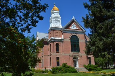
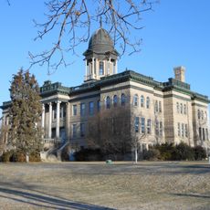
Chouteau County, County seat and historical river port in Montana, United States.

Description

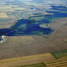
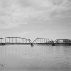
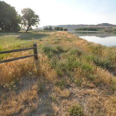
Chouteau County is an administrative division in Montana, with Fort Benton as its county seat located where the Judith River meets the Missouri River. The area features rolling plains and river valleys that have shaped settlement patterns and remain central to the region's character.

History

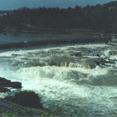
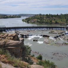
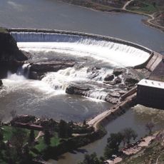
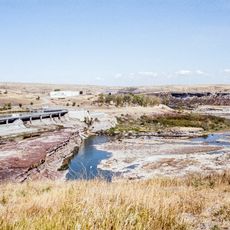
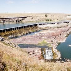
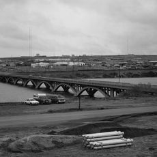
The county emerged in the early 1800s as a fur trading hub centered on the Missouri River, which became essential for transporting goods and people across the frontier. Economic activity in this region drove exploration and settlement throughout the northwestern territories.

Culture

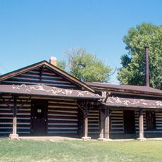
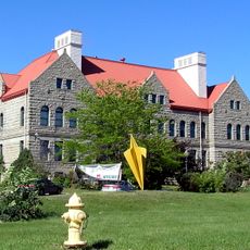
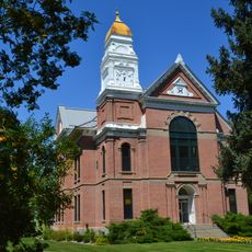
The Montana Agricultural Center and Historic Old Fort preserve the heritage of this region through exhibits about farming and early settlement.

Practical

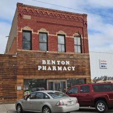
Visiting this area is best managed by car, as the county seat and surrounding attractions are connected by highways and local roads. Parking is available near downtown locations and along the riverfront areas where most visitor activities take place.

Did you know?

Signal Point Golf Course provides a nine-hole course overlooking the Missouri River, complementing the outdoor recreation facilities near the city pool.

Location
Inception
1865
Capital city
Fort Benton
Shares border with
Liberty County, Judith Basin County, Hill County, Blaine County, Fergus County, Cascade County, Teton County, Pondera County
GPS coordinates
47.88000,-110.44000
Latest update
December 7, 2025 20:47

AroundUs brings together thousands of curated places, local tips, and hidden gems, enriched daily by 60,000 contributors worldwide. Discover all places nearby (Montana).

Around this place
Great Falls
United States of America

Great Falls

61.7 km
Black Eagle Dam
United States of America

Black Eagle Dam

73.6 km
C. M. Russell Museum Complex
United States of America

C. M. Russell Museum Complex

75.6 km
Great Falls
United States of America

Great Falls

61.8 km
490th Missile Squadron
United States of America

490th Missile Squadron

69.8 km
Rainbow Falls
United States of America

Rainbow Falls

68.9 km
Rainbow Dam
United States of America

Rainbow Dam

69 km
Great Falls Portage
United States of America

Great Falls Portage

65.9 km
Great Falls Air Defense Sector
United States of America

Great Falls Air Defense Sector

68.8 km
Benton Lake National Wildlife Refuge
United States of America

Benton Lake National Wildlife Refuge

71 km
Eye of the Needle
United States of America

Eye of the Needle

28.4 km
Paris Gibson Square Museum of Art
United States of America

Paris Gibson Square Museum of Art

75.6 km
St. Ann's Cathedral
United States of America

St. Ann's Cathedral

76.3 km
Fort Benton Historic District
United States of America

Fort Benton Historic District

18.4 km
Cascade County Courthouse
United States of America

Cascade County Courthouse

76.6 km
Timothy Edwards Collins Mansion
United States of America

Timothy Edwards Collins Mansion

78.3 km
Masonic Temple
United States of America

Masonic Temple

76.3 km
Tenth Street Bridge
United States of America

Tenth Street Bridge

75.1 km
Fort Benton Bridge
United States of America

Fort Benton Bridge

17.9 km
Judith Landing Historic District
United States of America

Judith Landing Historic District

62.9 km
Chouteau County Courthouse
United States of America

Chouteau County Courthouse

18.2 km
Masonic Building
United States of America

Masonic Building

17.9 km
Lee M. Ford House
United States of America

Lee M. Ford House

76.5 km
Fort Benton Engine House
United States of America

Fort Benton Engine House

17.9 km
Margaret Block
United States of America

Margaret Block

76.7 km
Old Fort Benton
United States of America

Old Fort Benton

18 km
Our Savior's Lutheran Church (Great Falls)
United States of America

Our Savior's Lutheran Church (Great Falls)

75.7 km
First English Evangelical Lutheran Church (Great Falls)
United States of America

First English Evangelical Lutheran Church (Great Falls)

76.3 km
Show the full map
Administrative divisions
« Chouteau County - County seat and historical river port in Montana, United States » is provided by Around Us (aroundus.com). Images and texts are derived from Wikimedia project under a Creative Commons license. You are allowed to copy, distribute, and modify copies of this page, under the conditions set by the license, as long as this note is clearly visible.

Discover hidden gems everywhere you go!

From secret cafés to breathtaking viewpoints, skip the crowded tourist spots and find places that match your style. Our app makes it easy with voice search, smart filtering, route optimization, and insider tips from travelers worldwide. Download now for the complete mobile experience.

Around Us App Screenshot

A unique approach to discovering new places

Le Figaro

All the places worth exploring

France Info

A tailor-made excursion in just a few clicks

20 Minutes

Around Us
Travel Guide & Maps
Download

Send to your phone

QR Code
1

Open the camera app on your mobile.

2

Point at the QR code with your camera. A notification will appear.

3

Tap the notification to open the link.