Enable Location

We need your location to show you interesting places around you

Discover nearby places

Find interesting locations and hidden gems around you

Precise directions

Get accurate directions and distances to places

Your location is never shared with other users. It's only used when you tap the location button.

Blaine County

Log in to your account

Start exploring — it's free

Trusted by 61,506 travelers worldwide

Continue with Google
Continue with Apple
or

We will send you a code to connect

By continuing, you accept our Terms and Conditions and our Privacy Policy

Check your inbox

We've sent a pincode in your inbox. Please enter the code below.

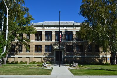
Blaine County, County of Montana in north-central United States.

Description

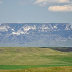
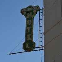
Blaine County is a county in north-central Montana that spans varied terrain including river valleys and mountain ranges. The area contains several geographic features and is administered from Chinook, the county seat.

History

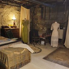
The county was established in 1895 and named after James G. Blaine, a prominent political figure of the era. The land had been home to Native American peoples for generations before formal territorial organization.

Culture

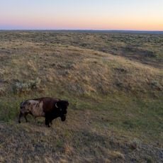
The Fort Belknap Indian Reservation in the southeast is home to the Gros Ventre and Assiniboine peoples, whose traditions and languages remain active in the region. Their cultural presence shapes community life through celebrations, art, and oral traditions shared with visitors.

Practical

The region is best explored by car, as distances between towns are larger than in urban areas. Visitors should check in advance what services are available in smaller communities and come prepared.

Did you know?

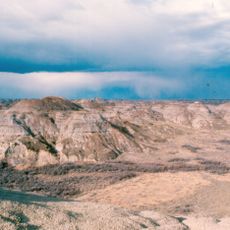
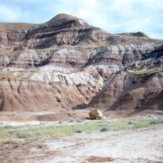
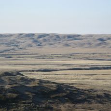
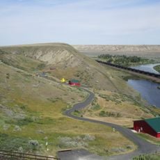
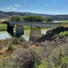
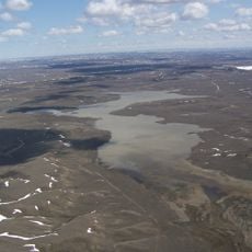
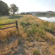
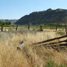
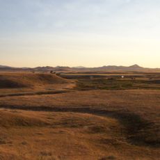
The county extends to the Canadian border with Saskatchewan and contains both flat river valleys and elevated mountain terrain within its boundaries. This geographic variety creates distinct landscapes and habitats across the region.

Location
Inception
1895
Capital city
Chinook
Shares border with
Phillips County, Fergus County, Hill County, Chouteau County
GPS coordinates
48.44000,-108.96000
Latest update
December 7, 2025 19:32

AroundUs brings together thousands of curated places, local tips, and hidden gems, enriched daily by 60,000 contributors worldwide. Discover all places nearby (Montana).

Around this place
Dinosaur Park Formation
Canada

Dinosaur Park Formation

135.3 km
Grasslands National Park
Canada

Grasslands National Park

132.5 km
American Prairie Reserve
United States of America

American Prairie Reserve

111.8 km
Bearpaw Shale
Canada

Bearpaw Shale

45.2 km
Fort Assinniboine
United States of America

Fort Assinniboine

61.9 km
T.rex Discovery Centre
Canada

T.rex Discovery Centre

120.9 km
Frenchman River
Canada

Frenchman River

128.4 km
Eye of the Needle
United States of America

Eye of the Needle

100.8 km
Too Close For Comfort Site
United States of America

Too Close For Comfort Site

57.3 km
Fred Robinson Bridge
United States of America

Fred Robinson Bridge

92.4 km
UL Bend National Wildlife Refuge
United States of America

UL Bend National Wildlife Refuge

121.5 km
Hewitt Lake National Wildlife Refuge
United States of America

Hewitt Lake National Wildlife Refuge

100.1 km
Great Plains Dinosaur Museum and Field Station
United States of America

Great Plains Dinosaur Museum and Field Station

81.2 km
Skyland Camp-Bowman Lake Ranger Station
United States of America

Skyland Camp-Bowman Lake Ranger Station

70.8 km
Havre Residential Historic District
United States of America

Havre Residential Historic District

54.2 km
Dave's Texaco
United States of America

Dave's Texaco

26.3 km
Judith Landing Historic District
United States of America

Judith Landing Historic District

92.6 km
H. Earl Clack Service Station
United States of America

H. Earl Clack Service Station

119.4 km
H. Earl Clack House
United States of America

H. Earl Clack House

54.5 km
Young–Almas House
United States of America

Young–Almas House

55.4 km
Phillips County Carnegie Library
United States of America

Phillips County Carnegie Library

80.6 km
Carnegie Public Library
United States of America

Carnegie Public Library

54.2 km
Ervin Homestead-Gist Bottom Historic District
United States of America

Ervin Homestead-Gist Bottom Historic District

70.8 km
Havre Beneath the Streets
United States of America

Havre Beneath the Streets

54.5 km
Grand Theater
United States of America

Grand Theater

16.2 km
Square Butte
United States of America

Square Butte

143.8 km
Chief Joseph Battleground of the Bear's Paw
United States of America

Chief Joseph Battleground of the Bear's Paw

19.5 km
Wallace Stegner House
Canada

Wallace Stegner House

120.1 km
Show the full map
Administrative divisions
« Blaine County - County of Montana in north-central United States » is provided by Around Us (aroundus.com). Images and texts are derived from Wikimedia project under a Creative Commons license. You are allowed to copy, distribute, and modify copies of this page, under the conditions set by the license, as long as this note is clearly visible.

Discover hidden gems everywhere you go!

From secret cafés to breathtaking viewpoints, skip the crowded tourist spots and find places that match your style. Our app makes it easy with voice search, smart filtering, route optimization, and insider tips from travelers worldwide. Download now for the complete mobile experience.

Around Us App Screenshot

A unique approach to discovering new places

Le Figaro

All the places worth exploring

France Info

A tailor-made excursion in just a few clicks

20 Minutes

Around Us
Travel Guide & Maps
Download

Send to your phone

QR Code
1

Open the camera app on your mobile.

2

Point at the QR code with your camera. A notification will appear.

3

Tap the notification to open the link.