Chest opened
+${chestReward.xp} XP
Explorer
NOUVEAU ×${chestReward.collectible.quantity}
tapez pour fermer
Chest locked

Open chests in the app

Around Us is built for your phone — chests unlock when you walk, explore and capture nearby places.

Enable Location

We need your location to show you interesting places around you

Discover nearby places

Find interesting locations and hidden gems around you

Precise directions

Get accurate directions and distances to places

Your location is never shared with other users. It's only used when you tap the location button.

Log in to your account

Start exploring — it's free

Trusted by 72,886 travelers worldwide

Continue with Google
Continue with Apple
or

We will send you a code to connect

By continuing, you accept our Terms and Conditions and our Privacy Policy

Check your inbox

We've sent a pincode in your inbox. Please enter the code below.

Discussion Reviews Photo
1.5k Popularity

Ellis Group, Geological formation in Alberta, United States and Canada

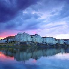
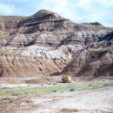
Ellis Group is a geological formation made of marine shale and sandstone layers that stretch across Alberta, Saskatchewan, Montana, and Wyoming. The rock layers are between 80 and 150 meters thick, with the Sawtooth Formation section containing valuable oil deposits.

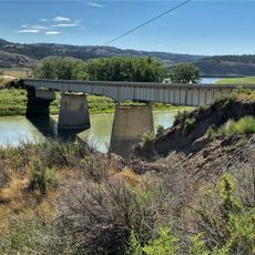
The formation was first documented in 1893 by geologist A.C. Peale near Rocky Creek Canyon and named after Fort Ellis in Montana. This discovery helped establish understanding of the Western Canadian Sedimentary Basin geology.

The Ellis Group formations contribute to the understanding of North American geology through their preserved marine fossils and sedimentary structures.

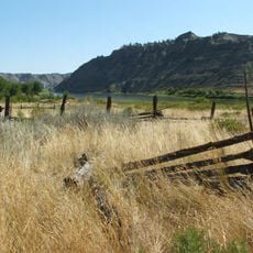
This formation spans a large area and shows different features depending on where you look at it. Access to study sites varies by location since the rock layers appear in multiple provinces and states.

The rock layers change westward into Fernie Group shales and eastward into Vanguard and Shaunavon Formations with different compositions. This shift reveals how ancient marine environments transformed across different regions.

The community of curious travelers

AroundUs brings together thousands of curated places, local tips, and hidden gems, enriched daily by 60,000 contributors worldwide.

Start exploring
Location
GPS coordinates
48.00000,-108.60000
Latest update
March 21, 2026 08:12
Around this place
Upper Missouri River Breaks National Monument
United States of America

Upper Missouri River Breaks National Monument

39.6 km
American Prairie Reserve
United States of America

American Prairie Reserve

66 km
Bearpaw Shale
Canada

Bearpaw Shale

72.4 km
Fred Robinson Bridge
United States of America

Fred Robinson Bridge

41.6 km
UL Bend National Wildlife Refuge
United States of America

UL Bend National Wildlife Refuge

67.8 km
United States of America

UL Bend Wilderness

75.5 km
United States of America

Black Coulee National Wildlife Refuge

77.5 km
Great Plains Dinosaur Museum and Field Station
United States of America

Great Plains Dinosaur Museum and Field Station

67.6 km
Lohman Block
United States of America

Lohman Block

80.9 km
Phillips County Carnegie Library
United States of America

Phillips County Carnegie Library

67 km
United States of America

Little Rockies National Forest

5.3 km
Ervin Homestead-Gist Bottom Historic District
United States of America

Ervin Homestead-Gist Bottom Historic District

37.6 km
United States of America

Manning Corral Prairie Dog Town

34.9 km
United States of America

Putnam Lake

30.8 km
United States of America

Fourchette Creek Recreation Area

79.5 km
United States of America

Black Coulee

78.6 km
United States of America

Lions Club Park

60.9 km
United States of America

First Creek Reservoir

62.4 km
United States of America

West Alkali Reservoir

44.5 km
United States of America

Weigand Reservoir

31.6 km
United States of America

J. D. Reservoir

22.4 km
Chief Joseph Battleground of the Bear's Paw
United States of America

Chief Joseph Battleground of the Bear's Paw

61.6 km
United States of America

Lake Seventeen

21.8 km
United States of America

Newhouse Reservoir

42.3 km
United States of America

Kachia Reservoir

67.9 km
United States of America

Veseth Flat

32.6 km
United States of America

Marion Hills Country Club

65.3 km
United States of America

Slippery Ann Elk Viewing area

42.6 km
Show the full map
Reviews
Share your experience

No review yet

Discussions
Start a discussion...

No discussion yet

« Ellis Group - Geological formation in Alberta, United States and Canada » is provided by Around Us (aroundus.com). Images and texts are derived from Wikimedia project under a Creative Commons license. You are allowed to copy, distribute, and modify copies of this page, under the conditions set by the license, as long as this note is clearly visible.

Discover hidden gems everywhere you go!

From secret cafés to breathtaking viewpoints, skip the crowded tourist spots and find places that match your style. Our app makes it easy with voice search, smart filtering, route optimization, and insider tips from travelers worldwide. Download now for the complete mobile experience.

Around Us App Screenshot

A unique approach to discovering new places

Le Figaro

All the places worth exploring

France Info

A tailor-made excursion in just a few clicks

20 Minutes

Around Us
Travel Guide & Maps
Download

Send to your phone

QR Code
1

Open the camera app on your mobile.

2

Point at the QR code with your camera. A notification will appear.

3

Tap the notification to open the link.