Sheridan County

Log in to your account

AroundUs is a community-driven map of interesting places, built by curious explorers like you. It grows with every review, story, and photo you share.
Connect to save your favorite spots, contribute locations, and create personalized routes.
By continuing, you accept our Terms and Conditions and our Privacy Policy
Add to collection
Map
Suggest a change
Share

Sheridan County, Administrative county in northeastern Montana, United States.

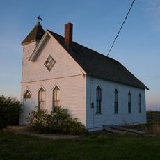
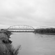
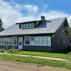
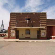
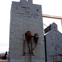
Sheridan County is an administrative county in northeastern Montana that spans plains and rolling hills along the borders with North Dakota and Saskatchewan, characterized by open farmland and wide spaces. The county is centered around the town of Plentywood, which serves as its administrative and economic hub.

The county was established in 1913 when the Montana Legislature divided portions of Dawson and Valley Counties, naming it after Civil War General Philip Sheridan. This creation reflected the administrative reorganization happening across Montana during the state's early development.

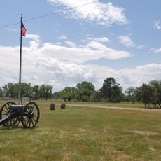
The region became known in the early 20th century as a center for socialist political movements, where local communities actively engaged with alternative political ideas. This distinctive history shaped how residents viewed themselves and continues to influence local identity today.

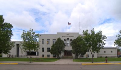
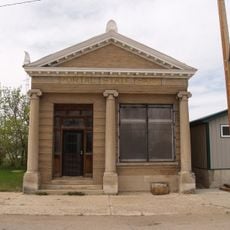
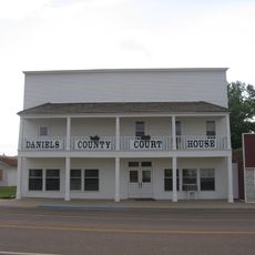
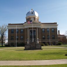
All local government services and administrative functions are headquartered in Plentywood, the county seat, making it easy to find official information. The flat to gently rolling terrain makes it simple to explore by car, with roads well maintained throughout the area.

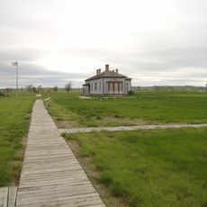
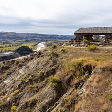
Part of the Medicine Lake National Wildlife Refuge lies within the county, serving as a crucial stopping point and breeding ground for migratory birds traveling across North America. This refuge draws birdwatchers from across the region who come to observe waterfowl and other native species.

Location: Montana

Inception: 1913

Capital city: Plentywood

Shares border with: Divide County, Daniels County, Roosevelt County, Williams County

Website: http://co.sheridan.mt.us

GPS coordinates: 48.73000,-104.50000

Latest update: December 8, 2025 13:43

Photos
Around this place
Show the full map
Bakken formation
Canada

Bakken formation

120.9 km
Interior Plains
United States of America

Interior Plains

93.1 km
Fort Buford
United States of America

Fort Buford

90.6 km
Montana Cowboy Hall of Fame
United States of America

Montana Cowboy Hall of Fame

110.4 km
Snowden Bridge
United States of America

Snowden Bridge

86.6 km
Missouri-Yellowstone Confluence Interpretive Center
United States of America

Missouri-Yellowstone Confluence Interpretive Center

91.1 km
Fairview Lift Bridge
United States of America

Fairview Lift Bridge

97.6 km
Ambrose–Torquay Border Crossing
Canada

Ambrose–Torquay Border Crossing

80 km
Trossachs
Canada

Trossachs

103.1 km
Lewis and Clark Bridge
United States of America

Lewis and Clark Bridge

106.3 km
Alkabo School
United States of America

Alkabo School

47.4 km
Lostwood Wilderness
United States of America

Lostwood Wilderness

150.9 km
Portal State Bank
United States of America

Portal State Bank

146 km
Rocky Valley Lutheran Church
United States of America

Rocky Valley Lutheran Church

18.8 km
Daniels County Courthouse
United States of America

Daniels County Courthouse

67.9 km
James Memorial Library
United States of America

James Memorial Library

91.4 km
Peoples' Congregational Church
United States of America

Peoples' Congregational Church

115.8 km
Niels Nielsen Fourteen-Side Barn Farm
United States of America

Niels Nielsen Fourteen-Side Barn Farm

113.6 km
Divide County Courthouse
United States of America

Divide County Courthouse

90.8 km
Old U.S. Post Office
United States of America

Old U.S. Post Office

91.6 km
Ray Opera House
United States of America

Ray Opera House

107.2 km
Charles C. Sargent House
United States of America

Charles C. Sargent House

152.3 km
Fort Union Trading Post National Historic Site
United States of America

Fort Union Trading Post National Historic Site

88.2 km
Fort Buford State Historic Site
United States of America

Fort Buford State Historic Site

90.5 km
Fort Peck Interpretive Center
United States of America

Fort Peck Interpretive Center

163.1 km
Columbus Theatre
United States of America

Columbus Theatre

127.5 km
River Bend Overlook
United States of America

River Bend Overlook

150.1 km
Cannonball Concretions Pullout
United States of America

Cannonball Concretions Pullout

153.1 km
Show the full map
Reviews

Visited this place? Tap the stars to rate it and share your experience / photos with the community! Try now! You can cancel it anytime.

Administrative divisions
« Sheridan County - Administrative county in northeastern Montana, United States » is provided by Around Us (aroundus.com). Images and texts are derived from Wikimedia project under a Creative Commons license. You are allowed to copy, distribute, and modify copies of this page, under the conditions set by the license, as long as this note is clearly visible.

Discover hidden gems everywhere you go!

From secret cafés to breathtaking viewpoints, skip the crowded tourist spots and find places that match your style. Our app makes it easy with voice search, smart filtering, route optimization, and insider tips from travelers worldwide. Download now for the complete mobile experience.

Around Us App Screenshot

A unique approach to discovering new places

Le Figaro

All the places worth exploring

France Info

A tailor-made excursion in just a few clicks

20 Minutes