Ogallala Aquifer, Underground water source beneath Great Plains, United States
The Ogallala Aquifer lies beneath portions of eight states stretching from South Dakota to Texas, holding water in layers of sand, gravel, and clay deposited over millions of years. These porous rock formations cover roughly 174,000 square miles and function as a natural underground reservoir for the Great Plains.
Geologist N.H. Darton named the formation in 1898 after the town of Ogallala in Nebraska, where he studied rock samples from the area. After World War II, electric pumps and center pivot technology allowed farmers to tap deep wells, transforming dry grassland into productive farmland across the region.
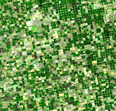
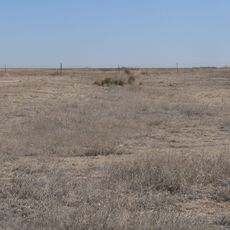
Farmers across the Great Plains depend on well water from this formation to raise cattle, grow grains, and maintain the rural way of life that defines the region. Windmills and pivot systems dot the flat landscape, marking the connection between invisible reserves below and the fields that rely on them above.
The formation supplies drinking water to households and towns, as well as irrigation systems that operate during dry months across the plains. Water levels drop more quickly in southern sections than in northern areas, affecting long-term availability and well depth in different regions.
Natural recharge rates range from less than one millimeter per year in Texas to roughly six inches (15 centimeters) annually in Kansas, depending on soil and rainfall. Under current conditions, full replenishment of withdrawn water would take several thousand years across much of the formation.
The community of curious travelers
AroundUs brings together thousands of curated places, local tips, and hidden gems, enriched daily by 60,000 contributors worldwide.