Enable Location

We need your location to show you interesting places around you

Discover nearby places

Find interesting locations and hidden gems around you

Precise directions

Get accurate directions and distances to places

Your location is never shared with other users. It's only used when you tap the location button.

Mustang

Log in to your account

Start exploring — it's free

Trusted by 68,094 travelers worldwide

Continue with Google
Continue with Apple
or

We will send you a code to connect

By continuing, you accept our Terms and Conditions and our Privacy Policy

Check your inbox

We've sent a pincode in your inbox. Please enter the code below.

Discussion Reviews 1 Photos
18.6k Popularity

Mustang, human settlement in Canadian County, Oklahoma, United States of America

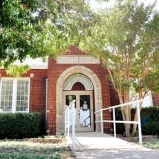
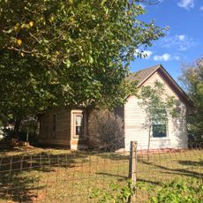
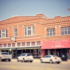
Mustang is a city in Canadian County on the west side of Oklahoma City near Will Rogers World Airport. It has residential neighborhoods, several parks with trails and recreation areas, a library, community center, local restaurants, and shops for groceries and other daily needs.

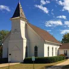
Mustang grew from a small settlement into a modern town that continues to expand with new residents and facilities. The town's history reflects families choosing to settle here and build a stable community over time.

Mustang has a strong community focus where neighbors know each other and gather regularly at local events and parks. The town maintains its small-town identity through these shared spaces and connections, which remain visible in how people interact daily.

Getting around Mustang is straightforward with clear roads, and nearby highways connect to larger city areas easily. The proximity to Will Rogers World Airport makes travel convenient, and essential services like health clinics, stores, and restaurants are accessible throughout the town.

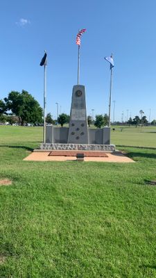
Elliott Park offers a quiet spot with large trees and a pond for watching birds and fish, often overlooked by visitors seeking more developed areas. Curtis Park by contrast features a rodeo arena and hosts horse shows and sporting events that reflect the local heritage.

The community of curious travelers

AroundUs brings together thousands of curated places, local tips, and hidden gems, enriched daily by 60,000 contributors worldwide.

Start exploring
Location
Elevation above the sea
411 m
GPS coordinates
35.39278,-97.72278
Latest update
February 16, 2026 23:42
Around this place
Oklahoma City University
United States of America

Oklahoma City University

20 km
Devon Energy Center
United States of America

Devon Energy Center

20.4 km
Skydance Pedestrian Bridge
United States of America

Skydance Pedestrian Bridge

19.9 km
First National Center
United States of America

First National Center

20.5 km
Myriad Botanical Gardens
United States of America

Myriad Botanical Gardens

20.2 km
Lake Overholser
United States of America

Lake Overholser

12.3 km
Oklahoma City Museum of Art
United States of America

Oklahoma City Museum of Art

20.2 km
Six Flags Hurricane Harbor Oklahoma City
United States of America

Six Flags Hurricane Harbor Oklahoma City

14.4 km
Civic Center Music Hall
United States of America

Civic Center Music Hall

20 km
Colcord Hotel
United States of America

Colcord Hotel

20.4 km
Leadership Square
United States of America

Leadership Square

20.5 km
BOK Park Plaza
United States of America

BOK Park Plaza

20.2 km
Oklahoma Tower
United States of America

Oklahoma Tower

20.5 km
Oklahoma County Courthouse
United States of America

Oklahoma County Courthouse

20.2 km
Will Rogers Gardens
United States of America

Will Rogers Gardens

17.7 km
Celebration Station
United States of America

Celebration Station

13.4 km
Wedgewood Village Amusement Park
United States of America

Wedgewood Village Amusement Park

20.1 km
Dowell Center
United States of America

Dowell Center

19.5 km
First Christian Church
United States of America

First Christian Church

20.2 km
Pilgrim Congregational Church
United States of America

Pilgrim Congregational Church

20.4 km
Yukon Public Library
United States of America

Yukon Public Library

12.9 km
Galaxy
United States of America

Galaxy

20.6 km
West Point Christian Church
United States of America

West Point Christian Church

9 km
Elks Lodge Building
United States of America

Elks Lodge Building

20.4 km
Meloy House
United States of America

Meloy House

1.3 km
Richardson Building
United States of America

Richardson Building

19.2 km
Mulvey Mercantile
United States of America

Mulvey Mercantile

12.5 km
Avid Extreme Sports Park
United States of America

Avid Extreme Sports Park

20 km
Show the full map
Reviews
Share your experience

No review yet

Discussions
Start a discussion...

No discussion yet

« Mustang - human settlement in Canadian County, Oklahoma, United States of America » is provided by Around Us (aroundus.com). Images and texts are derived from Wikimedia project under a Creative Commons license. You are allowed to copy, distribute, and modify copies of this page, under the conditions set by the license, as long as this note is clearly visible.

Discover hidden gems everywhere you go!

From secret cafés to breathtaking viewpoints, skip the crowded tourist spots and find places that match your style. Our app makes it easy with voice search, smart filtering, route optimization, and insider tips from travelers worldwide. Download now for the complete mobile experience.

Around Us App Screenshot

A unique approach to discovering new places

Le Figaro

All the places worth exploring

France Info

A tailor-made excursion in just a few clicks

20 Minutes

Around Us
Travel Guide & Maps
Download

Send to your phone

QR Code
1

Open the camera app on your mobile.

2

Point at the QR code with your camera. A notification will appear.

3

Tap the notification to open the link.