Enable Location

We need your location to show you interesting places around you

Discover nearby places

Find interesting locations and hidden gems around you

Precise directions

Get accurate directions and distances to places

Your location is never shared with other users. It's only used when you tap the location button.

Haskell County

Log in to your account

Start exploring — it's free

Trusted by 62,834 travelers worldwide

Continue with Google
Continue with Apple
or

We will send you a code to connect

By continuing, you accept our Terms and Conditions and our Privacy Policy

Check your inbox

We've sent a pincode in your inbox. Please enter the code below.

Haskell County, County in southeastern Oklahoma, United States

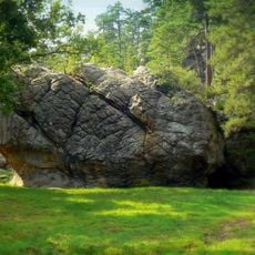
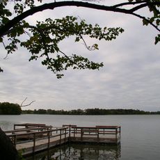
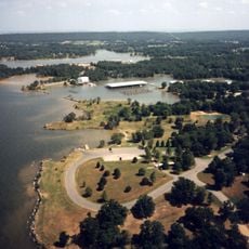
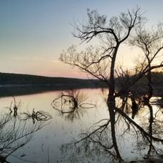
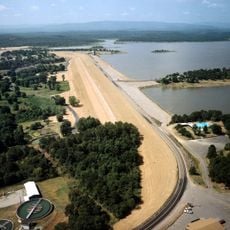
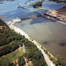
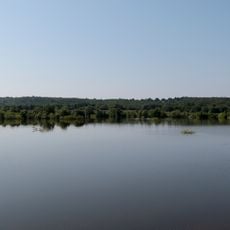
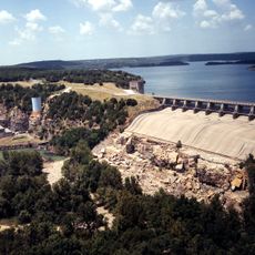
Haskell County is an administrative division in southeastern Oklahoma shaped by the Sans Bois Mountains and their rolling terrain. Two major water bodies, Lake Eufaula and Robert S. Kerr Reservoir, dominate the northern portion of the region.

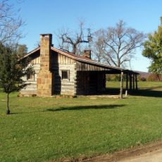
The territory was established as an independent county during Oklahoma statehood in 1907, separated from what had been Sans Bois County. Mining initially shaped its development before the economy gradually shifted toward agriculture.

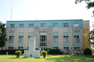
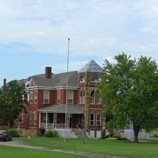
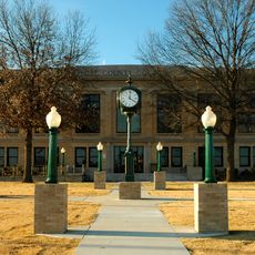
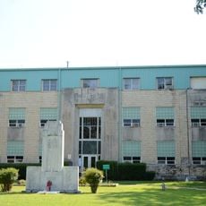
The courthouse in Stigler displays marble monuments on its grounds that represent important American documents. These monuments show how local residents connect their community to broader national values.

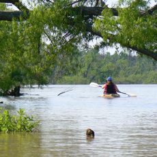
The county is connected by State Highways 2, 9, 31, 71, and 82, making it easy to navigate between different areas. The two lakes in the north provide natural landmarks and opportunities for outdoor activities throughout your visit.

A mining disaster at the Number Two mine in 1912 became a turning point that redirected the region's economic path. The incident accelerated the shift away from coal extraction toward farming and agricultural pursuits.

The community of curious travelers

AroundUs brings together thousands of curated places, local tips, and hidden gems, enriched daily by 60,000 contributors worldwide.

Start exploring
Location
Inception
July 16, 1907
Capital city
Stigler
Shares border with
Muskogee County, Sequoyah County, LeFlore County, Latimer County, McIntosh County, Pittsburg County
GPS coordinates
35.23000,-95.11000
Latest update
December 10, 2025 15:53
Around this place
Eufaula Lake
United States of America

Eufaula Lake

38.6 km
Robbers Cave State Park
United States of America

Robbers Cave State Park

32.9 km
Tenkiller Ferry Lake
United States of America

Tenkiller Ferry Lake

48.8 km
Greenleaf State Park
United States of America

Greenleaf State Park

44.2 km
Robert S. Kerr Reservoir
United States of America

Robert S. Kerr Reservoir

27 km
Arrowhead State Park
United States of America

Arrowhead State Park

47.5 km
Lake Eufaula State Park
United States of America

Lake Eufaula State Park

49.1 km
Lake Wister
United States of America

Lake Wister

47.4 km
Dwight Presbyterian Mission
United States of America

Dwight Presbyterian Mission

42.4 km
Webbers Falls Lake
United States of America

Webbers Falls Lake

43.1 km
Lake Wister State Park
United States of America

Lake Wister State Park

46.4 km
Oklahoma Odd Fellows Home at Checotah
United States of America

Oklahoma Odd Fellows Home at Checotah

46.5 km
Sacred Heart Catholic Church and Rectory
United States of America

Sacred Heart Catholic Church and Rectory

39.4 km
Trahern's Station
United States of America

Trahern's Station

30.5 km
Hines Round Barn
United States of America

Hines Round Barn

38 km
Terry House
United States of America

Terry House

48 km
LeFlore County Courthouse
United States of America

LeFlore County Courthouse

48.4 km
United States of America

Summerfield School

22.9 km
Kinta High School
United States of America

Kinta High School

17.8 km
Tucker School
United States of America

Tucker School

35 km
First Presbyterian Church
United States of America

First Presbyterian Church

38.7 km
Skullyville County Jail
United States of America

Skullyville County Jail

36.2 km
Haskell County Courthouse
United States of America

Haskell County Courthouse

3.8 km
First United Methodist Church
United States of America

First United Methodist Church

46.2 km
Judge Franklin Faulkner House
United States of America

Judge Franklin Faulkner House

39.8 km
14 Flags Museum
United States of America

14 Flags Museum

39.1 km
Tenkiller Ferry Dam
United States of America

Tenkiller Ferry Dam

41 km
Honey Springs Battlefield
United States of America

Honey Springs Battlefield

47.8 km
Show the full map
Administrative divisions
« Haskell County - County in southeastern Oklahoma, United States » is provided by Around Us (aroundus.com). Images and texts are derived from Wikimedia project under a Creative Commons license. You are allowed to copy, distribute, and modify copies of this page, under the conditions set by the license, as long as this note is clearly visible.

Discover hidden gems everywhere you go!

From secret cafés to breathtaking viewpoints, skip the crowded tourist spots and find places that match your style. Our app makes it easy with voice search, smart filtering, route optimization, and insider tips from travelers worldwide. Download now for the complete mobile experience.

Around Us App Screenshot

A unique approach to discovering new places

Le Figaro

All the places worth exploring

France Info

A tailor-made excursion in just a few clicks

20 Minutes

Around Us
Travel Guide & Maps
Download

Send to your phone

QR Code
1

Open the camera app on your mobile.

2

Point at the QR code with your camera. A notification will appear.

3

Tap the notification to open the link.