W National Park, Biosphere reserve in Niger and Benin, West Africa.
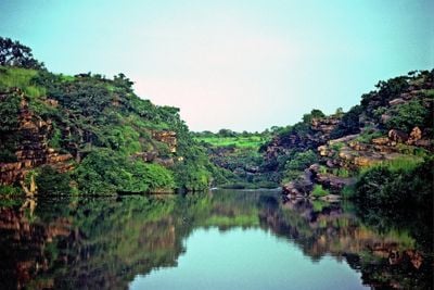
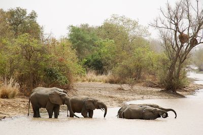
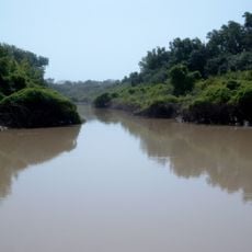
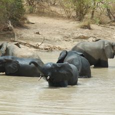
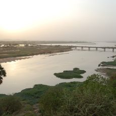
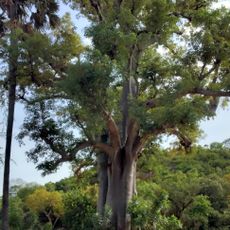
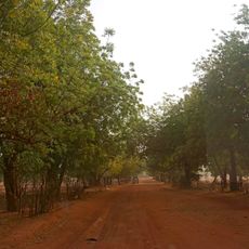
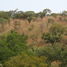
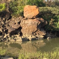
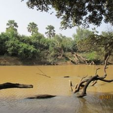
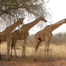
W National Park is a large protected area spanning Niger and Benin, shaped by a distinctive river bend that gives it its name. The landscape changes between dry grasslands, woodlands, and wetlands where rivers and water sources run through the year.
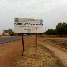
This protected area was established as a national park in 1954 and later gained recognition as a UNESCO World Heritage Site. The designation came as part of a broader conservation effort that linked several nature reserves across the region.
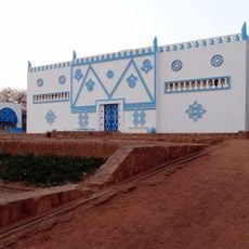
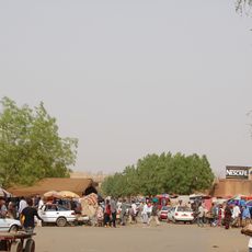
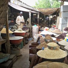
Several ethnic groups have lived alongside the wildlife and water sources in this region for many generations. Their traditional hunting and fishing practices shaped how people interact with the land today.
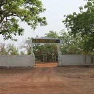
The park is mainly accessible during the dry months from November to April and requires organized safari tours with local guides. Visitors should prepare for long drives through remote areas and bring appropriate gear for changing weather conditions.
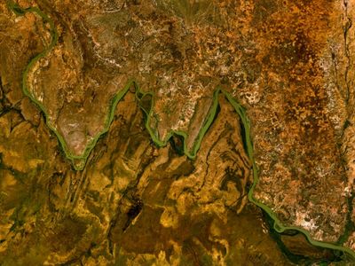
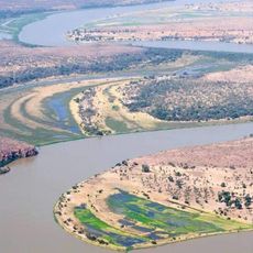
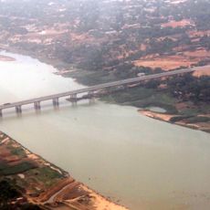
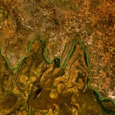
The park's name comes from the distinctive W-shaped bend in the Niger River along its northern border. This geographic feature is barely visible from ground level, but becomes immediately clear when viewed from the air.
Location: Niger
Location: Karimama
Inception: 1954
Part of: W-Arly-Pendjari Complex
Address: 9923+2X9, La Tapoa, Niger
GPS coordinates: 12.00000,2.50000
Latest update: December 6, 2025 16:03
Benin brings together centuries of history with landscapes that shift from the Atlantic coast to protected wilderness areas inland. The country holds places where royal dynasties left their mark, like the Royal Palaces of Abomey with walls decorated by Fon artisans, and coastal towns such as Ouidah where Portuguese forts now house museums telling the story of the region's complex past. In the north, Pendjari and W National Parks shelter elephants, lions, and leopards across savannas that stretch into neighboring countries, while along the coast, beaches like Coco Beach and Fidjrosse offer access to the Gulf of Guinea. Daily life unfolds in spaces that reveal how people have adapted to their surroundings. Ganvié sits above Lake Nokoué, a settlement where wooden houses stand on stilts and canoes serve as the main way to move from place to place. In Cotonou, Dantokpa Market spreads out near the Ouémé River, filled with vendors selling everything from cloth to herbs. Churches built during the colonial era, including the red and white striped cathedral in Cotonou, punctuate the cities. Whether you're drawn to wildlife, the layers of human history, or the rhythm of markets and waterfront communities, Benin provides a window into West Africa that mixes old traditions with everyday moments still taking shape.
Niger reveals its character through desert expanses, mud architecture, and traces of centuries of trade and culture. The Ténéré Desert stretches across the southeast, bordered by the Aïr Mountains where oases such as Timia provide relief from the surrounding sand. Agadez holds the 16th-century Great Mosque with its towering minaret and the Sultan's Palace, both shaped from adobe brick in the Sahelian style. In Niamey, the National Museum displays tools, textiles, and artifacts from Haussa, Zarma, and Tuareg communities, while the Grand Market fills covered passages with spices, fabrics, and everyday goods. Fort de Madama stands in ruin far to the northeast, a French military post from 1931 that once guarded caravan routes between Niger and Libya. Zinder preserves its own Great Mosque and Fort Tanimoune, and Dosso keeps the Palace of the Chief and Tunguma Stone as markers of local authority. Abaaba National Park shelters black rhinoceroses and Sahelian antelopes across thorn scrub and grassland, showing efforts to protect wildlife in a demanding climate. These places together tell the story of a country shaped by desert conditions, ancient trade, and the meeting of different peoples and beliefs.
Arli National Park
121.6 km
W National Park of Benin
21.2 km
Musée National Boubou Hama
173.6 km
W-Arly-Pendjari Complex
57.1 km
Niamey Grand Mosque
174.1 km
Niamey Grand Market
173.8 km
Kennedy Bridge
172.9 km
Lété Island
62.5 km
Dosso Reserve
67.6 km
Tamou Reserve
69.8 km
Kourtiagou Reserve
80.8 km
Palais du Zarmakoye
139.1 km
China-Niger Friendship Bridge
171.3 km
Our Lady of Mount Carmel Cathedral, Kandi
107.3 km
W National Park of Niger
42.2 km
Chutes de Koudou
40.9 km
Centre Culturel Franco-Nigérien Jean Rouch
173.8 km
Petit Marché
173.8 km
Centre Culturel Oumarou Ganda
173.9 km
Dosso Grand Mosque
139 km
Trois Sœurs
173.2 km
Regional Museum "Djermakoye"
138.7 km
Kiota Grand Mosque
152.2 km
Arli National Park
138.8 km
Kouré Reserve
152.2 km
Village d'Artisanal Wadata
172.8 km
Niamey City Hall
173.8 km
Ferme Youyou
174 kmReviews
Visited this place? Tap the stars to rate it and share your experience / photos with the community! Try now! You can cancel it anytime.
Discover hidden gems everywhere you go!
From secret cafés to breathtaking viewpoints, skip the crowded tourist spots and find places that match your style. Our app makes it easy with voice search, smart filtering, route optimization, and insider tips from travelers worldwide. Download now for the complete mobile experience.
A unique approach to discovering new places❞
— Le Figaro
All the places worth exploring❞
— France Info
A tailor-made excursion in just a few clicks❞
— 20 Minutes