W National Park of Niger

Log in to your account

AroundUs is a community-driven map of interesting places, built by curious explorers like you. It grows with every review, story, and photo you share.
Connect to save your favorite spots, contribute locations, and create personalized routes.
Continue with Google
Continue with Apple
Continue with X
Continue with Facebook
Continue with email
By continuing, you accept our Terms and Conditions and our Privacy Policy
Create an account
Add to collection
Map
Suggest a change
Share

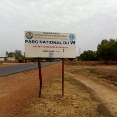
W National Park of Niger, national park in Niger

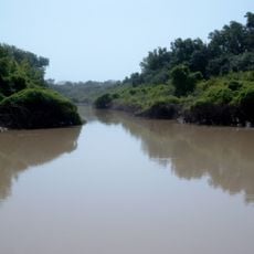
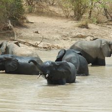
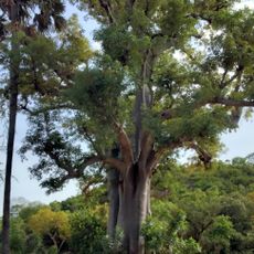
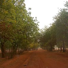
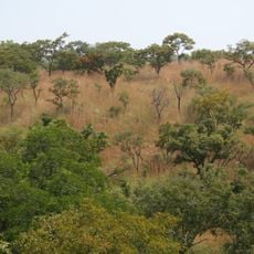
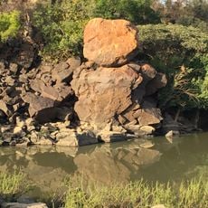
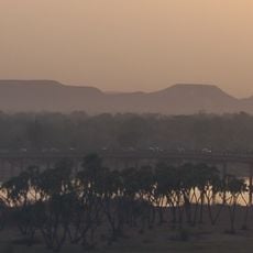
W National Park of Niger is a protected area in Tamou in western Niger that forms part of a larger complex with neighboring reserves in Benin and Burkina Faso. The landscape shifts between open grasslands, forest strips along the Niger River, and seasonal floodplains that change with the river's water levels.

The protected area was established decades ago to preserve wildlife and has since been expanded several times. Recognition as a UNESCO World Heritage Site and Ramsar site came later, reflecting international efforts to secure the ecological importance of the region.

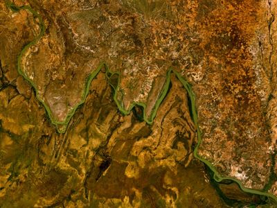
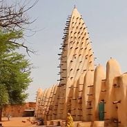
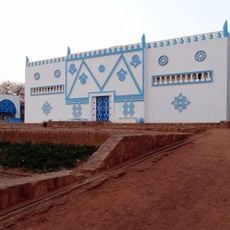
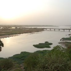
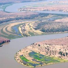
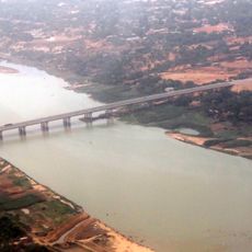
The park takes its name from the W-shaped bend of the Niger River that runs through the protected area. Visitors can observe how local communities work with park management and carry on traditions of caring for the land, while fishermen cast their nets along the riverbanks.

Visitors should plan to come during the cooler months from November to March, when animals gather at water sources and temperatures are more comfortable. Sturdy footwear, light clothing, binoculars, and plenty of drinking water are advisable, as facilities remain basic and paths are often unpaved.

The floodplains attract over 20,000 aquatic birds from February to May, which rest and feed along the river bends. The meandering oxbows that give the park its name are best seen from a boat at sunrise, when hippos and crocodiles rest along the banks.

Location: Tamou

Inception: 1954

Part of: W National Park

GPS coordinates: 12.35000,2.35000

Latest update: December 5, 2025 10:04

Photos
Tours and discoveries in Burkina Faso

Burkina Faso holds a wealth of places that reveal both the land itself and the people who call it home. You can explore ancient stone ruins dating back centuries, walk through forests and wildlife reserves, discover villages where traditional building methods and crafts remain part of daily life,...

What to see and do in Niger?

Niger reveals its character through desert expanses, mud architecture, and traces of centuries of trade and culture. The Ténéré Desert stretches across the southeast, bordered by the Aïr Mountains where oases such as Timia provide relief from the surrounding sand. Agadez holds the 16th-century Great...

Reviews

Visited this place? Tap the stars to rate it and share your experience / photos with the community! Try now! You can cancel it anytime.

« W National Park of Niger - national park in Niger » is provided by Around Us (aroundus.com). Images and texts are derived from Wikimedia project under a Creative Commons license. You are allowed to copy, distribute, and modify copies of this page, under the conditions set by the license, as long as this note is clearly visible.

Discover hidden gems everywhere you go!

From secret cafés to breathtaking viewpoints, skip the crowded tourist spots and find places that match your style. Our app makes it easy with voice search, smart filtering, route optimization, and insider tips from travelers worldwide. Download now for the complete mobile experience.

Around Us App Screenshot

A unique approach to discovering new places

Le Figaro

All the places worth exploring

France Info

A tailor-made excursion in just a few clicks

20 Minutes