Tunari National Park, National park in Cochabamba Department, Bolivia
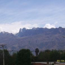
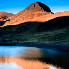
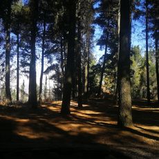
Tunari National Park is a protected area in western Cochabamba Department, Bolivia, spanning the provinces of Ayopaya, Cercado, Quillacollo, Chapare and Tapacarí. Its altitude runs from 2,200 m up to the 5,035 m Tunari peak, a blunt, slightly split crag of bare rock. The upper slopes glow orange-brown and reddish above a dark green-black middle slope, and the range feeds the Rocha and Chapare watersheds.
The area received national park status in March 1962 through Supreme Decree 6045 to control annual flooding affecting neighboring communities during rainy periods. This decision linked conservation with watershed protection for nearby urban areas.
The park's three visitor areas are the recreational zone at km 10 north of Cochabamba, with three cabins, about 10 km of trails and two waterfalls; the Cruzan cabins in Tiquipaya, 15 km from the city, with three trails and a walk through the community's ancestral farming systems; and the Liriuni hot springs in Quillacollo, 20 km away.
Three tourist areas are reached from Cochabamba: the recreational area at km 10 north of the city, with three cabins, about 10 km of trails and two waterfalls; the Cruzan cabins 15 km away in Tiquipaya, with three trails and a walk through ancestral farming systems; and the Liriuni hot springs 20 km away in Quillacollo. Trails climb from 2,200 m to the 5,035 m Tunari peak, so allow for altitude.
Four bird species live only here, including the endangered Cochabamba Mountain Finch, which nests exclusively in Polylepis besseri forests. These trees grow in scattered clusters near the upper elevation limit and provide the only habitat for these rare birds.
The community of curious travelers
AroundUs brings together thousands of curated places, local tips, and hidden gems, enriched daily by 92,781 contributors worldwide.