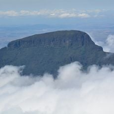
Monte Roraima National Park, Nature reserve at northern Brazil borders
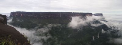
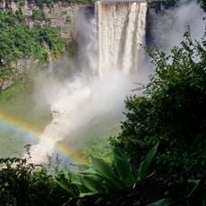
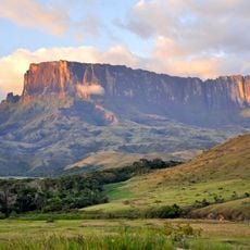
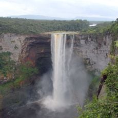
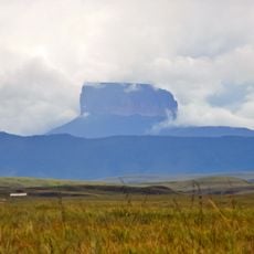
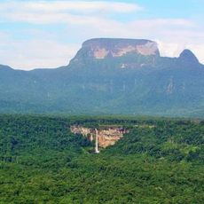
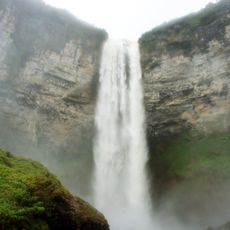
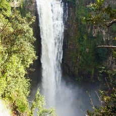
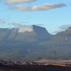
Monte Roraima National Park is a nature reserve in northern Brazil featuring vast expanses of protected land dominated by massive tepui mountain formations with vertical cliff faces. The landscape includes deep gorges, cascading waterfalls, and dense forest vegetation that create a dramatic and rugged environment.
The park was established in 1989 as a protected area administered by Brazil's national biodiversity conservation institute. This designation recognized the region's ecological importance and safeguarded its unique mountain formations for the future.
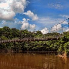
The Ingarikó and Macushi communities live and travel through this land, shaping how it is used and maintained. Visitors encounter these groups and witness how they navigate and care for the territory around them.
Visitors require authorization from the relevant authorities and should arrange guides familiar with the terrain before planning a trek. The trails are demanding and require good physical fitness along with weather-appropriate gear and supplies.
At the summit of Mount Roraima stands a triple border marker where the boundaries of Brazil, Venezuela, and Guyana converge. This singular point sits at significant altitude and represents the only place where these three nations meet.
The community of curious travelers
AroundUs brings together thousands of curated places, local tips, and hidden gems, enriched daily by 60,000 contributors worldwide.