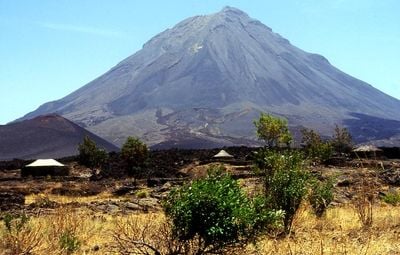
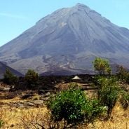
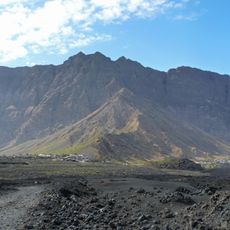
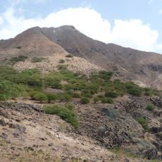
Pico do Fogo, Stratovolcano in Santa Catarina do Fogo, Cape Verde.
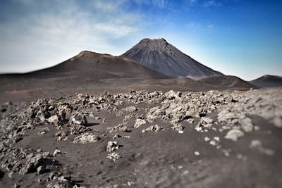
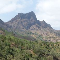
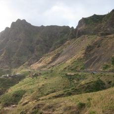
Pico do Fogo is a stratovolcano in Santa Catarina do Fogo with a peak at 2,829 meters above sea level, making it the highest point in Cape Verde. The volcanic cone sits within a caldera roughly 10 kilometers wide.
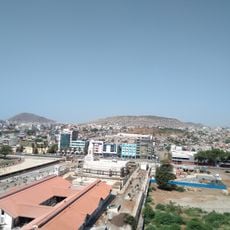
The most significant eruption occurred in 1680, when volcanic ash covered the entire island and forced residents to evacuate to nearby Brava Island. This catastrophic event shaped the island's history for generations to come.
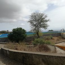
Local farmers work the mineral-rich volcanic soil to grow coffee and grapes, using methods passed down through generations and suited to this landscape. These farming traditions shape daily life on the island.
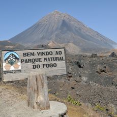
Local certified guides lead hiking expeditions along established trails to the summit while monitoring volcanic activity for visitor safety. Bring plenty of water and wear sturdy footwear, and check weather conditions before heading up the mountain.
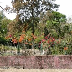
The volcano maintains constant low-level activity, releasing gases through vents near the peak while hosting specialized plant life in the caldera. These rare plants have adapted to thrive in the extreme volcanic conditions found nowhere else.
Location: Santa Catarina do Fogo
Elevation above the sea: 2,829 m
Made from material: feldspathoid
Address: Pico do Fogo, Cabo Verde
GPS coordinates: 14.94940,-24.34031
Latest update: December 6, 2025 16:02
Cape Verde offers landscapes and places full of stories that tell how these islands in the Atlantic came to be. This collection shows natural and cultural sites that make the archipelago special — from white sandy beaches to volcanic formations, colonial churches, and markets where the local life is...
Estádio da Várzea
89.1 km
Palácio Presidencial
89.5 km
Pelourinho
79.2 km
Mercado de Sucupira
89.4 km
Fort Real de São Filipe
79.5 km
Monumento de Diogo Gomes
89.4 km
Pico da Antónia
76.6 km
Fogo National Park
2.8 km
Ilhéus Secos
54.6 km
National Library of Cape Verde
89.2 km
Gimnodesportivo Vava Duarte
89.1 km
Jardim Botânico
80 km
Bordeira (Fogo)
5.7 km
Estádio 5 de Julho
17.7 km
Museu Municipal de São Filipe
18.2 km
Monte Graciosa
74.5 km
Museu da Tabanka
74.2 km
Ponta Preta Lighthouse
72.1 km
Ilhéu de Cima Lighthouse
32.5 km
National Botanical Garden of Grandvaux Barbosa
80 km
Rampa São Januário
89.4 km
Estadio de São Lourenço
14 km
Palacio da Cultura Ildo Lobo
89.4 km
Assomada market
74.2 km
Serra Malagueta Natural Park
75.1 km
Igreja do Nazareno, Assomada
74.1 km
Sé Catedral (Cidade Velha)
79.3 km
Carlota Fort
18.4 kmVisited this place? Tap the stars to rate it and share your experience / photos with the community! Try now! You can cancel it anytime.
Discover hidden gems everywhere you go!
From secret cafés to breathtaking viewpoints, skip the crowded tourist spots and find places that match your style. Our app makes it easy with voice search, smart filtering, route optimization, and insider tips from travelers worldwide. Download now for the complete mobile experience.
A unique approach to discovering new places❞
— Le Figaro
All the places worth exploring❞
— France Info
A tailor-made excursion in just a few clicks❞
— 20 Minutes