Enable Location

We need your location to show you interesting places around you

Discover nearby places

Find interesting locations and hidden gems around you

Precise directions

Get accurate directions and distances to places

Your location is never shared with other users. It's only used when you tap the location button.

Drusenfluh

Log in to your account

Start exploring — it's free

Trusted by 61,447 travelers worldwide

Continue with Google
Continue with Apple
or

We will send you a code to connect

By continuing, you accept our Terms and Conditions and our Privacy Policy

Check your inbox

We've sent a pincode in your inbox. Please enter the code below.

Drusenfluh

Drusenfluh, Mountain summit in Rätikon range, Austria and Switzerland

Description

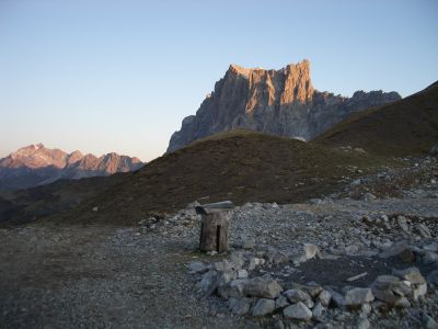
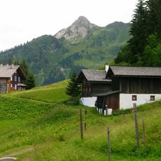
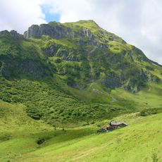
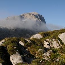
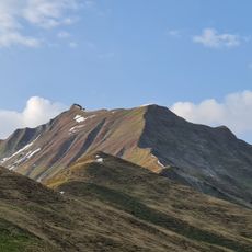
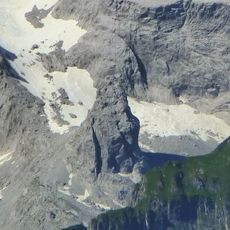
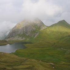
Drusenfluh is a summit in the Rätikon range rising to 2827 meters and forms the natural border between Vorarlberg in Austria and Graubünden in Switzerland. The southern side shows steep rock faces, while the landscape on both sides displays different geographic features.

History

Christian Zudrell completed the first documented ascent on August 14, 1870, leaving behind a stone with an inscription. This marked memorial was later moved to Lindauer Hütte, where it remains as a record of that early climb.

Culture

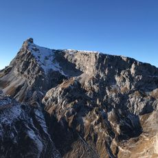
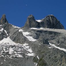
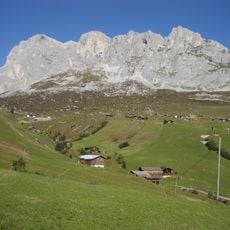
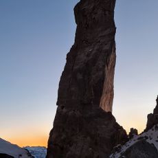
The three peaks here are called Drei Türme and form a distinctive rock formation between Austria and Switzerland. Visitors can see this characteristic shape from the mountain itself or from surrounding trails.

Practical

The mountain is accessible via several routes on the southern side in Swiss territory, and visitors should prepare for changing weather conditions. Equipment should be appropriate for alpine conditions, as the elevation and terrain require special precautions.

Did you know?

The highest point at 2827 meters sits on the border line itself, while the three peaks called Drei Türme rise slightly higher on the Austrian side. This arrangement makes the mountain a rare example of a geographically divided summit.

Location
Location
Elevation above the sea
2,827 m
GPS coordinates
47.02905,9.80166
Latest update
December 12, 2025 17:47

AroundUs brings together thousands of curated places, local tips, and hidden gems, enriched daily by 60,000 contributors worldwide. Discover all places nearby (Schiers).

« Drusenfluh - Mountain summit in Rätikon range, Austria and Switzerland » is provided by Around Us (aroundus.com). Images and texts are derived from Wikimedia project under a Creative Commons license. You are allowed to copy, distribute, and modify copies of this page, under the conditions set by the license, as long as this note is clearly visible.

Discover hidden gems everywhere you go!

From secret cafés to breathtaking viewpoints, skip the crowded tourist spots and find places that match your style. Our app makes it easy with voice search, smart filtering, route optimization, and insider tips from travelers worldwide. Download now for the complete mobile experience.

Around Us App Screenshot

A unique approach to discovering new places

Le Figaro

All the places worth exploring

France Info

A tailor-made excursion in just a few clicks

20 Minutes

Around Us
Travel Guide & Maps
Download

Send to your phone

QR Code
1

Open the camera app on your mobile.

2

Point at the QR code with your camera. A notification will appear.

3

Tap the notification to open the link.