Enable Location

We need your location to show you interesting places around you

Discover nearby places

Find interesting locations and hidden gems around you

Precise directions

Get accurate directions and distances to places

Your location is never shared with other users. It's only used when you tap the location button.

Riverfront Trail, Greater Moncton

Log in to your account

Start exploring — it's free

Trusted by 62,823 travelers worldwide

Continue with Google
Continue with Apple
or

We will send you a code to connect

By continuing, you accept our Terms and Conditions and our Privacy Policy

Check your inbox

We've sent a pincode in your inbox. Please enter the code below.

Riverfront Trail, Greater Moncton

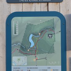
Riverfront Trail, Greater Moncton, multi-use trail in Greater Moncton

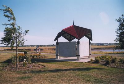
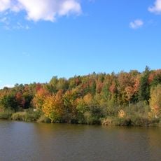
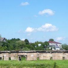
The Riverfront Trail is a flat path along the Petitcodiac River in Riverview that stretches about 5 kilometers and is made of crushed rock and wooden boardwalks. The route connects different parks and guides visitors past marshlands, a lighthouse structure, viewpoints, and several rest areas with picnic tables and shelters.

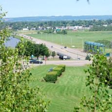
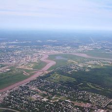
The river played an important role in Moncton's growth, as it was used early on for transportation and trade. The Petitcodiac was altered by the construction of a dam in 1968, which sparked decades of debate about the river and its environment.

The name Petitcodiac comes from the Mi'kmaq language and means "river of false salmon". Along the trail, you can see public art pieces created by local artists that give the area a personal touch reflecting the community's creativity.

The trail is well maintained and free to access from several parking areas, some near the Causeway and Gunningsville Bridge. The path is wide enough for wheelchairs, dogs on leash are allowed, and most of the route is flat, although there are some uneven spots and steps in places.

Locals call the river the "Chocolate River" because of its brown color caused by the mud the water carries. A special natural event is the tidal bore, a sudden rush of water moving upstream that occurs twice daily and can be watched from the trail.

The community of curious travelers

AroundUs brings together thousands of curated places, local tips, and hidden gems, enriched daily by 60,000 contributors worldwide.

Start exploring
Location
GPS coordinates
46.08510,-64.77560
Latest update
February 9, 2026 08:20
« Riverfront Trail, Greater Moncton - multi-use trail in Greater Moncton » is provided by Around Us (aroundus.com). Images and texts are derived from Wikimedia project under a Creative Commons license. You are allowed to copy, distribute, and modify copies of this page, under the conditions set by the license, as long as this note is clearly visible.

Discover hidden gems everywhere you go!

From secret cafés to breathtaking viewpoints, skip the crowded tourist spots and find places that match your style. Our app makes it easy with voice search, smart filtering, route optimization, and insider tips from travelers worldwide. Download now for the complete mobile experience.

Around Us App Screenshot

A unique approach to discovering new places

Le Figaro

All the places worth exploring

France Info

A tailor-made excursion in just a few clicks

20 Minutes

Around Us
Travel Guide & Maps
Download

Send to your phone

QR Code
1

Open the camera app on your mobile.

2

Point at the QR code with your camera. A notification will appear.

3

Tap the notification to open the link.